geo.wikisort.org - Montagne
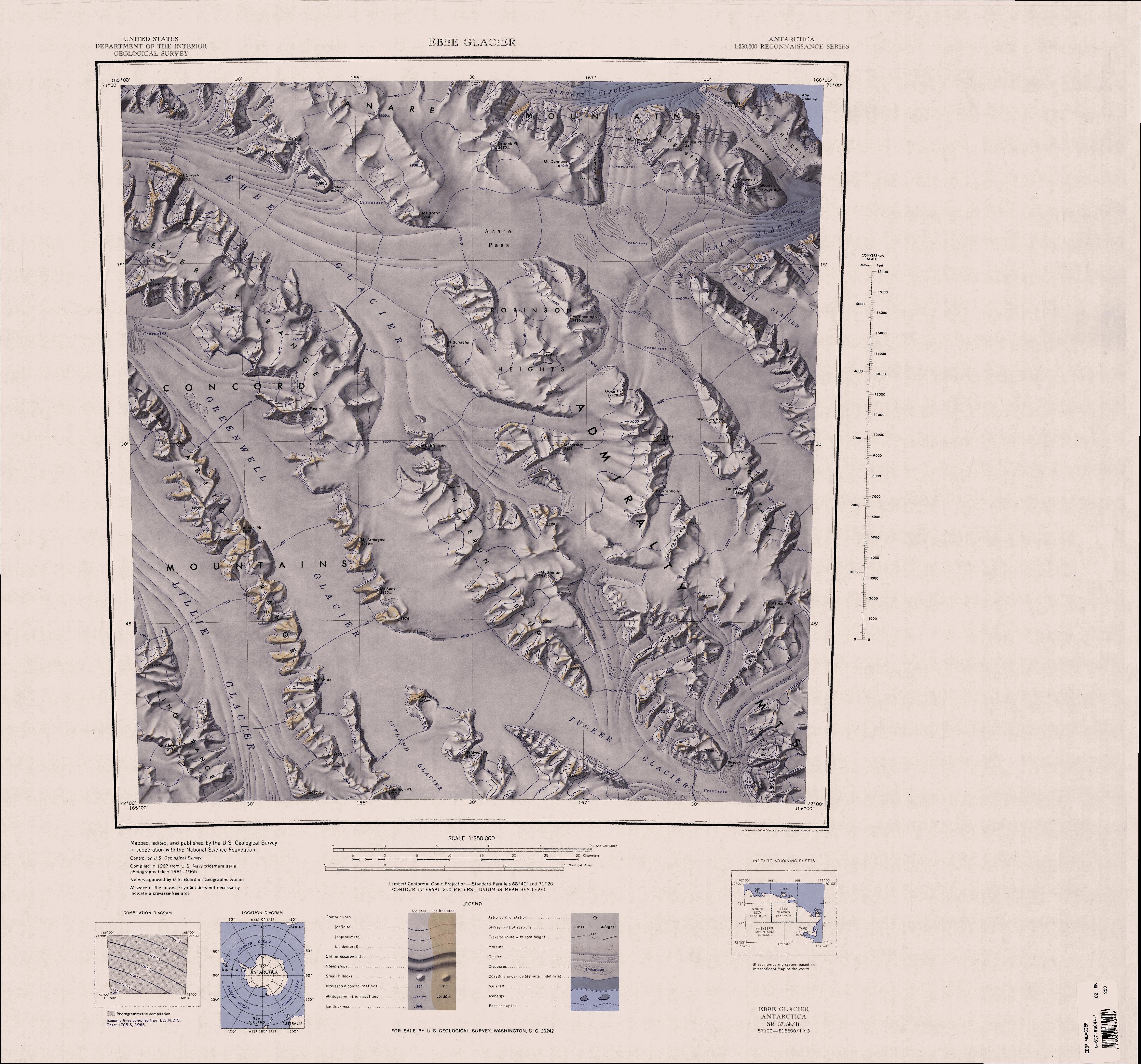
Le cime Robinson sono un gruppo montuoso situato nell'entroterra della costa di Pennell, nella Terra della Regina Vittoria, in Antartide. Il gruppo ha una pianta ovale di lunghezza pari a circa 28 e costituisce in particolare l'estremità nord-occidentale dei monti dell'Ammiragliato, raggiungendo i 2.170 m di altezza con la sua vetta più alta.[1]
| Cime Robinson | |
|---|---|
 | |
| Continente | Antartide |
| Stati | ATA |
| Catena principale | Monti dell'Ammiragliato |
| Lunghezza | 28 km |

Storia
Le cime Robinson sono state mappate per la prima volta dallo United States Geological Survey grazie a fotografie aeree scattate dalla marina militare statunitense (USN) nel periodo 1960-63, e così battezzate dal comitato consultivo dei nomi antartici in onore di Edwin S. Robinson, geofisico del Programma Antartico degli Stati Uniti d'America di base alla stazione McMurdo nel 1960, il quale nei primi anni sessanta prese parte a diverse spedizioni esplorative della regione.[2]
Note
- Cime Robinson, su sws.geonames.org, GeoNames.Org (cc-by), 20 gennaio 2008. URL consultato il 27 dicembre 2018.
- (EN) Cime Robinson, in Geographic Names Information System, USGS.
Collegamenti esterni
- (EN) Cime Robinson, su Geographic Names Information System per l'Antartico, USGS.
На других языках
[de] Robinson Heights
Die Robinson Heights sind ein hauptsächlich vereistes und bis zu 2170 m hohes Gebirge im Norden des ostantarktischen Viktorialands. Mit einer Länge von 24 km hat es in der Aufsicht eine elliptische Form. Das Gebirge ragt südlich des Anare-Passes auf und bildet das nordwestliche Ende der Admiralitätsberge.[en] Robinson Heights
Robinson Heights in Antarctica (.mw-parser-output .geo-default,.mw-parser-output .geo-dms,.mw-parser-output .geo-dec{display:inline}.mw-parser-output .geo-nondefault,.mw-parser-output .geo-multi-punct{display:none}.mw-parser-output .longitude,.mw-parser-output .latitude{white-space:nowrap}71°22′S 166°40′E) is the mainly ice-covered heights (2,170 m), elliptical in plan and 15 nautical miles (28 km) long, which rise south of Anare Pass and form the northwest end of the Admiralty Mountains. It was mapped by the United States Geological Survey (USGS) from surveys and U.S. Navy photography, 1960–63, and was named by the Advisory Committee on Antarctic Names (US-ACAN) for Edwin S. Robinson, a United States Antarctic Research Program (USARP) geophysicist at McMurdo Sound in 1960. He participated in a number of geophysical traverses, including his leadership of the South Pole Station Traverse, 1962–63.- [it] Cime Robinson
Другой контент может иметь иную лицензию. Перед использованием материалов сайта WikiSort.org внимательно изучите правила лицензирования конкретных элементов наполнения сайта.
WikiSort.org - проект по пересортировке и дополнению контента Википедии