geo.wikisort.org - Montagne
L'Agassizhorn (3 946 m s.l.m.) è una montagna delle Alpi Bernesi.
| Agassizhorn | |
|---|---|
 | |
| Stato | |
| Cantone | |
| Altezza | 3 946 m s.l.m. |
| Prominenza | 197 m |
| Isolamento | 1,38 km |
| Catena | Alpi |
| Coordinate | 46°32′47.6″N 8°06′51.9″E |
| Mappa di localizzazione | |
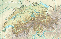 Agassizhorn  | |
| Dati SOIUSA | |
| Grande Parte | Alpi Occidentali |
| Grande Settore | Alpi Nord-occidentali |
| Sezione | Alpi Bernesi |
| Sottosezione | Alpi Bernesi in senso stretto |
| Supergruppo | Catena Jungfrau-Fiescherhorn |
| Gruppo | Gruppo Fiescherhorn-Grünhorn |
| Codice | I/B-12.II-B.3 |
Descrizione
Si trova lungo la linea di confine tra il Canton Vallese e il Canton Berna, a nord-ovest del più alto Finsteraarhorn. È separato da quest'ultimo dall'Agassizjoch.
Toponimo
Prende il nome da Jean Louis Rodolphe Agassiz, uno dei maggiori scienziati statunitensi del suo tempo.
Toponimo contestato
Nel 2007, in occasione del bicentenario della nascita di Louis Agassiz, la campagna e la petizione Smantellare Agassiz ha attirato l'attenzione sulle teorie razziste di quest'ultimo e ha chiesto che il picco fosse rinominato "Rentyhorn", dal nome di uno schiavo che Agassiz fotografò nella Carolina del Sud per dimostrare "scientificamente" l'inferiorità della "razza nera".[1]
Salita alla vetta
Si può salire sulla vetta partendo dalla Finsteraarhornhütte.
Note
- Rentyhorn petizione, su rentyhorn.ch. URL consultato il 23 aprile 2022.
Voci correlate
- Canton Vallese
Altri progetti
 Wikimedia Commons contiene immagini o altri file su Agassizhorn
Collegamenti esterni
- L'Agassizhorn su hikr.org, su hikr.org.
На других языках
[de] Agassizhorn
Das Agassizhorn (3947 m ü. M.) ist ein Berg in den Berner Alpen in der Verlängerung des Nordwestgrats des Finsteraarhorns, von dem es weniger als 1,5 Kilometer entfernt und durch das Agassizjoch (3747 m) getrennt ist. Der Berg ist nach dem Schweizer Naturforscher Louis Agassiz benannt.[en] Agassizhorn
The Agassizhorn is a mountain of the Bernese Alps in Switzerland. It lies just north-west of the Finsteraarhorn, the main summit of the range. The Agassizhorn is the tripoint between the valleys of the Lower Grindelwald Glacier, the Unteraar Glacier and the Fiescher Glacier. Because the Lower Grindelwald and Unteraar glaciers drain into the Aar and hence the Rhine and North Sea, whilst the Fiescher glacier drains into the Rhone and hence the Mediterranean Sea, the Sidelhorn lies on the European continental divide.[2][es] Agassizhorn
El Agassizhorn es una montaña de los Alpes de Berna en Suiza. Se encuentra justo al noroeste del Finsteraarhorn, la cumbre principal de la cordillera. El Agassizhorn es el punto triple entre los valles del glaciar Lower Grindelwald, el glaciar Unteraar y el glaciar Fiescher. Debido a que los glaciares de Lower Grindelwald y Unteraar drenan en el Aar y, por lo tanto, en el Rin y el Mar del Norte, mientras que el glaciar Fiescher drena en el Ródano y, por tanto, en el Mar Mediterráneo, el Sidelhorn se encuentra en la divisoria continental europea.[1][fr] Pic Agassiz
Le pic Agassiz (en allemand : Agassizhorn) est une montagne des Alpes bernoises, située 1,5 kilomètre au nord-ouest du Finsteraarhorn, dont il est séparé par l’Agassizjoch. Il doit son nom au géologue et zoologiste Louis Agassiz.- [it] Agassizhorn
Другой контент может иметь иную лицензию. Перед использованием материалов сайта WikiSort.org внимательно изучите правила лицензирования конкретных элементов наполнения сайта.
WikiSort.org - проект по пересортировке и дополнению контента Википедии