geo.wikisort.org - Montagne
Le Várhegy ([ˈvaːɾhɛɟ], « colline du château ») est un sommet de Hongrie situé dans le 1er arrondissement de Budapest dans les collines de Buda. Il borde le Danube au nord du Gellért-hegy. On y trouve le quartier du château de Buda, Vár qui surplombe la ville.
Cet article est une ébauche concernant la montagne.
Vous pouvez partager vos connaissances en l’améliorant (comment ?) selon les recommandations des projets correspondants.
| Várhegy | ||||

| ||||
| Géographie | ||||
|---|---|---|---|---|
| Altitude | 175 m | |||
| Massif | Collines de Buda | |||
| Coordonnées | 47° 30′ 10″ nord, 19° 01′ 54″ est | |||
| Administration | ||||
| Pays | ||||
| Région | Hongrie centrale | |||
| Collectivité métropolitaine | Budapest | |||
| Géolocalisation sur la carte : Hongrie
Géolocalisation sur la carte : Budapest
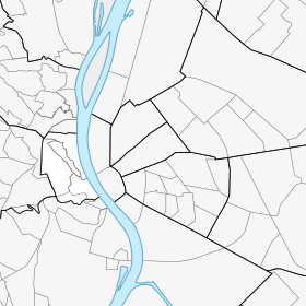
Géolocalisation sur la carte : 1er arrondissement de Budapest
| ||||
| modifier |
||||


Voir aussi
- Vár (quartier)
- Géographie de la Hongrie
 Portail de la montagne
  Portail de Budapest
На других языках
[en] Várhegy
Castle Hill (Hungarian: Várhegy) is a hill in Budapest's 1st district. Geographically, it is connected to the Buda Hills and Rose Hill (Rózsadomb). The Castle Quarter (Várnegyed) is located on the top of the hill with many monuments around the Buda Castle. The area is one of the most popular attractions in the capital, and can be accessed by bus or in the carriages of a funicular (Budavári sikló).- [fr] Várhegy (Buda)
Текст в блоке "Читать" взят с сайта "Википедия" и доступен по лицензии Creative Commons Attribution-ShareAlike; в отдельных случаях могут действовать дополнительные условия.
Другой контент может иметь иную лицензию. Перед использованием материалов сайта WikiSort.org внимательно изучите правила лицензирования конкретных элементов наполнения сайта.
Другой контент может иметь иную лицензию. Перед использованием материалов сайта WikiSort.org внимательно изучите правила лицензирования конкретных элементов наполнения сайта.
2019-2025
WikiSort.org - проект по пересортировке и дополнению контента Википедии
WikiSort.org - проект по пересортировке и дополнению контента Википедии