geo.wikisort.org - Montagne
Le Tacune, également appelé Cerro Tacune, est un volcan de 5 417 mètres d'altitude situé au sud du Pérou dans les Andes, province d'Arequipa, région d'Arequipa, au nord-est de la ville d'Arequipa.
Cet article est une ébauche concernant le volcanisme, le Pérou et la montagne.
Vous pouvez partager vos connaissances en l’améliorant (comment ?) selon les recommandations des projets correspondants.
| Tacune | ||
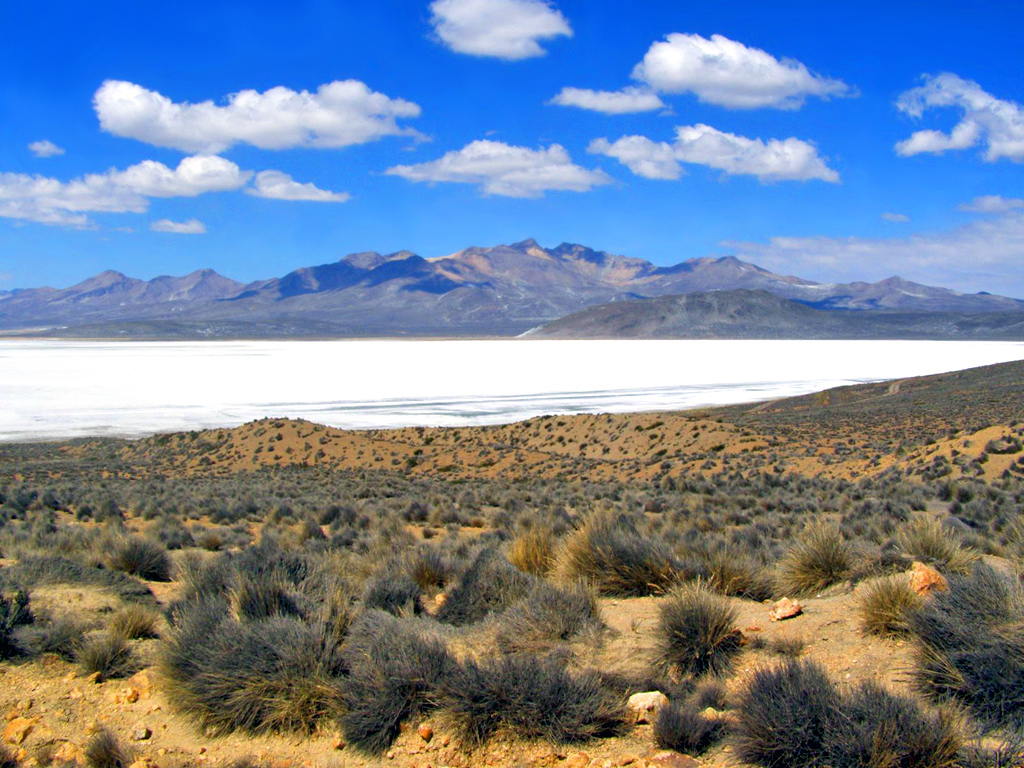 Vue de la Laguna Salinas et du Tacune en arrière-plan. | ||
| Géographie | ||
|---|---|---|
| Altitude | 5 417 m | |
| Massif | Cordillère Occidentale (Andes) | |
| Coordonnées | 16° 28′ 26″ sud, 71° 08′ 17″ ouest | |
| Administration | ||
| Pays | ||
| Régions | Arequipa Moquegua |
|
| Provinces | Arequipa General Sánchez Cerro |
|
| Géologie | ||
| Type | Volcan de subduction | |
| Activité | Inconnue | |
| Dernière éruption | Inconnue | |
| Code GVP | Aucun | |
| Observatoire | Aucun | |
| Géolocalisation sur la carte : Pérou
| ||
| modifier |
||

Ce volcan se trouve sur le territoire de la réserve nationale Salinas y Aguada Blanca.
Articles connexes
- Zone volcanique centrale des Andes
- Liste des chaînes de montagnes péruviennes
 Portail du volcanisme
  Portail du Pérou
  Portail de la montagne
На других языках
[en] Tacune
Tacune (possibly from Aymara taku Prosopis (genus of South American tree) / colored medicinal earth,[2] -ni a suffix to indicate ownership, "the one with the taku tree" or "the one with medicinal earth") is a mountain in the Andes of Peru, about 5,500 metres (18,045 ft) high. It is situated south of Lake Salinas and east of the mountain Pichu Pichu. Tacune is located in the Arequipa Region, Arequipa Province, Tarucani District, and in the Moquegua Region, General Sánchez Cerro Province, Puquina District.[1]- [fr] Tacune
Текст в блоке "Читать" взят с сайта "Википедия" и доступен по лицензии Creative Commons Attribution-ShareAlike; в отдельных случаях могут действовать дополнительные условия.
Другой контент может иметь иную лицензию. Перед использованием материалов сайта WikiSort.org внимательно изучите правила лицензирования конкретных элементов наполнения сайта.
Другой контент может иметь иную лицензию. Перед использованием материалов сайта WikiSort.org внимательно изучите правила лицензирования конкретных элементов наполнения сайта.
2019-2026
WikiSort.org - проект по пересортировке и дополнению контента Википедии
WikiSort.org - проект по пересортировке и дополнению контента Википедии