geo.wikisort.org - Montagne
Les monts Aurunces (Monti Aurunci) sont un massif montagneux de l'Italie centrale appartenant à l'Anti-Apennin latin contenu exclusivement dans le Latium.
Cet article est une ébauche concernant la montagne et le Latium.
Vous pouvez partager vos connaissances en l’améliorant (comment ?) selon les recommandations des projets correspondants.
| Monts Aurunces | ||
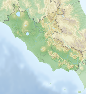
| Localisation des monts Aurunces dans le Latium. | ||
| Géographie | ||
|---|---|---|
| Altitude | 1 533 m, Mont Petrella | |
| Massif | Apennins | |
| Longueur | 28 km | |
| Largeur | 28 km | |
| Administration | ||
| Pays | ||
| Région | Latium | |
| Province | Frosinone | |
| Géologie | ||
| Roches | Calcaire | |
| modifier |
||
Ils sont délimités au nord par une ligne Fondi-Lenola-Pico-Ceprano qui les sépare des monts Ausons, à l'est par la vallée du Liri, au sud par le fleuve Garigliano et à l'ouest par la mer Tyrrhénienne au niveau du mont Lauzo.
La zone des monts Aurunces est partiellement protégée grâce à l'instauration du parc naturel régional des monts Aurunces créé en 1997.
Toponymie
Les montagnes doivent leur nom à l'ancienne tribu des Aurunces, branche de celle des Ausons. Les deux tribus étaient issues du peuple italique appelé par les Romains Volsques : les monts Lépins, les monts Ausons et les monts Aurunces sont aussi appelés les monts Volsques ou la chaîne Volscienne[1].
Principaux sommets
- Mont Petrella : 1 533 m
- Mont Redentore : 1 252 m
- Mont Sant'Angelo : 1 402 m
Notes et références
- Romano 2007, p. 17.
Annexes
Bibliographie
- (en) Antonio Romano, Gianpaolo Montinaro, Marco Mattoccia et Valerio Sbordoni, « Amphibians of the Aurunci Mountains (Latium, Central Italy). Checklist and conservation guidelines », Acta Herpetologica, vol. 2, no 1, , p. 17–25 (lire en ligne [PDF])
Lien externe
- (it) « Parco Naturale dei Monti Aurunci », sur parcoaurunci.it
 Portail de la montagne
  Portail du Latium
На других языках
[de] Monti Aurunci
Die Monti Aurunci (Aurunker Berge) sind ein Mittelgebirge in der italienischen Region Latium. Es liegt etwa 130 km südöstlich von Rom und 70 km nordwestlich von Neapel, zwischen dem Tal des Liri und dem Tyrrhenischen Meer. Im Nordwesten schließen die Monti Ausoni an. Der Höhenzug ist ein verkarstetes Kalkgebirge.[en] Aurunci Mountains
The Monti Aurunci (or Aurunci Mountains) is a mountain range of southern Lazio, in central Italy. It is part of the Antiappennini, a group running from the Apennines chain to the Tyrrhenian Sea, where it forms the promontory of Gaeta. It is bounded to the north-west by the Ausoni Mountains, to the north by the Liri river, to the east by the Ausente, to the south-east by the Garigliano and to the south by the Tyrrhenian sea. The line between the Aurunci and the Ausoni has not been clearly established but the Aurunci are considered by convention to be east of a line through Fondi, Lenola, Pico, S. Giovanni and Incarico.[1] Altitudes vary from hills to the 1,533 m of Monte Petrella. Main peaks include the Redentore (1,252 m) and Monte Sant'Angelo (1,402 m). They include a regional park, the Parco Naturale dei Monti Aurunci, created in 1997.- [fr] Monts Aurunces
[it] Monti Aurunci
I Monti Aurunci sono un gruppo montuoso dell'Italia centrale, appartenente all'Antiappennino laziale, contenuto interamente nel Lazio, che costituiscono il settore meridionale dei Monti Volsci. Confinano a ovest con il gruppo dei Monti Ausoni seguendo una linea ideale che congiunge Fondi-Lenola-Pico-Ceprano, a nord con la Valle del Liri, a est con il fiume Garigliano mentre a sud sono limitati dal mar Tirreno, con le estreme propaggini del monte Lauzo.Другой контент может иметь иную лицензию. Перед использованием материалов сайта WikiSort.org внимательно изучите правила лицензирования конкретных элементов наполнения сайта.
WikiSort.org - проект по пересортировке и дополнению контента Википедии