geo.wikisort.org - Montagne
Le mont La Pérouse (en anglais : Mount La Perouse) est un sommet de la région de recensement de Hoonah-Angoon, dans l'État américain de l'Alaska. Il culmine à 3 270 mètres d'altitude dans le chaînon Fairweather. Il est protégé au sein du parc national de Glacier Bay.
Pour les articles homonymes, voir La Pérouse (homonymie).
Cet article est une ébauche concernant la montagne et l’Alaska.
Vous pouvez partager vos connaissances en l’améliorant (comment ?) selon les recommandations des projets correspondants.

Cet article est orphelin. Moins de trois articles lui sont liés ().
Vous pouvez aider en ajoutant des liens vers [[Mont La Pérouse (États-Unis)]] dans les articles relatifs au sujet.
| Mont La Pérouse | |||
 Vue du versant est. | |||
| Géographie | |||
|---|---|---|---|
| Altitude | 3 270 m[1] | ||
| Massif | Chaînon Fairweather (chaîne Saint-Élie) |
||
| Coordonnées | 58° 33′ 47″ nord, 137° 04′ 57″ ouest[1] | ||
| Administration | |||
| Pays | |||
| État | Alaska | ||
| Région de recensement | Hoonah-Angoon | ||
| Ascension | |||
| Première | 1952 par Paul Bowen, Rolland Reid, James Frederick Seitz, Karl Stauffer et Rowland Tabor | ||
| Géologie | |||
| Roches | Gabbro | ||
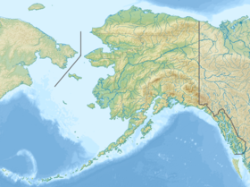
| Géolocalisation sur la carte : Alaska
Géolocalisation sur la carte : États-Unis
| |||
| modifier |
|||

Notes et références
- Visualisation sur l'USGS.
Liens externes
- Ressources relatives à la géographie :
 Portail de la montagne
  Portail de l’Alaska
На других языках
[en] Mount La Perouse
Mount La Perouse is a 10,728-foot (3,270 meter) glaciated mountain summit located in the Fairweather Range of the Saint Elias Mountains, in southeast Alaska, United States. The peak is situated in Glacier Bay National Park, 4 mi (6 km) southeast of Mount Dagelet, 7.6 mi (12 km) south-southeast of Mount Crillon which is the nearest higher peak, and 28.6 mi (46 km) southeast of Mount Fairweather, which is the highest peak in the Fairweather Range. Topographic relief is significant as the mountain rises up from tidewater in less than nine miles. The mountain was named in 1874 by William Healey Dall of the U.S. Geological Survey, for Jean-François de Galaup, comte de Lapérouse (1741-1788), a French navigator who explored this coastal area in 1786.[2][3] The first ascent of the peak was made in 1953 by USGS party consisting of James Seitz, Karl Stauffer, Rowland Tabor, Rolland Reid, and Paul Bowen.[4] On February 16, 2014, a colossal 68 million ton landslide broke free from the flanks of Mt. La Perouse and flowed nearly 4.6 miles (7.4 km) from where it originated.[5] The months May through June offer the most favorable weather for climbing and viewing.- [fr] Mont La Pérouse (États-Unis)
Текст в блоке "Читать" взят с сайта "Википедия" и доступен по лицензии Creative Commons Attribution-ShareAlike; в отдельных случаях могут действовать дополнительные условия.
Другой контент может иметь иную лицензию. Перед использованием материалов сайта WikiSort.org внимательно изучите правила лицензирования конкретных элементов наполнения сайта.
Другой контент может иметь иную лицензию. Перед использованием материалов сайта WikiSort.org внимательно изучите правила лицензирования конкретных элементов наполнения сайта.
2019-2025
WikiSort.org - проект по пересортировке и дополнению контента Википедии
WikiSort.org - проект по пересортировке и дополнению контента Википедии