geo.wikisort.org - Montagne
Le Ma Alalta est un volcan d'Éthiopie.
Cet article est une ébauche concernant l’Éthiopie, la montagne et le volcanisme.
Vous pouvez partager vos connaissances en l’améliorant (comment ?) selon les recommandations des projets correspondants.
| Ma Alalta | ||
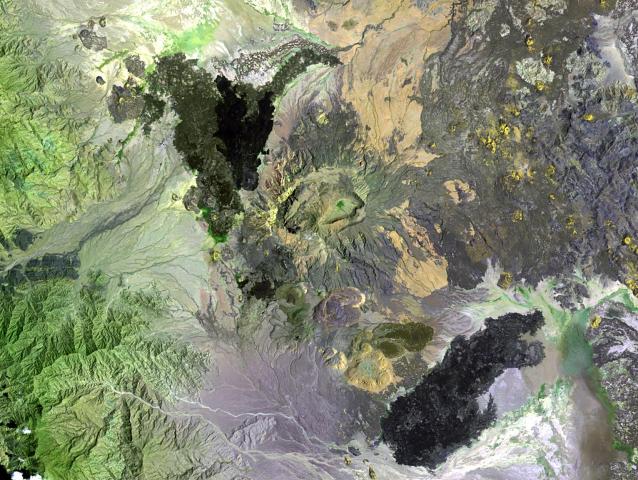 Image satellite du Ma Alalta. | ||
| Géographie | ||
|---|---|---|
| Altitude | 1 815 m | |
| Massif | Vallée du Grand Rift | |
| Coordonnées | 13° 00′ 45″ nord, 40° 11′ 04″ est | |
| Administration | ||
| Pays | ||
| Région | Afar | |
| Zone | Zone 2 | |
| Géologie | ||
| Âge | Holocène | |
| Roches | Trachyte, rhyolite | |
| Type | Volcan de rift | |
| Morphologie | Stratovolcan | |
| Activité | Actif | |
| Dernière éruption | Inconnue | |
| Code GVP | 221111 | |
| Géolocalisation sur la carte : Éthiopie
| ||
| modifier |
||

Voir aussi
Articles connexes
Liens externes
- (en) Ma Alalta, Global Volcanism Program
 Portail de l’Éthiopie
  Portail de la montagne
  Portail du volcanisme
На других языках
[en] Ma Alalta
Ma Alalta is a stratovolcano in the Afar Region of Ethiopia, located well to the west of the Danakil Depression at the foot of the regional Ethiopian scarp. It has a summit elevation of 1,745 m (5,725 ft) and lies between two large horsts related to the East African Rift.[1]- [fr] Ma Alalta
Текст в блоке "Читать" взят с сайта "Википедия" и доступен по лицензии Creative Commons Attribution-ShareAlike; в отдельных случаях могут действовать дополнительные условия.
Другой контент может иметь иную лицензию. Перед использованием материалов сайта WikiSort.org внимательно изучите правила лицензирования конкретных элементов наполнения сайта.
Другой контент может иметь иную лицензию. Перед использованием материалов сайта WikiSort.org внимательно изучите правила лицензирования конкретных элементов наполнения сайта.
2019-2025
WikiSort.org - проект по пересортировке и дополнению контента Википедии
WikiSort.org - проект по пересортировке и дополнению контента Википедии