geo.wikisort.org - Montagne
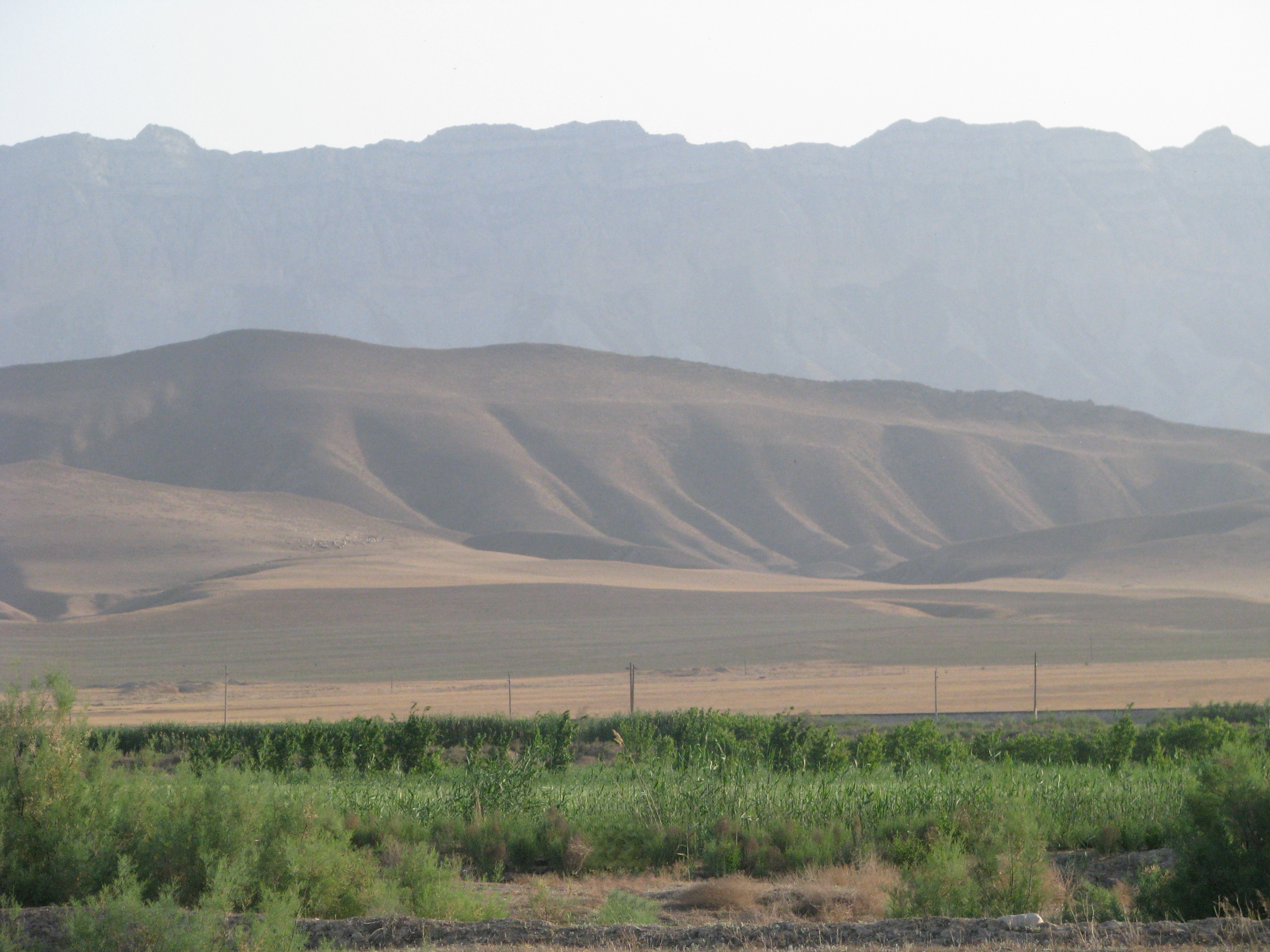
Le Kopet-Dag, کپهداغ en persan[1], est une chaîne de montagnes d'Asie centrale qui forme la frontière entre l'Iran au sud et le Turkménistan au nord. Elle s'étend sur près de 650 km à l'est de la mer Caspienne. Le plus haut sommet du Turkménistan est situé au sud-ouest de la capitale, Achgabat, et s'élève à 2 940 m, tandis que le plus haut sommet iranien atteint une altitude de 3 191 m.
Pour la subdivision du Turkménistan, voir District de Kopetdag.
Cet article est une ébauche concernant la montagne.
Vous pouvez partager vos connaissances en l’améliorant (comment ?) selon les recommandations des projets correspondants.
| Kopet-Dag | ||
| Localisation du Kopet-Dag en Iran. | ||
| Géographie | ||
|---|---|---|
| Altitude | 3 191 m, Kuh-e Qutschān | |
| Massif | Ceinture alpine | |
| Longueur | 650 km | |
| Administration | ||
| Pays | ||
| Provinces iraniennes Provinces turkmènes |
Khorasan-e-shomali, Khorasan-e-razavi Ahal, Balkan |
|
| modifier |
||


La région a vu l'émergence de cultures très anciennes : celle de Jeitun, au Néolithique (VIIe millénaire av. J.-C.), et celle de Namazga-depe (Ve au IIIe millénaire av. J.-C.). L'ancienne cité parthe de Nisa (ou Nessa) est située sur les contreforts de la chaîne, près d'Achgabat.
En 2018, la région de Kopet-Dag a été reconnue réserve de biosphère par l'Unesco[2], notamment pour ses savanes de pistachiers sauvages, berceau de la culture du pistachier domestique.
Références
- Noms géographiques, « خرِبِت كُپِتدَگ: Iran », www.GeoMondiale.fr (consulté le )
- (en) « Kopet Dag Biosphere Reserve, Islamic Republic of Iran », sur UNESCO (consulté le )
 Portail de la montagne
  Portail de l’Iran et du monde iranien
  Portail du Turkménistan
На других языках
[de] Kopet-Dag
Das Kopet-Dag-Gebirge (auch Kopet Dag, Koppe Dag, Koppeh Dagh, Köpet Dag, turkmenisch Köpetdag, persisch کپهداغ Kope-Dāgh, russisch Копетдаг) ist ein Gebirge an der Grenze zwischen Turkmenistan und dem Iran.[en] Kopet Dag
The Köpet Dag, Kopet Dagh, or Koppeh Dagh (Turkmen: Köpetdag; Persian: کپهداغ), also known as the Turkmen-Khorasan Mountain Range,[1] is a mountain range on the border between Turkmenistan and Iran that extends about 650 kilometres (400 mi) along the border southeast of the Caspian Sea, stretching northwest-southeast from near the Caspian Sea in the northwest to the Harirud River in the southeast.[2] In the southwest it borders on the parallel eastern endings of the Alborz mountains being together part of the much larger Alpide belt. The highest peak of the range in Turkmenistan is the Mount Rizeh (Kuh-e Rizeh), located at the southwest of the capital Ashgabat and stands at 2,940 metres (9,646 ft). The highest Iranian summit is Mount Quchan (Kuh-e Quchan) with 3,191 metres (10,469 ft).[3][es] Kopet Dag
La cordillera Kopet Dag, también Kopetdag o Kopetdagh (en farsi: کپهداغ)[1] está situada en el suroeste de Asia Central, al este del mar Caspio. Se extiende 650 km a lo largo de la frontera entre Turkmenistán e Irán. El pico más alto, del lado iraní, alcanza los 3.191 metros.- [fr] Kopet-Dag
[it] Kopet Dag
Il Kopet Dag è una catena montuosa situata alla frontiera tra Turkmenistan e Iran, ad oriente del Mar Caspio ed è estesa per circa 650 km lungo il confine asiatico. La vetta più alta della catena presente nel territorio del Turkmenistan si trova a sud-ovest della capitale Ashgabat e si eleva a 2940 m, mentre la sommità iraniana più alta è di 3191 m.[ru] Копетдаг
Копетда́г (тюркск. «многогорье»; перс. کپهداغ, туркм. Köpetdag) — крупная горная система в Иране и Туркмении, часть Туркмено-Хорасанских гор. Длина около 650 километров, высота до 3117 метров. Параллельные хребты, гряды и плато разделены продольными и поперечными долинами рек Атрек и Сумбар. Высокая сейсмичность, проявившаяся при сильнейшем землетрясении 1948 года в Ашхабаде, во время которого погибло от трети до двух третей всех жителей города. На склонах — полупустынная растительность. В советское время на территории хребта в Туркмении был создан Копетдагский заповедник.Другой контент может иметь иную лицензию. Перед использованием материалов сайта WikiSort.org внимательно изучите правила лицензирования конкретных элементов наполнения сайта.
WikiSort.org - проект по пересортировке и дополнению контента Википедии