geo.wikisort.org - Montagne
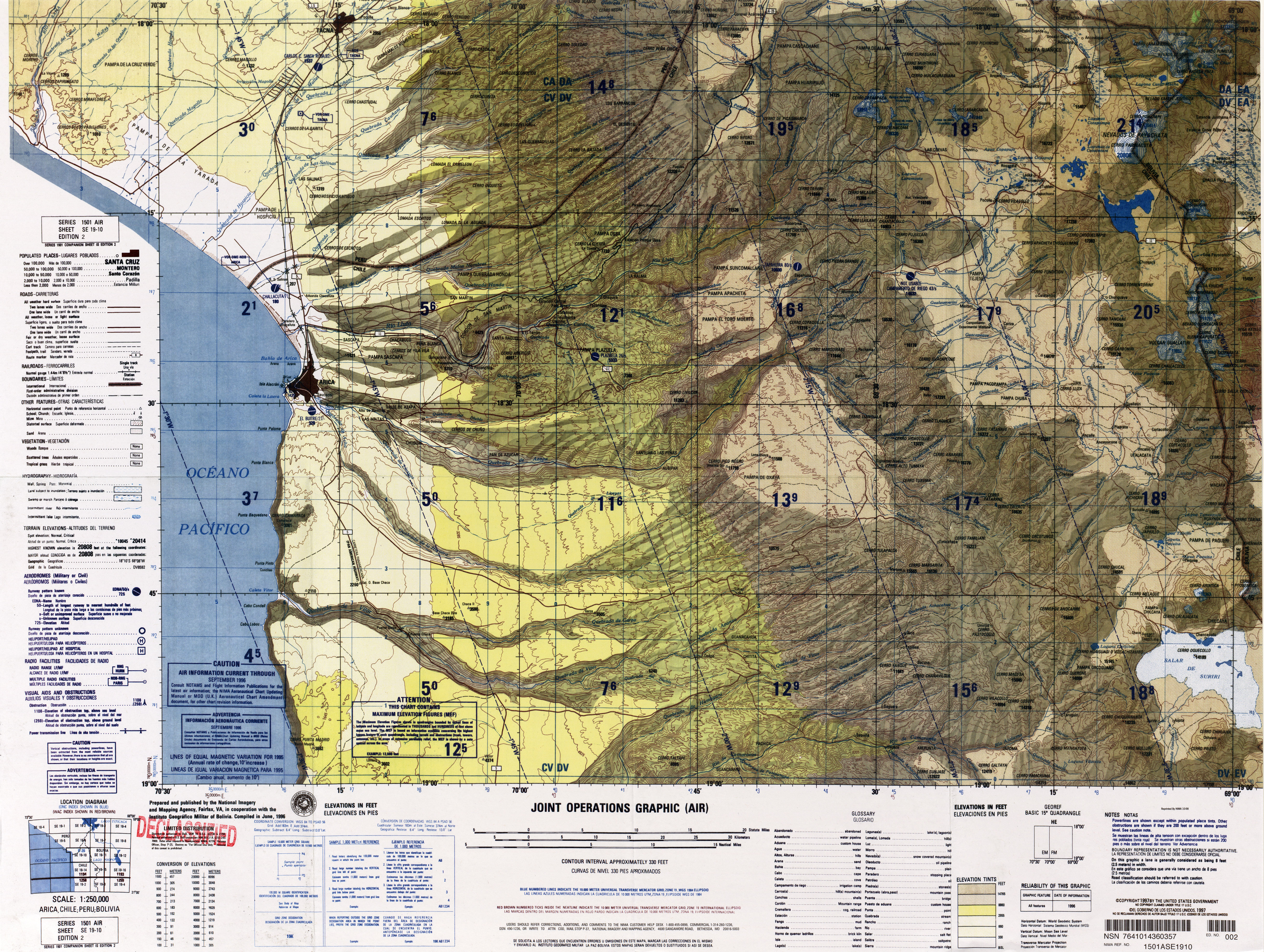
L'Humarata, ou cerro Humarata, est — avec l'Acotango et le cerro Capurata — l'un des trois stratovolcans formant le groupe connu sous le nom de Nevados de Quimsachata et situés à la frontière entre la Bolivie et le Chili.
Cet article est une ébauche concernant le volcanisme et la montagne.
Vous pouvez partager vos connaissances en l’améliorant (comment ?) selon les recommandations des projets correspondants.
| Humarata | |||
 De gauche à droite : l'Humarata, l'Acotango et le cerro Capurata. | |||
| Géographie | |||
|---|---|---|---|
| Altitude | 5 717 m | ||
| Massif | Nevados de Quimsachata (cordillère Occidentale, Andes) | ||
| Coordonnées | 18° 21′ 20″ sud, 69° 02′ 59″ ouest | ||
| Administration | |||
| Pays | |||
| Département Région |
Oruro Arica et Parinacota |
||
| Province Province |
Sajama Parinacota |
||
| Géologie | |||
| Type | Volcan de subduction | ||
| Activité | Inconnue | ||
| Dernière éruption | Inconnue | ||
| Code GVP | Aucun | ||
| Observatoire | Aucun | ||
| Géolocalisation sur la carte : Chili
Géolocalisation sur la carte : Bolivie
| |||
| modifier |
|||

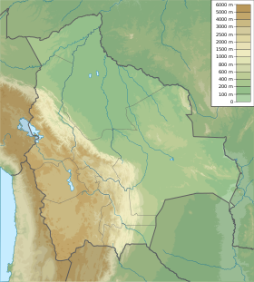
L'Humurata s'élève à une altitude de 5 717 mètres. Il est situé dans la région d'Arica et Parinacota (province de Parinacota) au Chili et dans le département d'Oruro (province de Sajama) en Bolivie.
Références
Voir aussi
Articles connexes
 Portail du volcanisme
  Portail de la Bolivie
  Portail du Chili
  Portail de la montagne
На других языках
[de] Humarata
Der Humarata, auch Cerro Umurata, ist ein 5601 m[1] hoher Vulkan in der Provinz Sajama des Departamento Oruro im Westen von Bolivien. Er befindet sich im Grenzgebiet zwischen Bolivien und Chile. Zusammen mit dem Capurata (6039 m) und dem Acotango (6052 m) bildet er die Quimsachata-Vulkankette. Er ist deren nördlichster Gipfel. Der Zeitpunkt des letzten Ausbruchs ist nicht bekannt.[en] Umurata
Umurata[2] is a mountain in the Andes, about 5,717 m (18,757 ft) high, situated in the Cordillera Occidental on the border of Bolivia and Chile. It is located in the Arica and Parinacota Region of Chile and in the Oruro Department of Bolivia, in the Sajama Province, Turku Municipality, Chachakumani Canton. Umurata lies south of the Uqi Uqini volcano, north of the Acotango and north-east of the Wallatiri volcano.[3] Argon-argon dating has yielded ages of 970,000±120,000 for Umurata rocks.[4] Umurata is situated south of National Route 4 near the Chungara-Tambo Quemado pass.- [fr] Humarata
Текст в блоке "Читать" взят с сайта "Википедия" и доступен по лицензии Creative Commons Attribution-ShareAlike; в отдельных случаях могут действовать дополнительные условия.
Другой контент может иметь иную лицензию. Перед использованием материалов сайта WikiSort.org внимательно изучите правила лицензирования конкретных элементов наполнения сайта.
Другой контент может иметь иную лицензию. Перед использованием материалов сайта WikiSort.org внимательно изучите правила лицензирования конкретных элементов наполнения сайта.
2019-2026
WikiSort.org - проект по пересортировке и дополнению контента Википедии
WikiSort.org - проект по пересортировке и дополнению контента Википедии