geo.wikisort.org - Montagne
Le Glittertind est une montagne de Norvège culminant à 2 452 m d'altitude.
Cet article est une ébauche concernant la montagne.
Vous pouvez partager vos connaissances en l’améliorant (comment ?) selon les recommandations des projets correspondants.
| Glittertind | |||
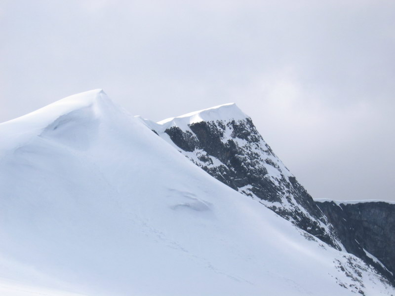 Vue de l'arête sommitale du Glittertind depuis l'est. | |||
| Géographie | |||
|---|---|---|---|
| Altitude | 2 452 m[1] | ||
| Massif | Jotunheimen (Alpes scandinaves) | ||
| Coordonnées | 61° 39′ 04″ nord, 8° 33′ 27″ est[1] | ||
| Administration | |||
| Pays | |||
| Landsdel | Østlandet | ||
| Fylke | Innlandet | ||
| Ascension | |||
| Première | 1841 par Wergeland et Sletten | ||
| Géologie | |||
| Roches | Gneiss | ||
| Géolocalisation sur la carte : Norvège
Géolocalisation sur la carte : Innlandet
| |||
| modifier |
|||


Deuxième sommet du pays et des Alpes scandinaves derrière le Galdhøpiggen, il a par le passé été considéré comme le point culminant de la chaîne. Ainsi, une carte de 1917 du Jotunheimen indique une altitude de 2 481 m pour le Glittertind contre 2 468 m pour le Galdhøpiggen[2]. Néanmoins cette mesure concernait la calotte glaciaire sommitale et non le sommet rocheux ce qui était sujet à débat[3]. Le glacier du Glittertind ayant depuis lors perdu de l'altitude (2 457 m), le statut de point culminant de la Norvège du Galdhøpiggen n'est plus contesté[3].
Toponymie
Le Glittertind tire son nom de la rivière voisine Glitra à laquelle a été adjointe la terminaison tind signifiant « pic, montagne ». Le toponyme Glitra provient quant à lui du verbe glitre, « scintiller ».
Notes et références
- Visualisation sur Kartverket.
- « Carte du massif de Jotunheimen »
- (en) « Glittertind », sur Jotunheimen National Park (consulté le )
 Portail de la Norvège
  Portail de la montagne
На других языках
[de] Glittertind
Der Glittertind (dt. „Glitzerzinne“) ist mit 2464 moh. nach dem Galdhøpiggen (2469 moh.) der zweithöchste Berg Norwegens.[en] Glittertind
Glittertind or Glittertinden is a mountain in Lom Municipality in Innlandet county, Norway. The 2,452-metre (8,045 ft) tall mountain is the second highest mountain in Norway. It is located in the Jotunheimen mountains within Jotunheimen National Park. The mountain sits about 22 kilometres (14 mi) southeast of the village of Fossbergom and about 38 kilometres (24 mi) southwest of the village of Vågåmo. The mountain is surrounded by several other notable mountains including Trollsteineggje, Trollsteinrundhøe, and Svartholshøe to the north; Grotbreahesten to the northeast; Veslekjølen to the east; Austre Hestlægerhøe and Nautgardstinden to the southeast; Steinbukampen and Veopallan to the south; and Galdhøpiggen to the west.[1]- [fr] Glittertind
[it] Glittertind (montagna)
Il Glittertind è la seconda montagna più alta della Norvegia dopo il Galdhøpiggen. Si trova nel comune di Lom, nella contea di Innlandet e nella catena del Jotunheimen.Другой контент может иметь иную лицензию. Перед использованием материалов сайта WikiSort.org внимательно изучите правила лицензирования конкретных элементов наполнения сайта.
WikiSort.org - проект по пересортировке и дополнению контента Википедии