geo.wikisort.org - Montagne
Enchanted Rock (littéralement « rocher enchanté ») est un énorme rocher de granite rose faisant partie de la formation de Llano Uplift, environ 24 km au nord de Fredericksburg au Texas (États-Unis) et à 24 km au sud de Llano. Sa superficie est d'environ 2,6 km2, son dénivelé de 130 mètres et son altitude de 556 mètres. Il s'agit du deuxième plus important monadnock de granite des États-Unis derrière Stone Mountain en Géorgie. Il est protégé au sein de l'aire naturelle d'État d'Enchanted Rock, qui s'étend sur 6,7 km2.
Cet article est une ébauche concernant la montagne et le Texas.
Vous pouvez partager vos connaissances en l’améliorant (comment ?) selon les recommandations des projets correspondants.
| Enchanted Rock | |||
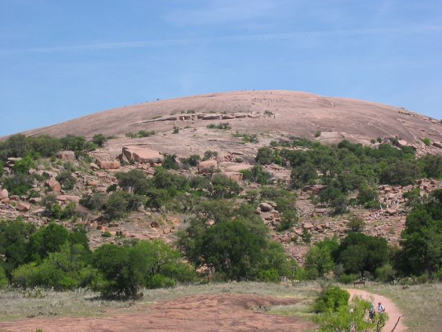 Vue d'Enchanted Rock depuis le sentier menant au sommet. | |||
| Géographie | |||
|---|---|---|---|
| Altitude | 556 m[1] | ||
| Massif | Plateau d'Edwards | ||
| Coordonnées | 30° 30′ 24″ nord, 98° 49′ 08″ ouest[1] | ||
| Administration | |||
| Pays | |||
| État | Texas | ||
| Comté | Llano | ||
| Ascension | |||
| Voie la plus facile | Summit Trail | ||
| Géologie | |||
| Roches | Granite | ||
| Type | Dôme | ||
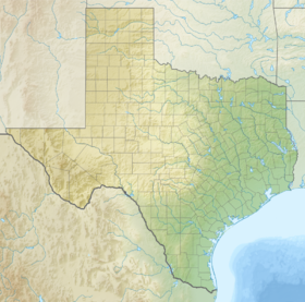
| Géolocalisation sur la carte : Texas
Géolocalisation sur la carte : États-Unis
| |||
| modifier |
|||

Notes et références
- Visualisation sur l'USGS.
Voir aussi
Liens externes
- Ressources relatives à la géographie :
- Ressource relative à l'architecture :
 Portail de la montagne
  Portail de l’archéologie
  Portail du Registre national des lieux historiques
  Portail du Texas
На других языках
[en] Enchanted Rock
Enchanted Rock is a pink granite mountain located in the Llano Uplift about 17 miles (27 km) north of Fredericksburg, Texas and 24 miles (39 km) south of Llano, Texas, United States. Enchanted Rock State Natural Area, which includes Enchanted Rock and surrounding land, spans the border between Gillespie and Llano counties, south of the Llano River. Enchanted Rock covers roughly 640 acres (260 ha) and rises around 425 feet (130 m) above the surrounding terrain to an elevation of 1,825 feet (556 m) above sea level. It is the largest pink granite monadnock in the United States. Enchanted Rock State Natural Area, a part of the Texas state park system, includes 1,644 acres (665 ha).[4] In 1936, the area was designated a Recorded Texas Historic Landmark.[5] In 1971, Enchanted Rock was designated as a National Natural Landmark by the National Park Service.[6]- [fr] Enchanted Rock
[it] Enchanted Rock
Enchanted Rock (roccia incantata) è un enorme masso di granito rosa situato nella regione del Llano Uplift, posta circa 24 chilometri a nord della città di Fredericksburg, in Texas e 24 km a sud della città di Llano.[ru] Энчантед-Рок
Энчантед-Рок (англ. Enchanted Rock) — огромный розовый гранитный батолит, который находится в 27 километрах к северу от города Фредериксберга в штате Техас, США. Энчантед-Рок и земли около него входят в состав природного заповедника Энчантед-Рок, который охватывает земли на границе округов Гиллеспи и Ллано и находится на юге от реки Ллано. Батолит занимает площадь около 260 га и является одним из крупнейших гранитных батолитов в США. Природный заповедник Энчантед-Рок занимает площадь около 665 гектаров[2].Текст в блоке "Читать" взят с сайта "Википедия" и доступен по лицензии Creative Commons Attribution-ShareAlike; в отдельных случаях могут действовать дополнительные условия.
Другой контент может иметь иную лицензию. Перед использованием материалов сайта WikiSort.org внимательно изучите правила лицензирования конкретных элементов наполнения сайта.
Другой контент может иметь иную лицензию. Перед использованием материалов сайта WikiSort.org внимательно изучите правила лицензирования конкретных элементов наполнения сайта.
2019-2026
WikiSort.org - проект по пересортировке и дополнению контента Википедии
WikiSort.org - проект по пересортировке и дополнению контента Википедии