geo.wikisort.org - Montagne
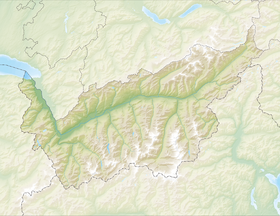
Le Dos de Rollin, ou Bosse de Rollin (Gobba di Rollin en italien), est un sommet des Alpes valaisannes situé à la frontière entre la Suisse (canton du Valais) et l'Italie (Vallée d'Aoste), qui culmine à 3 899 m d'altitude[1].
Pour les articles homonymes, voir Rollin.
| Dos de Rollin | |
 Vue du Dos de Rollin (large dôme neigeux à gauche) depuis le sud-ouest. | |
| Géographie | |
|---|---|
| Altitude | 3 899 m[1],[2] |
| Massif | Alpes valaisannes (Alpes) |
| Coordonnées | 45° 55′ 26″ nord, 7° 44′ 06″ est[1],[2] |
| Administration | |
| Pays | |
| Canton Région à statut spécial |
Valais Vallée d'Aoste |
| District | Viège |
| modifier |
|
Le Dos de Rollin est situé au sud du Petit Cervin et au sud-ouest du Breithorn. Son versant sud est recouvert par le glacier d'Aventine. Le Dos de Rollin fait partie du domaine skiable du Matterhorn ski paradise[1].
Références
- Visualisation sur Swisstopo.
- Visualisation sur le géoportail italien.
- Portail de la montagne
- Portail des Alpes
- Portail de la géographie de la Suisse
- Portail du Valais
- Portail de la Vallée d'Aoste
На других языках
[de] Gobba di Rollin
Die Gobba di Rollin (Gobba (ital.) = Buckel, Kuppe, franz. Dos de Rollin) ist mit 3899 m ü. M. der höchste Punkt des Breithornplateaus. Der Berg bildet mit 85 m Schartenhöhe einen eigenständigen, flachen Gletschergipfel, der bergsteigerisch unbedeutend ist.[en] Gobba di Rollin
Gobba di Rollin (Italian, French: Dos de Rollin; 3,899 m) is a mountain of the Pennine Alps, straddling the border between Switzerland and Italy. It is located south of the Breithorn and it is largely covered by ice, the summit area being particularly flat. On the north side is the Breithorn Plateau of the Theodul Glacier, on the east side is the Verraz Glacier and on the south is the Glacier d'Aventine.- [fr] Dos de Rollin
[it] Gobba di Rollin
La Gobba di Rollin (pron. fr. AFI: [ʁɔlɛ̃] - in francese, Dos de Rollin o Bosse de Rollin[1]) (3.899 m s.l.m.) è una montagna delle Alpi del Monte Rosa nelle Alpi Pennine, posta lungo la linea di frontiera tra l'Italia e la Svizzera.Текст в блоке "Читать" взят с сайта "Википедия" и доступен по лицензии Creative Commons Attribution-ShareAlike; в отдельных случаях могут действовать дополнительные условия.
Другой контент может иметь иную лицензию. Перед использованием материалов сайта WikiSort.org внимательно изучите правила лицензирования конкретных элементов наполнения сайта.
Другой контент может иметь иную лицензию. Перед использованием материалов сайта WikiSort.org внимательно изучите правила лицензирования конкретных элементов наполнения сайта.
2019-2025
WikiSort.org - проект по пересортировке и дополнению контента Википедии
WikiSort.org - проект по пересортировке и дополнению контента Википедии


