geo.wikisort.org - Montagne
Le cerro Bayo Gorbea est un stratovolcan endormi, qui se trouve à la frontière entre l'Argentine et le Chili. Son versant argentin est situé dans la province de Catamarca (département d'Antofagasta de la Sierra), alors que son versant chilien est situé dans la région d'Atacama (province de Chañaral). Il culmine à 5 413 mètres d'altitude.
Pour les articles homonymes, voir Bayo.
Cet article est une ébauche concernant la montagne, le volcanisme, l’Argentine et le Chili.
Vous pouvez partager vos connaissances en l’améliorant (comment ?) selon les recommandations des projets correspondants.
| Cerro Bayo Gorbea | |||
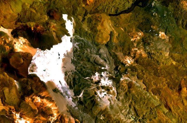 Image satellite du cerro Bayo Gorbea. | |||
| Géographie | |||
|---|---|---|---|
| Altitude | 5 413 m | ||
| Massif | Andes | ||
| Coordonnées | 25° 24′ 52″ sud, 68° 35′ 21″ ouest[1] | ||
| Administration | |||
| Pays | |||
| Province Région |
Catamarca Atacama |
||
| Département Province |
Antofagasta de la Sierra Chañaral |
||
| Géologie | |||
| Type | Volcan de subduction | ||
| Activité | Endormi | ||
| Dernière éruption | Inconnue | ||
| Code GVP | 355122 | ||
| Observatoire | Aucun | ||
| Géolocalisation sur la carte : Argentine
Géolocalisation sur la carte : Chili
| |||
| modifier |
|||


Références
- Visualisation sur le géoportail de l'Argentine.
Annexes
Articles connexes
- Liste des volcans d'Argentine
- Liste des volcans du Chili
 Portail de la montagne
  Portail du volcanisme
  Portail de l’Argentine
  Portail du Chili
На других языках
[de] Cerro Bayo
Der Cerro Bayo ist ein komplexer Vulkan in Nord-Chile.[en] Cerro Bayo Complex
Cerro Bayo is a complex volcano on the northern part border between Argentina and Chile. It consists of four overlapping stratovolcanoes along a north–south line. The main volcano fauce is located on the Argentine side, thought the summit of the complex is just west of the border, in Chile. The volcano is about 800,000 years old, but it is associated with ongoing ground uplift encompassing also the more northerly Lastarria and Cordón del Azufre volcanoes. The 5,401-metre (17,720 ft) high summit is the source of two viscous dacitic lava flows with prominent levees that traveled to the north. In 2007 a steam eruption were observed by researchers investigating nearby salt pans such as Salar Ignorado.[1][es] Complejo Cerro Bayo
El Complejo Cerro Bayo es un estratovolcán de varias fumarolas ubicado en la cordillera de los Andes en la frontera entre Argentina (Provincia de Catamarca) y Chile (Región de Atacama), con una altura máxima de 5401 metros (en Chile) y cráter principal en Argentina.- [fr] Cerro Bayo Gorbea
[it] Monte Cerro Bayo
Il Cerro Bayo è un vulcano situato lungo il confine tra l'Argentina ed il Cile.[ru] Серро-Байо
Серро-Байо — вулкан. Располагается на границе Чили (область Атакама) и Аргентины (провинция Катамарка). Находится к востоку от солончака Салар-де-Гобреа.Текст в блоке "Читать" взят с сайта "Википедия" и доступен по лицензии Creative Commons Attribution-ShareAlike; в отдельных случаях могут действовать дополнительные условия.
Другой контент может иметь иную лицензию. Перед использованием материалов сайта WikiSort.org внимательно изучите правила лицензирования конкретных элементов наполнения сайта.
Другой контент может иметь иную лицензию. Перед использованием материалов сайта WikiSort.org внимательно изучите правила лицензирования конкретных элементов наполнения сайта.
2019-2026
WikiSort.org - проект по пересортировке и дополнению контента Википедии
WikiSort.org - проект по пересортировке и дополнению контента Википедии