geo.wikisort.org - Montagne
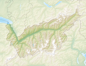
Castor (italien : Punta Castore) est le plus haut (4 223 mètres) des deux « Jumeaux » des Alpes pennines à la frontière entre le canton du Valais et la région autonome de la Vallée d'Aoste, non loin du Pollux (4 092 mètres) au nord-nord-ouest.
Pour les articles homonymes, voir Castor.
| Castor | |
 Castor, à gauche. | |
| Géographie | |
|---|---|
| Altitude | 4 221 ou 4 223 m[1],[2] |
| Massif | Alpes pennines (Alpes) |
| Coordonnées | 45° 55′ 15″ nord, 7° 47′ 36″ est[2],[1] |
| Administration | |
| Pays | |
| Canton Région à statut spécial |
Valais Vallée d'Aoste |
| District Commune |
Viège Gressoney-La-Trinité |
| Ascension | |
| Première | par William Mathews et Frederick William Jacomb avec Michel Croz |
| Voie la plus facile | par le refuge Quintino Sella au Félik |
| modifier |
|
Le Castor est situé entre le Breithorn et le mont Rose. La première ascension a eu lieu le . Ces deux sommets sont ainsi nommés en référence aux Dioscures de la mythologie grecque, Castor et Pollux.
Notes et références
- Visualisation sur le géoportail italien.
- Visualisation sur Swisstopo.
Annexes
Articles connexes
- Classement des sommets des Alpes de plus de 4000 mètres
Liens externes
- Portail de la montagne
- Portail des Alpes
- Portail de la Vallée d'Aoste
- Portail du Valais
На других языках
[de] Castor (Berg)
Castor, ital. Castore, ist der höhere der beiden Zwillinge genannten Hochgipfel in den Walliser Alpen, direkt südöstlich des von NNW ähnlich aussehenden, aber kleineren Pollux. Der Castor ist 4223 m hoch. In westlicher Richtung reiht sich Pollux und Breithorn und in östlicher Richtung Felikhorn, Liskamm und Monte Rosa in die Reihe der Viertausender ein. Die Zwillinge Castor und Pollux werden durch das Zwillingsjoch (ital. Passo di Verra, 3845 m ü. M.) getrennt. Die italienisch-schweizerische Grenze zwischen dem Kanton Wallis und der Region Aostatal verläuft zwischen Pollux über den Castor zum Liskamm entlang des Grats mit Ausnahme des Felikhorns (Gipfel in Italien).[1][en] Castor (mountain)
Castor (Italian: Castore) is a mountain in the Pennine Alps on the border between Valais, Switzerland and the Aosta Valley in Italy. It is the higher of a pair of twin peaks (German: Zwillinge), the other being Pollux, named after the Gemini twins of Roman mythology. Castor's peak is at an elevation of 4,223 m (13,855 ft), and it lies between Breithorn and the Monte Rosa. It is separated from Pollux by a pass at 3,847 m (12,621 ft), named Passo di Verra in Italian and Zwillingsjoch in German.[es] Cástor (montaña)
El Cástor (en italiano Càstore y en francés y alemán Castor) es una montaña del macizo del Monte Rosa en los Alpes Peninos. Se encuentra en el límite entre el Valle de Aosta (Italia) y el Cantón del Valais (Suiza). Queda en la vertiente de aguas que del Breithorn conduce hacia la Punta Dufour.- [fr] Castor (montagne)
[it] Castore (monte)
Il Castore (Castor in francese e in tedesco) alto 4.228 m è una montagna del massiccio del Monte Rosa, nelle Alpi Pennine, posto sul confine tra la Valle d'Aosta ed il Vallese[1].[ru] Кастор (гора)
Кастор (ит. Castore) — вершина в Пеннинских Альпах на границе Швейцарии, кантон Вале и Италии, провинция Валле-д’Аоста. Высота вершины 4228 метров над уровнем моря. Она расположена между массивом Монте-Роза и горой Брайтхорн.Текст в блоке "Читать" взят с сайта "Википедия" и доступен по лицензии Creative Commons Attribution-ShareAlike; в отдельных случаях могут действовать дополнительные условия.
Другой контент может иметь иную лицензию. Перед использованием материалов сайта WikiSort.org внимательно изучите правила лицензирования конкретных элементов наполнения сайта.
Другой контент может иметь иную лицензию. Перед использованием материалов сайта WikiSort.org внимательно изучите правила лицензирования конкретных элементов наполнения сайта.
2019-2025
WikiSort.org - проект по пересортировке и дополнению контента Википедии
WikiSort.org - проект по пересортировке и дополнению контента Википедии


