geo.wikisort.org - Montagne
Le Begunjščica est un sommet des Alpes, à 2 060 m, dans les Karavanke, en Slovénie.
| Begunjščica | ||
 Le Begunjščica. | ||
| Géographie | ||
|---|---|---|
| Altitude | 2 060 m[1] | |
| Massif | Karavanke (Alpes) | |
| Coordonnées | 46° 25′ 18″ nord, 14° 13′ 47″ est[1] | |
| Administration | ||
| Pays | ||
| Région historique | Haute-Carniole | |
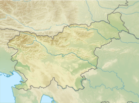
| Géolocalisation sur la carte : Slovénie
| ||
| modifier |
||
Notes et références
- Visualisation sur le géoportail de la Slovénie.
- Portail de la montagne
- Portail des Alpes
- Portail de la Slovénie
На других языках
[en] Begunjščica
Begunjščica is a ridge mountain in the Karawanks. It rises from the western Smokuč mountain pasture (Slovene: Smokuška planina) to St. Anne (Sv. Ana) on its eastern side. The mountain has three main peaks, the highest being Big Peak (Veliki vrh, 2,060 metres or 6,760 feet). The western Middle Peak (Srednji vrh) lies a little lower, and the lowest is Begunje Mount Vrtača (Begunjska Vrtača, 1,997 m or 6,552 ft). Its southern slopes rise over the Draga Valley. The ascent of the mountain is relatively easy and possible throughout the year. In the winter and early spring conditions are favourable for ski touring.- [fr] Begunjščica
Текст в блоке "Читать" взят с сайта "Википедия" и доступен по лицензии Creative Commons Attribution-ShareAlike; в отдельных случаях могут действовать дополнительные условия.
Другой контент может иметь иную лицензию. Перед использованием материалов сайта WikiSort.org внимательно изучите правила лицензирования конкретных элементов наполнения сайта.
Другой контент может иметь иную лицензию. Перед использованием материалов сайта WikiSort.org внимательно изучите правила лицензирования конкретных элементов наполнения сайта.
2019-2025
WikiSort.org - проект по пересортировке и дополнению контента Википедии
WikiSort.org - проект по пересортировке и дополнению контента Википедии
