geo.wikisort.org - Montañas
El Muztagh Ata, que significa "padre de los hielos", es el segundo pico más alto de la cordillera de Kunlun, por detrás del Kongur.
| Muztagh Ata | ||
|---|---|---|
 | ||
| Localización geográfica | ||
| Región | Kongur | |
| Cordillera | Kunlun | |
| Coordenadas | 38°16′42″N 75°06′57″E | |
| Localización administrativa | ||
| País |
| |
| División | Prefectura de Kasgar | |
| Características generales | ||
| Altitud | 7.546 msnm | |
| Prominencia | 2 735 metros | |
| Montañismo | ||
| 1.ª ascensión | 1956 | |
| Ruta | Nieve y hielo | |
| Mapa de localización | ||
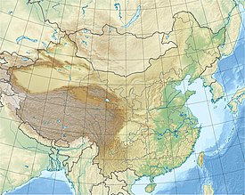 Muztagh Ata Ubicación en República Popular China. | ||
Está situado a pocos kilómetros de la frontera entre China y Pakistán, muy cerca de la carretera del Karakórum y dentro de la Región Autónoma Uigur de Sinkiang. Es una montaña de cima redondeada y siempre cubierta de nieve, por lo que se puede descender desde la cima al campo base esquiando con bastante facilidad. La ascensión a esta montaña suele iniciarse en el lago Karakul. El Muztagh Ata ocupa el lugar número 47 entre las montañas más altas del mundo.
Aunque la primera expedición se realizó en 1893, la primera ascensión con éxito la realizó una expedición mixta chino-soviética en 1956, compuesta por 31 miembros y liderada por Eugeni Beletsky y Chu Ying Hua. Para ello, utilizaron la ruta más larga, que queda al sur de la ruta normal de hoy en día.
En la actualidad se utiliza como campo de entrenamiento antes de las ascensión al Everest.
Enlaces externos
 Wikimedia Commons alberga una categoría multimedia sobre Muztagh Ata.
| Control de autoridades |
|---|
 Datos: Q630579
- Multimedia: Muztagh Ata
На других языках
[de] Muztagata
Der Muztagata ist mit einer Höhe von 7509 m der dritthöchste Gipfel des Pamir-Gebirges in der Volksrepublik China.[en] Muztagh Ata
Muztagh Ata or Muztagata (Uighur: مۇز تاغ ئاتا, Музтағ Ата, literally "ice-mountain-father"; Chinese: 慕士塔格峰; pinyin: Mùshìtǎgé Fēng; formerly known as Mount Tagharma or Taghalma and Wi-tagh) is the second highest (7509 metres)[2] of the mountains which form the northern edge of the Tibetan Plateau (not the second highest of the mountains of the Tibetan Plateau). It is sometimes regarded as being part of the Kunlun Mountains, although physically it is more closely connected to the Pamirs. It is also one of the relatively easier 7,000 m peaks in the world to climb, due to its gentle western slope and the comparatively drier weather of Xinjiang, though a thorough acclimatization period and a very strong physical condition are crucial for success.- [es] Muztagh Ata
[fr] Mustagh Ata
Mustagh Ata, ou Muztagata, en ouïghour : مۇز تاغ ئاتا, littéralement « Père des montagnes de glace », est un sommet situé dans la région autonome ouïghoure du Xinjiang en République populaire de Chine, non loin du Pakistan. Il culmine à 7 546 m d'altitude. Il est parfois considéré comme faisant partie de la cordillère du Kunlun, bien que géographiquement plus proche de celle du Pamir[réf. nécessaire]. Compte tenu de sa face Ouest dont la pente est relativement douce et au climat sec de la région, il est considéré comme étant l'un des sommets de plus de 7 000 mètres les plus faciles.[it] Muztagata
Il Muztagata[1][2] (o Muztagh Ata; in uiguro مۇز تاغ ئاتا, Музтағ Ата; in cinese: 慕士塔格峰; in pinyin: Mùshìtǎgé Fēng) è la seconda vetta più alta del Pamir (o del Kunlun, come indicano altre fonti). Il nome deriva dall'uiguro e significa padre delle montagne ghiacciate.[ru] Музтагата
Музтагата́[2] (кит. упр. 慕士塔格峰, пиньинь Mùshìtǎgé Fēng, уйг. مۇز تاغ ئاتا, Музтағ Ата — «отец ледяных гор») — гора на Памире, расположенная на территории СУАР, Китай. Высота 7546 м, из-за пологого западного склона и относительно сухой погоды в регионе является одним из наиболее легко покоряемых пиков выше 7 тыс. м.Другой контент может иметь иную лицензию. Перед использованием материалов сайта WikiSort.org внимательно изучите правила лицензирования конкретных элементов наполнения сайта.
WikiSort.org - проект по пересортировке и дополнению контента Википедии