geo.wikisort.org - Montañas
La Cuchilla Grande es una cordillera de cuchillas, que cruza el territorio de Uruguay de oriente a poniente por el sur del Río Negro. Se origina en la región de la Sierra Aceguá (400 m de altitud) luego decae para volverse a elevar cuando se desprende hacia el este, la Cuchilla del Olimar y la Sierra de Sosa. Hacia el oeste se desprenden varios ramales. La Cuchilla Grande del Durazno que delimita la divisoria de aguas entre el Río Negro y el Río Yí. La Cuchilla Grande Inferior, pierde altura hacia el oeste con los nombres de Cuchilla de Santo Domingo, Cuchilla del Pintado; luego se divide en 3 ramas: Cuchilla del Bizcocho, de San Salvador y de Colonia acercándose a las márgenes del Río Uruguay y del Río de la Plata. Más al sur la Cuchilla Grande del Sur, atraviesa con escasa altura los departamentos de Canelones y Montevideo.
| Cuchilla Grande | ||
|---|---|---|
 | ||
| Coordenadas | 34°22′00″S 54°40′00″O | |
| Ubicación administrativa | ||
| País | Uruguay | |
| División | Departamento de Maldonado | |
| Características | ||
| Máxima cota | Cerro Catedral 250 m (promedio) y 514 m (máxima) | |
| Cumbres | Cerro Catedral, Cerro de las Ánimas, Cerro Arequita, Cerro Baltasar, Cerro del Verdún, Cerro Artigas, Cerro Pan de Azúcar, Cerro del Penitente, Cerro de Tupambaé | |
| Longitud | alrededor de 700 km | |
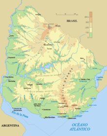
De las ramificaciones orientales, la más importante es la Sierra Carapé donde se encuentra el Cerro Catedral (la máxima altura del país).
Principales ramales
- Cuchilla de Mansavillagra
- Sierra Carapé
- Sierra Aceguá
- Sierra de las Ánimas
- Cuchilla Grande Inferior
- Cuchilla de Cerro Largo
- Cuchilla de Mangrullo
- Cuchilla de Legris
Véase también
- Cuchilla de Haedo
- Cuchilla de Santa Ana
- Cuchilla de San Fernando

| Control de autoridades |
|---|
 Datos: Q1143026
На других языках
[de] Cuchilla Grande
Die Cuchilla Grande (zu deutsch: scharfer Kamm bzw. Schneide eines Messers) ist mit bis zu 513 Meter die bedeutendste Hügelkette in Uruguay.[en] Cuchilla Grande
Cuchilla Grande is a hill range that crosses the east part of Uruguay from north to south. It extends from the south part of Cerro Largo Department, through the departments of Treinta y Tres and Lavalleja and ends in Maldonado Department where it forms its highest peaks.- [es] Cuchilla Grande (Uruguay)
[ru] Кучилья-Гранде
Кучилья-Гранде (исп. Cuchilla Grande) — возвышенность на востоке Уругвая. Разделяет бассейны реки Уругвай и озера Лагоа-Мирин. Сложена гранитами. На возвышенности находится гора Серро-Катедраль высотой 514 метров — наивысшая точка страны. Растительность — субтропическая саванна, местами вечнозелёные и листопадные леса и кустарники[1][2].Другой контент может иметь иную лицензию. Перед использованием материалов сайта WikiSort.org внимательно изучите правила лицензирования конкретных элементов наполнения сайта.
WikiSort.org - проект по пересортировке и дополнению контента Википедии