geo.wikisort.org - Mountains
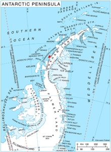
Wooden Peak (66°8′S 65°35′W) is a peak 2 nautical miles (3.7 km) southeast of Black Head on Stresher Peninsula on the west coast of Graham Land. Charted by the British Graham Land Expedition (BGLE) under Rymill, 1934–37. Named by the United Kingdom Antarctic Place-Names Committee (UK-APC) in 1959 for Frederick E. Wooden, Falkland Islands Dependencies Survey (FIDS) surveyor at Danco Island in 1956 and at Prospect Point in 1957. Wooden was also attached to the British Naval Hydrographic Survey Unit which worked in the area in 1957–58.
![]() This article incorporates public domain material from the United States Geological Survey document: "Wooden Peak". (content from the Geographic Names Information System)
This article incorporates public domain material from the United States Geological Survey document: "Wooden Peak". (content from the Geographic Names Information System)
This Graham Coast location article is a stub. You can help Wikipedia by expanding it. |
На других языках
[de] Wooden Peak
Der Wooden Peak ist ein rund 900 m hoher Berg an der Graham-Küste des Grahamlands im Norden der Antarktischen Halbinsel. Am Südufer der Holtedahl Bay ragt er 3 km südöstlich des Black Head auf.- [en] Wooden Peak
Другой контент может иметь иную лицензию. Перед использованием материалов сайта WikiSort.org внимательно изучите правила лицензирования конкретных элементов наполнения сайта.
WikiSort.org - проект по пересортировке и дополнению контента Википедии