geo.wikisort.org - Mountains
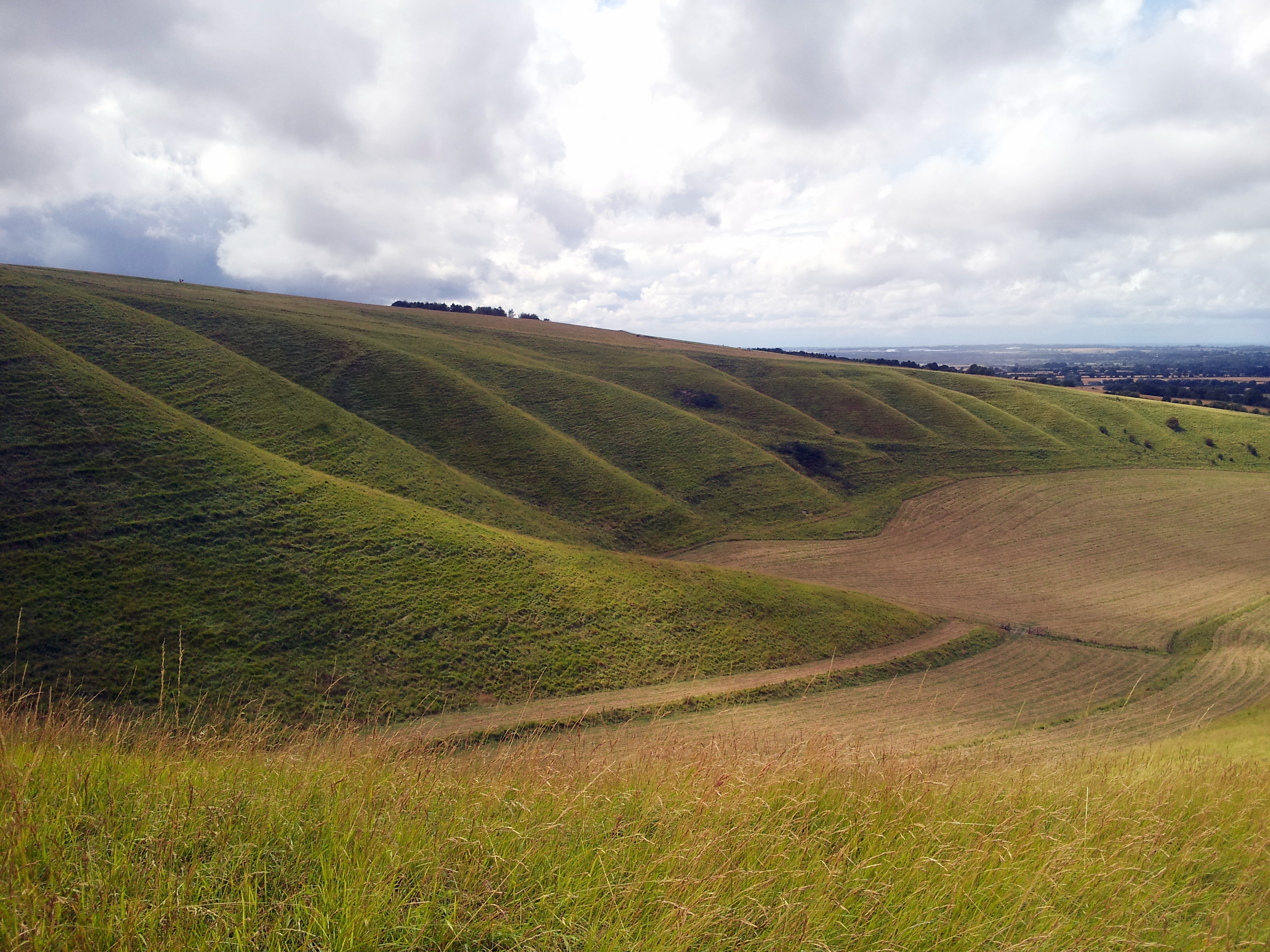
Whitehorse Hill is a hill in the Berkshire Downs in Oxfordshire, England, west of Wantage. At 261 metres (856 ft), it is the highest point in Oxfordshire. Uffington Castle lies on the summit of the hill, and the Uffington White Horse is on the hill's northern slope.[2][3] The hill and an adjacent area below, including Dragon Hill and The Manger, make up a 98.9-hectare (244-acre) biological and geological Site of Special Scientific Interest.[1][4]
| Site of Special Scientific Interest | |
 | |
| Location | Oxfordshire |
|---|---|
| Grid reference | SU 300 867[1] |
| Interest | Biological Geological |
| Area | 98.9 hectares (244 acres)[1] |
| Notification | 1986[1] |
| Location map | Magic Map |
The Manger, a dry valley below the hill, is a Geological Conservation Review site.[5] It provides evidence of solifluction (slow slipping of soil downhill due to repeated freezing and thawing) during at least one cold stage of the Pleistocene.
The site has unimproved chalk grassland with a rich variety of flora, particularly in former chalk quarries. Grasses include upright brome and sheep’s fescue.[6]
The Ridgeway National Trail crosses the hill south of Uffington Castle.
See also
References
- "Designated Sites View: Whitehorse Hill". Sites of Special Scientific Interest. Natural England. Retrieved 30 March 2020.
- Historic England. "Uffington Castle: a univallate hillfort immediately north of the Ridgeway on Whitehorse Hill (1008412)". National Heritage List for England. Retrieved 26 February 2020.
- Historic England. "The White Horse hill figure 170m NNE of Uffington Castle on Whitehorse Hill (1008413)". National Heritage List for England. Retrieved 30 March 2020.
- "Map of Whitehorse Hill". Sites of Special Scientific Interest. Natural England. Retrieved 30 March 2020.
- "The Manger (Karst)". Geological Conservation Review. Joint Nature Conservation Committee. Retrieved 26 February 2020.
- "Whitehorse Hill citation" (PDF). Sites of Special Scientific Interest. Natural England. Retrieved 30 March 2020.
На других языках
[de] White Horse Hill
White Horse Hill ist ein Hügel in Oxfordshire (Distrikt Vale of White Horse). Das Uffington White Horse auf der Seite gilt als das älteste Scharrbild in England. Es handelt sich um das stilisierte Bild eines Pferdes, das in die Vegetation geschnitten und in den Boden gescharrt wurde. Dadurch wird die darunter liegende Kreide sichtbar. Die Umrisse werden von drei Meter breiten, 60 bis 90 Zentimeter tiefen Gräben gebildet. Die Pferdefigur hat die Ausmaße von 107 × 37 m.[1] Sowohl die Position als auch die Form des Pferdes haben sich über die Jahrtausende kaum verändert, nur die Linien sind ein wenig dünner geworden.- [en] Whitehorse Hill
Другой контент может иметь иную лицензию. Перед использованием материалов сайта WikiSort.org внимательно изучите правила лицензирования конкретных элементов наполнения сайта.
WikiSort.org - проект по пересортировке и дополнению контента Википедии