geo.wikisort.org - Mountains
Voio (Greek: Βόιο, Vóio; Ancient Greek: Βόιον - Boeon) is a mountain range in the southwestern Kastoria and western Kozani regional units in Greece. The mountain is part of the Pindus mountains. Its highest elevation is 1,805 m.[1] It is a densely forested and sparsely populated mountain range. It is drained towards the river Sarantaporos in the west and towards the Aliakmonas in the east. The nearest mountain ranges are Gramos to the west and Smolikas to the southwest.
| Voio | |
|---|---|
| Βόιο | |
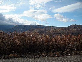
 The mountain ridge Ondria (Όντρια), part of the Voio. | |
| Highest point | |
| Elevation | 1,805 m (5,922 ft)[1] |
| Listing | List of mountains in Greece |
| Coordinates | 40°13′30″N 21°05′02″E |
| Naming | |
| Pronunciation | Greek: [ˈvoʝo] |
| Geography | |
| Location | Kastoria and Kozani regional units, Greece |
The nearest villages are Pentalofos in the east, Eptachori in the west and Kypseli in the north. The municipality Voio, named after the mountains, is situated in the eastern part. The Greek National Road 20 (Kozani - Konitsa - Ioannina) passes through the mountains, 2 km south of the highest point. The first home of the Boeotians was the mountain Boion; the mountain gave them their name.[2]
References
- Oreivatein.com
- Bury, John Bagnell. A History of Greece to the Death of Alexander the Great (Volume 1). ISBN 0-543-97069-8, p. 54.
На других языках
[de] Voio (Berg)
Der Voio (griechisch Βόιο auch Βόϊο (n. sg.)) ist ein Berg in Westmakedonien. Er nimmt den östlichen Teil des Regionalbezirks Kastoria ein. Zum Teil wird er als Verlängerung des Grammos-Massivs angesehen. Sein höchster Gipfel steigt auf 1.802 m über dem Meer an. Der größte Teil des Berges ist bewaldet und ein Teil steht unter Naturschutz (Katafigio Agrias Zois Tria Alonia - Mantani-Vounopika - Καταφύγιο Άγριας Ζωής Τρία Αλώνια - Μαντάνι). In seinem Gebiet entspringen die Hauptquellen des Aliakmonas. Nach dem Berg ist auch die Gemeinde Voio benannt, die im östlichen Teil des Gebiets liegt. Weitere Siedlungen sind Pendalofos im Osten, Eptachori im Westen und Kypseli im Norden. Zum Voio-Massiv gehört auch der niedrigere Ondria(Όντρια), der sich bis nach Kozani zieht. Die Ethniki Odos 20 verläuft zwei Kilometer südlich des höchsten Gipfels. Die ältesten Besiedlung des Berges geschah durch den dorischen Stamm, der vom Berg den Namen Boioter (Βοιωτοί, Böotier) annahm und ihn auf die Landschaft Böotien übertrug.[1]- [en] Voio
[ru] Войон
Во́йон (греч. Βόιον) — горный хребет в Греции, в горной системе Пинд. Тянется с северо-запада на юго-восток[1]. Высочайшая вершина — гора Профитис-Илиас-Супаниу высотой 1804,6 м над уровнем моря, на границе периферийных единиц Кастория и Козани в периферии Западная Македония. Южным продолжением являются горы Талиарос (Τάλιαρος) между селами Доцикон[en] и Эптахорион[el][1]. Северная часть называется Ондрия[el] (горы Мегало-Ондрия, 1596 м[1] и Микра-Ондрия, 1525 м[2]). На западе отделён от гор Грамос рекой Сарандапорос. С севера ограничен рекой Альякмон от гор Амуда (1546 м) и Алевица (1585 м)[3]. Восточнее находятся горы Аскион. На юге граничит с горами Аница (1728 м), Скурдза (1800 м) и Василица (2248 м)[4].Другой контент может иметь иную лицензию. Перед использованием материалов сайта WikiSort.org внимательно изучите правила лицензирования конкретных элементов наполнения сайта.
WikiSort.org - проект по пересортировке и дополнению контента Википедии
