geo.wikisort.org - Mountains
Virginia Peak is a mountain summit in the northern part of Yosemite National Park, north of Tuolumne Meadows. It is the 25th-highest mountain in Yosemite National Park.[2]
| Virginia Peak | |
|---|---|
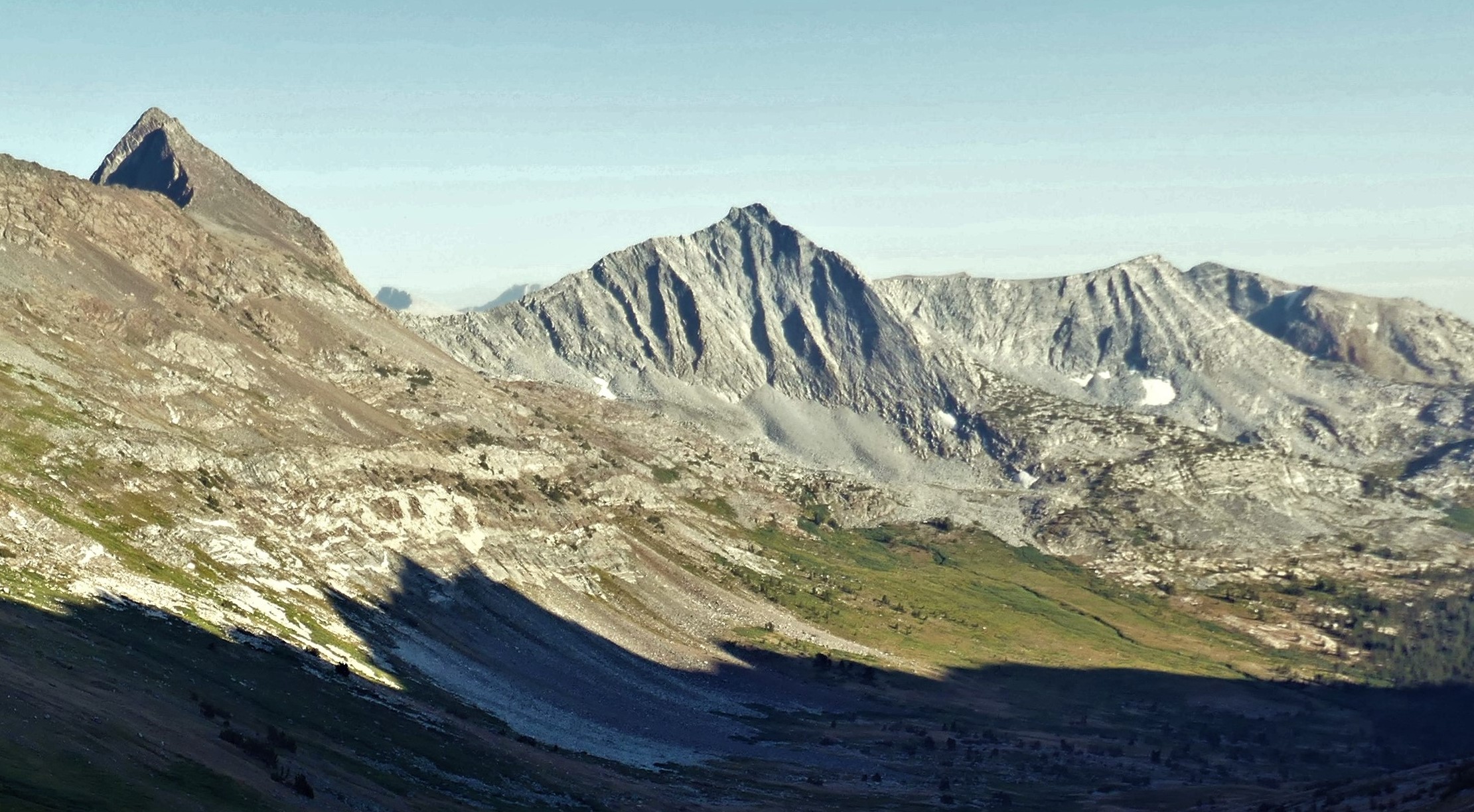
 East aspect (centered), from Black Mountain | |
| Highest point | |
| Elevation | 12,002 ft (3,658 m) NAVD 88[1] |
| Prominence | 481 ft (147 m)[1] |
| Coordinates | 38°3′57″N 119°21′29″W[1] |
| Geography | |
 Virginia Peak Virginia Peak  Virginia Peak Virginia Peak (the United States) | |
| Location | Yosemite National Park Tuolumne County, California, U.S. |
| Parent range | Sierra Nevada |
| Topo map | USGS Dunderberg Peak |
| Climbing | |
| Easiest route | class 2 to class 3 |
Virginia Peak's particulars
Virginia Peak is in northeastern Yosemite National Park, on a north–south ridge splitting off the main Sierra crest at Twin Peaks.
Virginia Pass and Sawtooth Ridge are near, as are Whorl Mountain, Excelsior Mountain and Matterhorn Peak.[3]
Near Virginia Pass, viewed from the east, Virginia Peak looks dark, forbidding — it is not composed of more-common Yosemite granite, but of reddish metamorphic rock, such as is found on Mount Dana and Dunderberg Peak.[4] Of note, Virginia Peak is along the ancient boundary between the Sierra Nevada Batholith's intruding granite and pre-existing sediments, which are now metamorphosed, so-called metasediments.[5]
Climate
Virginia Peak is located in an alpine climate zone.[6] Most weather fronts originate in the Pacific Ocean, and travel east toward the Sierra Nevada mountains. As fronts approach, they are forced upward by the peaks (orographic lift), causing moisture in the form of rain or snowfall to drop onto the range.[citation needed]
See also
 Mountains portal
- Geology of the Yosemite area
References
- "Virginia Peak, California". Peakbagger.com. Retrieved 2019-03-18.
- Kelliher, Mat. "Yosemite NP Peaks". Peakbagger.com. Retrieved 18 March 2019.
- "Virginia Peak, Part of Yosemite National Park". Anyplaceamerica.com. Retrieved 19 March 2019.
- Steeleman. "Virginia Peak, California, United States, North America". Summitpost.org. Retrieved 18 March 2019.
- mpbro. "Stanton Peak". Summitpost.org. Retrieved 18 March 2019.
- "Climate of the Sierra Nevada". Encyclopædia Britannica.
External links
Places adjacent to Virginia Peak (Yosemite) | ||||||||||||||||
|---|---|---|---|---|---|---|---|---|---|---|---|---|---|---|---|---|
| ||||||||||||||||
This Yosemite-related article is a stub. You can help Wikipedia by expanding it. |
Другой контент может иметь иную лицензию. Перед использованием материалов сайта WikiSort.org внимательно изучите правила лицензирования конкретных элементов наполнения сайта.
WikiSort.org - проект по пересортировке и дополнению контента Википедии