geo.wikisort.org - Mountains
The Unterrothon (or simply Rothorn) is a mountain of the Swiss Pennine Alps, overlooking Zermatt in the canton of Valais. It is located west of the Oberrothorn, on the range north of the Findel Glacier.
| Unterrothorn | |
|---|---|
 | |
| Highest point | |
| Elevation | 3,104 m (10,184 ft) |
| Prominence | 123 m (404 ft)[1] |
| Parent peak | Monte Rosa |
| Coordinates | 46°01′19″N 7°47′51″E |
| Geography | |
 Unterrothorn Location in Switzerland | |
| Location | Valais, Switzerland |
| Parent range | Pennine Alps |
| Climbing | |
| Easiest route | Cable car |
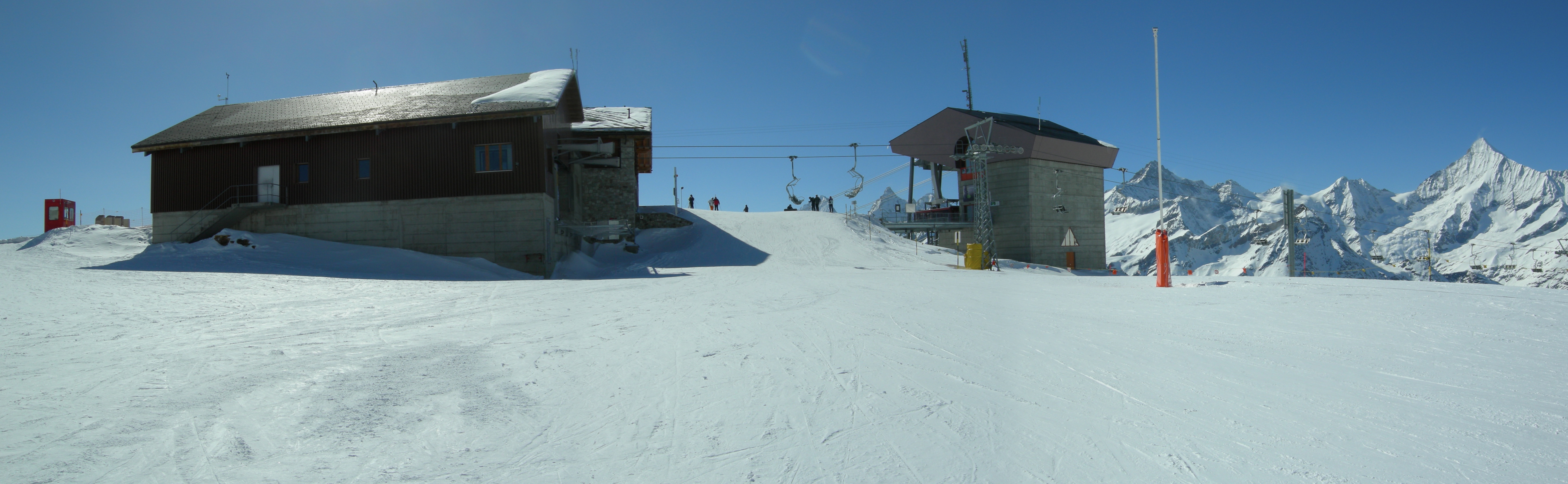
The summit can be reached by cable car via Sunnegga and Blauherd. The Rothorn paradise is one of the main ski areas located around Zermatt.
See also
References
- Retrieved from the Swisstopo topographic maps. The key col is the Furggji (2,981 m).
External links
| Authority control |
|
|---|
This Valais location article is a stub. You can help Wikipedia by expanding it. |
На других языках
[de] Unterrothorn
Das Unterrothorn ist ein 3104 m ü. M. hoher Berg im Kanton Wallis, nahe Zermatt. Das Unterrothorn befindet sich rund 5 km östlich des Dorfes und markiert den obersten Punkt des Skigebiets Zermatt-Rothorn, welches von Sunnegga und Blauherd durch eine Metro, eine Gondelbahn und eine Seilbahn oder von der Kumme her mit einer Sesselbahn erreicht werden kann.- [en] Unterrothorn
[fr] Unterrothorn
L'Unterrothorn est une montagne du canton du Valais, en Suisse, culminant à 3 102 mètres d'altitude et surplombant la station de Zermatt, à environ 5 km à l’est.[it] Unterrothorn
L'Unterrothorn è una montagna di 3103 m s.l.m. delle Alpi Pennine nel comune di Zermatt, nel Canton Vallese. È particolarmente noto perché è una delle stazioni più importanti degli impianti sciistici di Zermatt e del Matterhorn Ski Paradise.Текст в блоке "Читать" взят с сайта "Википедия" и доступен по лицензии Creative Commons Attribution-ShareAlike; в отдельных случаях могут действовать дополнительные условия.
Другой контент может иметь иную лицензию. Перед использованием материалов сайта WikiSort.org внимательно изучите правила лицензирования конкретных элементов наполнения сайта.
Другой контент может иметь иную лицензию. Перед использованием материалов сайта WikiSort.org внимательно изучите правила лицензирования конкретных элементов наполнения сайта.
2019-2026
WikiSort.org - проект по пересортировке и дополнению контента Википедии
WikiSort.org - проект по пересортировке и дополнению контента Википедии