geo.wikisort.org - Mountains
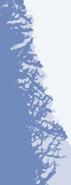
Umiasussuk (old spelling: Umiasugssuk) is a 620 m (2,030 ft)[1] mountain in Avannaata municipality in northwestern Greenland, located in the northern part of Qaarsorsuaq Island in the Upernavik Archipelago. The name of the mountain means "a boat-shaped mountain" in the Greenlandic language.
| Umiasussuk | |
|---|---|
 Umiasussuk seen from the northwest, from Upernavik Island | |
| Highest point | |
| Elevation | 620 m (2,030 ft)[1] |
| Prominence | 620 m (2,030 ft) |
| Coordinates | 72°45′39″N 55°56′25″W |
| Geography | |
 Umiasussuk | |
| Location | Qaarsorsuaq Island, Upernavik Archipelago, Greenland |
Geography
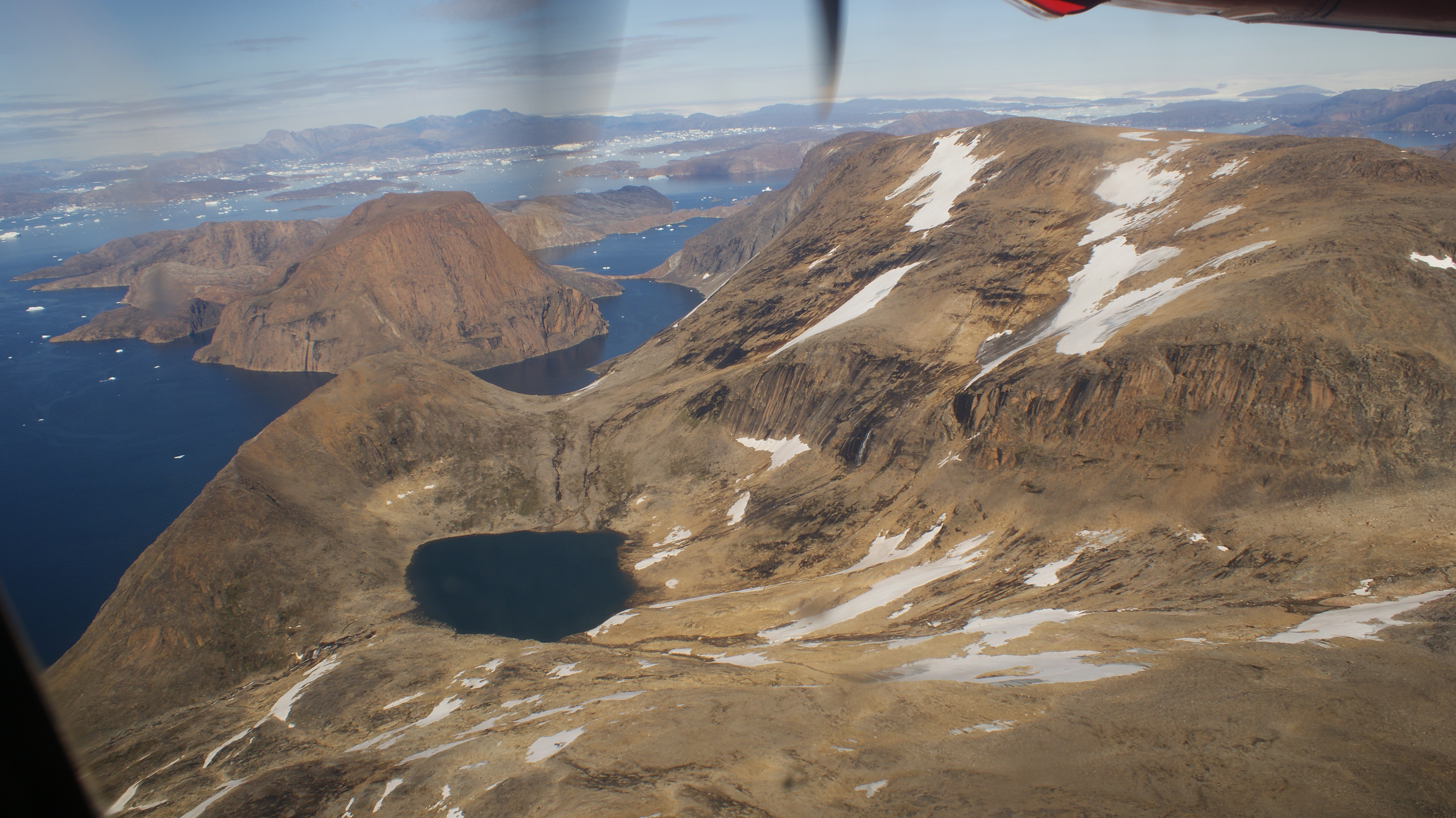
Umiasussuk is a standalone mountain, a flooded peak, whose trapezoid shape is the landmark of Upernavik town, visible from the Upernavik Airport 7 km (23,000 ft) away, and from the entire eastern and northern coast of Upernavik Island.
Via a small isthmus in the east, the mountain is connected with the remainder of the large Qaarsorsuaq Island.[1] To the north, the Torsuut strait separates the mountain from Atilissuaq Island. To the west, the low Akia Island separates the mountain from Upernavik Island.
References
- Upernavik, Saga Map, Tage Schjøtt, 1992
На других языках
[de] Umiasussuk (Berg, Upernavik)
Umiasussuk (deutsch ein wie ein Boot geformter Berg) ist ein Berg auf der Insel Qaarsorsuatsiaq, welche in der Bucht Tasiusap Imaa liegt, im Distrikt Upernavik in der Avannaata Kommunia, Grönland. Der Umiasussuk hat eine Höhe von 620 Metern.- [en] Umiasussuk
Другой контент может иметь иную лицензию. Перед использованием материалов сайта WikiSort.org внимательно изучите правила лицензирования конкретных элементов наполнения сайта.
WikiSort.org - проект по пересортировке и дополнению контента Википедии