geo.wikisort.org - Mountains
Tymfristos (Greek: Τυμφρηστός) is a mountain in the eastern part of Evrytania and the western part of Phthiotis, Greece. The mountain is a part of the Pindus mountain range. The elevation of its highest peak, Velouchi (Greek: Βελούχι), is 2,315 m.[1] The nearest mountains are Kaliakouda and Panaitoliko to the south, Vardousia to the southeast and the Agrafa mountains to the north. It is drained by the river Spercheios to the east and by tributaries of the Acheloos (including Megdovas) to the west. The name Velouchi comes from Velos which means arrow, as Aetolian archers were known for harassing invading pre-Christian Celts and Persians with their famous archery. See The Greek and Macedonian Art of War, by F.E. Adcock, 1962.
| Tymfristos | |
|---|---|
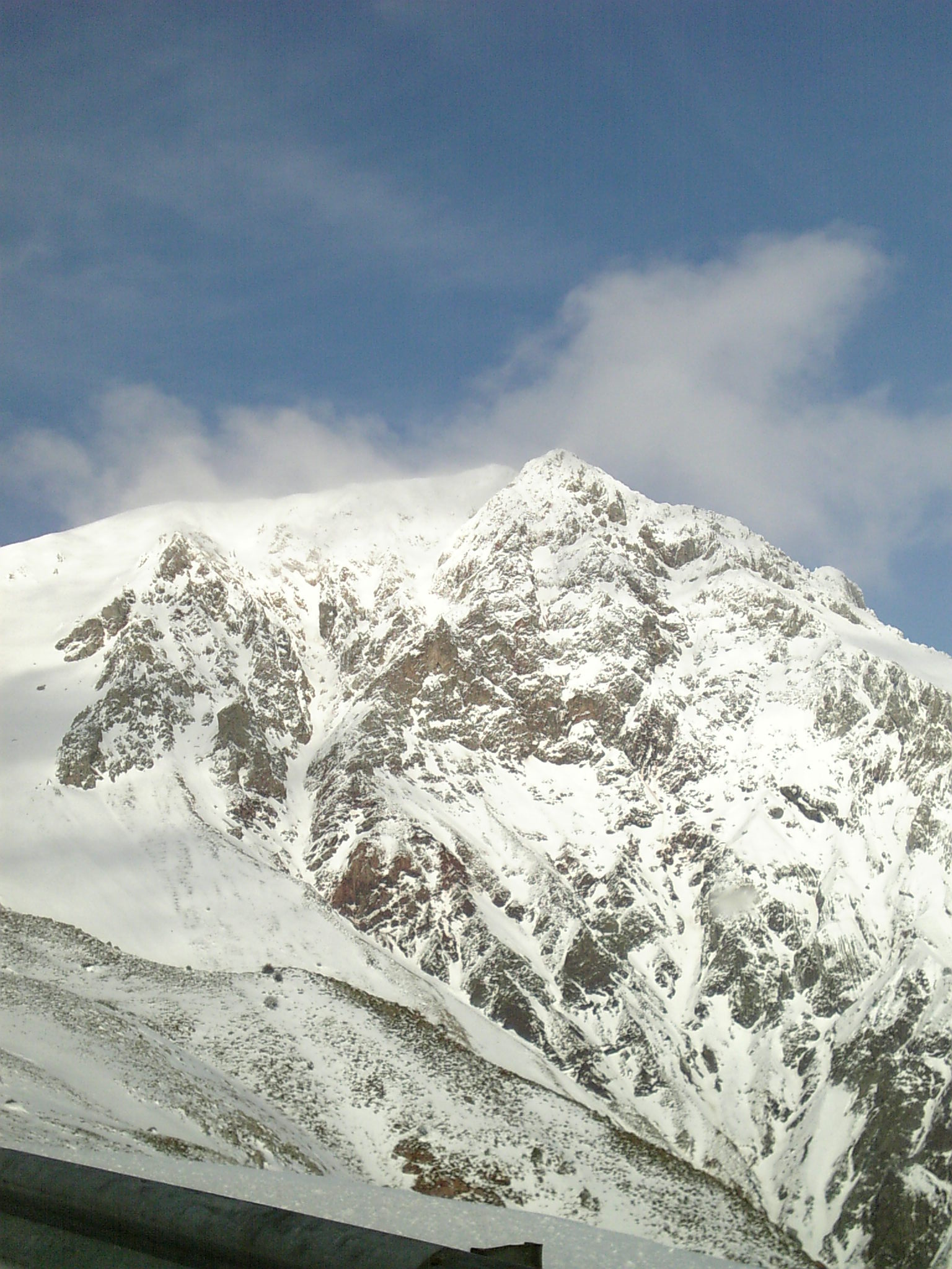 The summit of Mount Tymfristos | |
| Highest point | |
| Elevation | 2,315 m (7,595 ft)[1] |
| Coordinates | 38°56′42″N 21°49′26″E |
| Naming | |
| Pronunciation | Greek: [timfrisˈtos] |
| Geography | |
 Tymfristos eastern Evrytania and western Phthiotis, Greece | |
Forests dominate the lower areas of the mountain, and the higher elevations are covered with grasslands. The nearest town is Karpenisi, to the southwest. Other villages are Tymfristos and Agios Georgios Tymfristou to the east. The Greek National Road 38 (Agrinio - Karpenisi - Lamia) passes south of the mountain.
See also
| Wikimedia Commons has media related to Mount Velouchi. |
References
External links
На других языках
[de] Tymfristos
Der Tymfristos (griechisch Τυμφρηστός, gesprochen Timfristos; auch Velouchi Βελούχι) ist ein 2315 m hoher Berg im Regionalbezirk Evrytania der Region Mittelgriechenland. Er befindet sich am südlichen Ende des Pindos-Gebirges und grenzt das Tal des Flusses Karpenissiotis nach Westen hin gegen das Tal des Sperchios ab. Der Karpenissiotis entspringt an seiner Westflanke, der Sperchios an seiner Ostflanke. Im Norden und Westen wird der Tymfristos vom Fluss Tavropos (Megdova) umflossen. Südlich des Tymfristos liegt die Stadt Karpenisi.- [en] Tymfristos
[es] Monte Timfristos
El monte Timfristos es una montaña de Grecia perteneciente a la cordillera del Pindo, cuya cima se halla a 2.315 metros sobre el nivel del mar. Esta montaña está situada en la zona central del país, entre las unidades periféricas de Euritania y Ftiótide.[fr] Mont Tymphreste
Le mont Tymphreste (grec moderne : Τυμφρηστός / Tymfristós) ou mont Veloúchi (Βελούχι) est une montagne grecque appartenant à la chaîne du Pinde. Situé au centre de la Grèce, entre les nomes d'Eurytanie et de Phtiotide, il culmine à 2 315 mètres d'altitude.[ru] Велухи
Велу́хи[1] (греч. Βελούχι) или Тимфристо́с, Тимфрест[3][4] (Τυμφρηστός) — гора в Греции. Расположена в 12 километрах к северо-востоку от Карпенисиона, административного центра периферийной единицы Эвритании в периферии Центральной Греции. Высота — 2315 метров над уровнем моря[1]. Является частью одноимённого горного массива горной системы Пинд. Состоит из известняков, кристаллических сланцев и песчаника. Покрыта густыми и большими лесами из каштанов, пихт и дубов, поэтому считается одной из самых красивых гор в Греции. Из горы Маврильотико (Μαυριλιώτικο), которая является её самой низкой вершиной, берёт начало река Сперхиос.Другой контент может иметь иную лицензию. Перед использованием материалов сайта WikiSort.org внимательно изучите правила лицензирования конкретных элементов наполнения сайта.
WikiSort.org - проект по пересортировке и дополнению контента Википедии