geo.wikisort.org - Mountains
Tsangbu Ri (also known as Kimshung) is a mountain peak in the Himalayas, located on the border of Bagmati Province of Nepal and the Tibet Autonomous Region of China.
| Tsangbu Ri | |
|---|---|
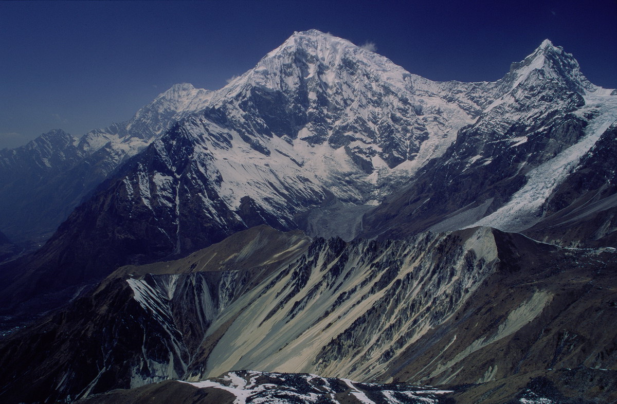 Langtang Lirung in center and Tsangbu Ri in right, as seen from Tsergo Ri | |
| Highest point | |
| Elevation | 6,781 m (22,247 ft) |
| Prominence | 631 m (2,070 ft) |
| Coordinates | 28°16′20″N 85°33′06″E |
| Geography | |
 Tsangbu Ri  Tsangbu Ri  Tsangbu Ri  Tsangbu Ri | |
| Country | Nepal |
| Parent range | Himalayas |
| Climbing | |
| First ascent | No records |
Location
The mountain peak lies north of the Langtang Khola river valley in Langtang National Park at 6,781 m (22,247 ft) above sea level.[1] The border to China is just 2 km north of the summit. Along the east flank, the Kimshung Glacier extends into the Langtang Valley, and along the west side, the Lirung Glacier. In the west, Langtang Lirung is located at a distance of 4 km.
Climbing history
No ascents of Tsangbu Ri are documented.
Attempts
- In 2017, Swiss climbing duo Alex Gammeter and Philipp Bührer made an attempt via Kimshung Glacier.[2]
References
- "Kimshung". PeakVisor. Retrieved 2022-05-18.
- "AAC Publications - Urkinmang, North-Northeast Face and Northeast Ridge; Kimshung Attempt". publications.americanalpineclub.org. Retrieved 2022-05-18.
This Asia mountain, mountain range, or peak related article is a stub. You can help Wikipedia by expanding it. |
This article related to a mountain or hill in Nepal is a stub. You can help Wikipedia by expanding it. |
На других языках
[de] Kimshung
Der Berg Kimshung (auch Tsangbu Ri) befindet sich im Gebirgsmassiv Langtang Himal im Zentral-Himalaya in der nepalesischen Verwaltungszone Bagmati.- [en] Tsangbu Ri
Другой контент может иметь иную лицензию. Перед использованием материалов сайта WikiSort.org внимательно изучите правила лицензирования конкретных элементов наполнения сайта.
WikiSort.org - проект по пересортировке и дополнению контента Википедии