geo.wikisort.org - Mountains
Tromedja (Albanian: Trekufiri; Montenegrin and Serbian Cyrillic: Тромеђа, Tromeđa) is a mountain in the Bogićevica area in the Prokletije range. Its peak which measures a height of 2,366 m (7,762 ft) above sea level forms a boundary between Albania, Kosovo[a] and Montenegro. Albania contains the south of the mountain which is the majority of it, Kosovo the north-east and Montenegro the north-west. There is a valley in the Albanian and Kosovan side of the mountain. The village of Debërdol in Albania is located quite close to the summit.
This article does not cite any sources. (October 2008) |
| Tromedja | |
|---|---|
 Tromedja/Trekufiri and other mountains of the Albanian Alps | |
| Highest point | |
| Elevation | 2,366 m (7,762 ft) |
| Prominence | 75 m (246 ft) |
| Coordinates | |
| Geography | |
 Tromedja Albania 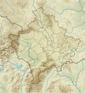 Tromedja Tromedja (Kosovo)  Tromedja Tromedja (Montenegro) | |
| Parent range | Prokletije |
 | |
Notes
| a. | ^ The political status of Kosovo is disputed. Having unilaterally declared independence from Serbia in 2008, it is formally recognised as an independent state by 97 UN member states (with another 15 recognising it at some point but then withdrawing recognition), while Serbia continues to claim it as part of its own sovereign territory. |
References
This article about a specific location in Kukës County, Albania, is a stub. You can help Wikipedia by expanding it. |
This Kosovo location article is a stub. You can help Wikipedia by expanding it. |
This Montenegro location article is a stub. You can help Wikipedia by expanding it. |
На других языках
[de] Tromeđa
Die Tromeđa (auch Tromedja, kyrillisch Тромеђа, albanisch Trekufiri) ist ein Berg im Prokletije, auf dessen Gipfel die Staaten Albanien, Kosovo und Montenegro zusammentreffen. Die Höhenangaben für den Dreiländerpunkt variieren stark: Auf albanischen Karten ist der Berg mit 2354 m ü. A. vermerkt,[1] offizielle serbische Angaben verzeichnen 2366 m. i. J.[2]- [en] Tromedja (mountain)
Другой контент может иметь иную лицензию. Перед использованием материалов сайта WikiSort.org внимательно изучите правила лицензирования конкретных элементов наполнения сайта.
WikiSort.org - проект по пересортировке и дополнению контента Википедии