geo.wikisort.org - Mountains
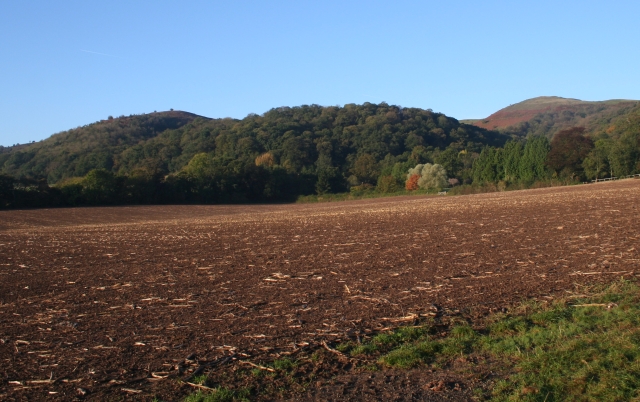
Tinkers Hill is situated in the range of Malvern Hills that runs about 13 kilometres (8 mi) north-south along the Herefordshire-Worcestershire border. It lies to the east of Herefordshire Beacon with views across the Vale of Evesham and the Cotswolds.[2] It has an elevation of 213 metres (699 ft).[1]
| Tinkers Hill | |
|---|---|
 Tinkers Hill | |
| Highest point | |
| Elevation | 213 m (699 ft)[1] |
| Coordinates | 52.057274°N 2.341485°W |
| Geography | |
| Location | Malvern Hills, England |
| Topo map | OS Landranger 150 |
| Geology | |
| Age of rock | Pre-Cambrian |
| Mountain type | Igneous, Metamorphic |
| Climbing | |
| Easiest route | Hiking |
In June 2004, the Worcestershire Bat Group identified Tinkers Hill Wood as being home to a colony of barbastelles, a species of bat protected under the European Habitats Directive.[3]
References
- "Identification of key views to and from the Malvern Hills Areas of Outstanding Natural Beauty - A Report prepared by Cooper Partnership for The Malvern Hills AONB Partnership" (PDF). The Malvern Hills AONB Partnership. March 2009. p. Appendix Table L2: Assessment of Views from and within Malvern Hills AONB. Retrieved 11 August 2015.
- Smart, Mike (2009). Malvern Hills. Frances Lincoln Ltd. p. 15. ISBN 0-7112-2915-5.
- "Barbastelles on the Malvern Hills". Worcestershire Bat Group. 22 July 2009. Retrieved 13 December 2011.
Текст в блоке "Читать" взят с сайта "Википедия" и доступен по лицензии Creative Commons Attribution-ShareAlike; в отдельных случаях могут действовать дополнительные условия.
Другой контент может иметь иную лицензию. Перед использованием материалов сайта WikiSort.org внимательно изучите правила лицензирования конкретных элементов наполнения сайта.
Другой контент может иметь иную лицензию. Перед использованием материалов сайта WikiSort.org внимательно изучите правила лицензирования конкретных элементов наполнения сайта.
2019-2026
WikiSort.org - проект по пересортировке и дополнению контента Википедии
WikiSort.org - проект по пересортировке и дополнению контента Википедии