geo.wikisort.org - Mountains
The Sundial is a 7,590-foot (2,313 meter) elevation white Navajo Sandstone summit located in Zion National Park, in Washington County of southwest Utah, United States.[2]
| The Sundial | |
|---|---|
 The Sundial, east aspect at dawn (The Witch Head to right) | |
| Highest point | |
| Elevation | 7,590 ft (2,310 m)[1] |
| Prominence | 530 ft (160 m)[1] |
| Parent peak | The West Temple (7,810 ft)[1] |
| Isolation | 0.38 mi (0.61 km)[1] |
| Coordinates | 37°12′56″N 113°01′27″W[2] |
| Geography | |
 The Sundial Location in Utah  The Sundial The Sundial (the United States) | |
| Location | Zion National Park Washington County, Utah United States |
| Parent range | Colorado Plateau |
| Topo map | USGS Springdale West |
| Geology | |
| Age of rock | Jurassic |
| Type of rock | Navajo sandstone |
| Climbing | |
| Easiest route | class 5+ climbing[1] |
Description
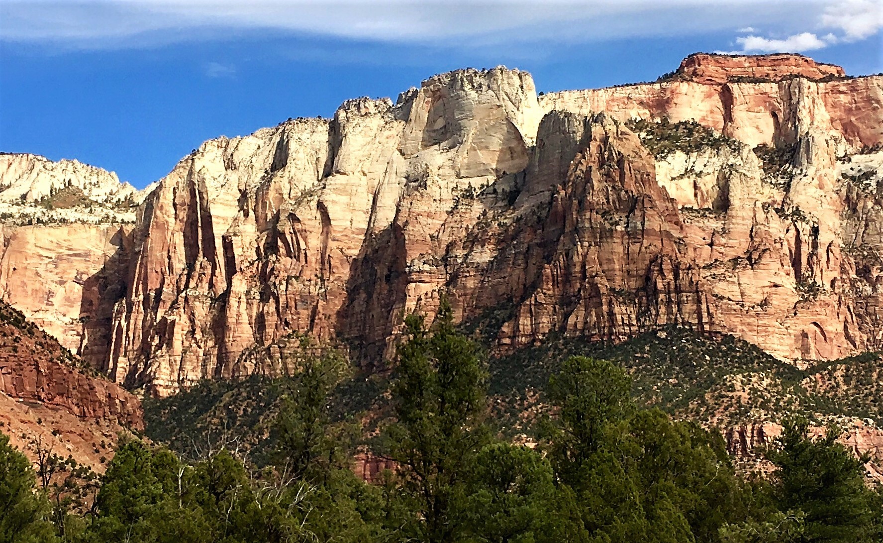
The Sundial is situated in the "Towers of the Virgin", 2.5 mi (4.0 km) west of Zion's park headquarters, towering 3,600-feet (1,100 meters) above the floor of Zion Canyon and the Virgin River which drains precipitation runoff from this mountain. Its nearest higher neighbor is The West Temple, one half mile to the southeast, and Altar of Sacrifice is set approximately one mile to the north-northeast. Other neighbors include The Witch Head, Bee Hive, The Sentinel, Mount Spry, Bridge Mountain, and Mount Kinesava. This geographical feature was named by the park's third superintendent, Preston P. Patraw, because it had long been used as a sundial to regulate clocks in the nearby town of Grafton. The Sundial's name was officially adopted in 1934 by the U.S. Board on Geographic Names.[2]
Climate
Spring and fall are the most favorable seasons to visit The Sundial. According to the Köppen climate classification system, it is located in a Cold semi-arid climate zone, which is defined by the coldest month having an average mean temperature below 32 °F (0 °C), and at least 50% of the total annual precipitation being received during the spring and summer. This desert climate receives less than 10 inches (250 millimeters) of annual rainfall, and snowfall is generally light during the winter.[3]
Gallery
 West aspect of Sundial. West Temple to right
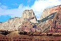 The Sundial centered, from the southwest
 The West Temple (left), The Sundial, The Witch Head, Altar of Sacrifice (right)
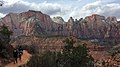 The West Temple (left), The Sundial, The Witch Head, Altar of Sacrifice (right)
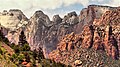 Towers of the Virgin. Left to right:The Sundial, The Witch Head, Broken Tooth, Rotten Tooth, Altar of Sacrifice (upper right).
 The Sundial (left) and The Witch Head (right)
 The West Temple (left), The Sundial (right)
 Mt. Kinesava (centered), The Sundial to left, seen from Grafton cemetery
 The Sundial (left), The Witch Head, Broken Tooth, Rotten Tooth, Altar of Sacrifice.
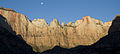 Moon over The Sundial
 The Sundial from Chinle Trail


See also
- List of mountains in Utah
- Geology of the Zion and Kolob canyons area
- Colorado Plateau
References
- "Sundial, The - 7,590' UT". listsofjohn.com. Retrieved 2020-09-10.
- U.S. Geological Survey Geographic Names Information System: The Sundial
- "Zion National Park, Utah, USA - Monthly weather forecast and Climate data". Weather Atlas. Archived from the original on August 31, 2020. Retrieved 31 August 2020.
External links
- Zion National Park National Park Service
- Weather forecast
- Web cam
Другой контент может иметь иную лицензию. Перед использованием материалов сайта WikiSort.org внимательно изучите правила лицензирования конкретных элементов наполнения сайта.
WikiSort.org - проект по пересортировке и дополнению контента Википедии