geo.wikisort.org - Mountains
Svilaja is a mountain range in Croatia, in the Dalmatian Hinterland.
| Svilaja | |
|---|---|
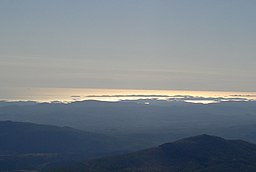
 Svilaja The highest peak of Svilaja | |
| Highest point | |
| Elevation | 1,508 m (4,948 ft) |
| Coordinates | 43°48′35.12″N 16°26′37.63″E |
| Geography | |
| Location | Dalmatia, Croatia |
| Parent range | Dinaric Alps |

It is part of the Dinaric Alps and stretches from the town of Sinj northwest to the Petrovo field, approximately 30 km in length. The highest peak is Svilaja or Bat at 1508 m.a.s.l.[1] Some of other northwest peaks are Jančak (1483 m), Kita (1413 m), Turjača (1340 m), and Lisina (1301 m) which closest to the town of Vrlika.
From nearest mountain cliff Veliki Kozjak (1207 m), which is northwest continuation of Svilaja, it is separated by the saddle called Lemeš (860 m) above the village of Maovice.
The Bat summit offers beautiful vistas of the Adriatic Sea, Peruća lake, and mountain ranges farther in Bosnia and Herzegovina. The summit is easily approachable from southeast, either by following an unpaved road from Donje Ogorje or by taking the marked trail from Orlove Stine mountain lodge. Northern parts of the mountain are deemed dangerous because of the mines left during the Croatian War of Independence.[2]


See also
References
- Ostroški, Ljiljana, ed. (December 2015). Statistički ljetopis Republike Hrvatske 2015 [Statistical Yearbook of the Republic of Croatia 2015] (PDF). Statistical Yearbook of the Republic of Croatia (in Croatian and English). Vol. 47. Zagreb: Croatian Bureau of Statistics. p. 49. ISSN 1333-3305. Retrieved 27 December 2015.
- "Svilaja – vrh Svilaja". hps.hr (in Croatian). Croatian Mountaineering Association. Retrieved 2 January 2016.
На других языках
[de] Svilaja
Das Svilaja-Gebirge ist ein sich von Nordwest nach Südost hinziehendes Gebirge in der Zagora in der kroatischen Gespanschaft Split-Dalmatien. Das Gebirge ist geprägt durch eine mal mehr, mal weniger zertalte Hochebene, die nach Südost durch einen sehr markanten Steilanstieg über der Stadt Sinj begrenzt wird mit einer Höhe von 1508 Meter, hingegen nach Norden sanft abdacht und dort bei der Stadt Knin unmerklich ins Dinarische Gebirge übergeht.- [en] Svilaja
[fr] Svilaja
La Svilaja est une montagne de la chaîne des Alpes dinariques. Située dans la région de Dalmatie en Croatie, la montagne culmine à 1 509 mètres d’altitude[2].Другой контент может иметь иную лицензию. Перед использованием материалов сайта WikiSort.org внимательно изучите правила лицензирования конкретных элементов наполнения сайта.
WikiSort.org - проект по пересортировке и дополнению контента Википедии