geo.wikisort.org - Mountains
Stefan Karadzha Peak (Bulgarian: връх Стефан Караджа, romanized: vrah Stefan Karadzha, IPA: [ˈvrɤx ˈstɛfɐn kɐrɐˈd͡ʒa]) is the ice-covered peak of elevation 2038 m[1] in the west foothills of Avery Plateau on Loubet Coast in Graham Land, Antarctica. It has rounded top and steep, partly ice-free west and northeast slopes, and surmounts Erskine Glacier to the northeast, and a tributary to that glacier to the south and west.
The peak is named after Stefan Karadzha (Stefan Dimov, 1840–1868), a leader of the Bulgarian liberation movement, in connection with the settlements of Stefan Karadzha in Northeastern and Stefan Karadzhovo in Southeastern Bulgaria.
Location
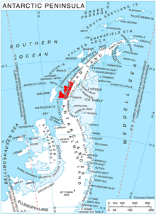
Stefan Karadzha Peak is located at 66°35′42″S 65°15′30″W, which is 13.9 km northeast of Voit Peak, 7.7 km east of Hadzhi Dimitar Peak, 10 km southeast of Mount Bain, 8 km south of Semela Ridge and 11.54 km north-northwest of Bacharach Nunatak. British mapping in 1976.
Maps
- Antarctic Digital Database (ADD). Scale 1:250000 topographic map of Antarctica. Scientific Committee on Antarctic Research (SCAR). Since 1993, regularly upgraded and updated.
- British Antarctic Territory. Scale 1:200000 topographic map. DOS 610 Series, Sheet W 66 64. Directorate of Overseas Surveys, Tolworth, UK, 1976.
Notes
- Reference Elevation Model of Antarctica. Polar Geospatial Center. University of Minnesota, 2019
References
- Bulgarian Antarctic Gazetteer. Antarctic Place-names Commission. (details in Bulgarian, basic data in English)
- Stefan Karadzha Peak. SCAR Composite Antarctic Gazetteer
External links
- Stefan Karadzha Peak. Copernix satellite image
This article includes information from the Antarctic Place-names Commission of Bulgaria which is used with permission.
This Loubet Coast location article is a stub. You can help Wikipedia by expanding it. |
На других языках
[de] Stefan Karadzha Peak
Der Stefan Karadzha Peak (englisch; bulgarisch връх Стефан Караджа .mw-parser-output .Latn{font-family:"Akzidenz Grotesk","Arial","Avant Garde Gothic","Calibri","Futura","Geneva","Gill Sans","Helvetica","Lucida Grande","Lucida Sans Unicode","Lucida Grande","Stone Sans","Tahoma","Trebuchet","Univers","Verdana"}wrach Stefan Karadscha) ist ein 2050 m hoher und vereister Berg an der Loubet-Küste des Grahamlands im Norden der Antarktischen Halbinsel. In den westlichen Ausläufern des Avery-Plateaus ragt er 13,9 km nordöstlich des Voit Peak, 10 km südöstlich des Mount Bain, 8 km südlich des Semela Ridge und 11,54 km nordnordwestlich des Bacharach-Nunataks auf. Sein Gipfel ist abgerundet und seine steilen West- und Nordosthänge sind teilweise unvereist. Der Erskine-Gletscher liegt nordöstlich, einer dessen Nebengletscher südlich und westlich von ihm.- [en] Stefan Karadzha Peak
Другой контент может иметь иную лицензию. Перед использованием материалов сайта WikiSort.org внимательно изучите правила лицензирования конкретных элементов наполнения сайта.
WikiSort.org - проект по пересортировке и дополнению контента Википедии