geo.wikisort.org - Coast
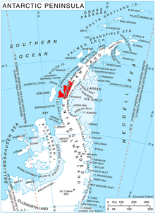
Loubet Coast is the portion of the west coast of Graham Land in Antarctic Peninsula, extending 158 km between Cape Bellue to the northeast and Bourgeois Fjord to the southwest. South of Loubet Coast is Fallières Coast, north is Graham Coast.
The coast is named after Émile Loubet, President of France during the exploration of the area by the French Antarctic Expedition under Jean-Baptiste Charcot in January 1905.
Location
Loubet Coast is centred at 67°00′S 66°00′W. British mapping in 1976 - 78.
Maps
- British Antarctic Territory. Scale 1:200000 topographic map. DOS 610 Series, Sheet W 66 64. Directorate of Overseas Surveys, Tolworth, UK, 1976.
- British Antarctic Territory. Scale 1:200000 topographic map. DOS 610 Series, Sheet W 66 66. Directorate of Overseas Surveys, Tolworth, UK, 1976.
- British Antarctic Territory. Scale 1:200000 topographic map. DOS 610 Series, Sheet W 67 66. Directorate of Overseas Surveys, Tolworth, UK, 1978.
References
This Loubet Coast location article is a stub. You can help Wikipedia by expanding it. |
На других языках
- [en] Loubet Coast
[it] Costa di Loubet
La costa di Loubet (centrata alle coordinate .mw-parser-output .geo-default,.mw-parser-output .geo-dms,.mw-parser-output .geo-dec{display:inline}.mw-parser-output .geo-nondefault,.mw-parser-output .geo-multi-punct{display:none}.mw-parser-output .latitude,.mw-parser-output .longitude{white-space:nowrap}.mw-parser-output .geo{}body.skin-vector .mw-parser-output #coordinates{font-size:85%;line-height:1.5em;position:absolute;right:0;top:0;white-space:nowrap}67°00′S 66°00′W) è una porzione della costa della Terra di Graham, in Antartide. In particolare, la costa di Loubet si estende per 158 km nella parte occidentale della penisola Antartica tra capo Bellue, a nordest, e il fiordo di Bourgeois, a sudovest, confinando quindi a nordest con la costa di Graham e a sudovest con la costa di Fallières.[1]Текст в блоке "Читать" взят с сайта "Википедия" и доступен по лицензии Creative Commons Attribution-ShareAlike; в отдельных случаях могут действовать дополнительные условия.
Другой контент может иметь иную лицензию. Перед использованием материалов сайта WikiSort.org внимательно изучите правила лицензирования конкретных элементов наполнения сайта.
Другой контент может иметь иную лицензию. Перед использованием материалов сайта WikiSort.org внимательно изучите правила лицензирования конкретных элементов наполнения сайта.
2019-2026
WikiSort.org - проект по пересортировке и дополнению контента Википедии
WikiSort.org - проект по пересортировке и дополнению контента Википедии