geo.wikisort.org - Mountains
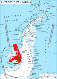
Simon Peak (69°16′S 71°53′W) is a mountain rising to about 1,000 m on the west side of the Havre Mountains, situated in the northwest portion of Alexander Island, Antarctica. The peak lies northeast of Umber Island, an island situated in Lazarev Bay off the west coast of Alexander Island. It is situated 9.9 km east-southeast of Buneva Point, 6.4 km northeast of Kamhi Point, 14.65 km west of Mount Pontida and 6.15 km north-northeast of Gazey Nunatak, and surmounts Pipkov Glacier to the north and Oselna Glacier to the southwest. Possibly sighted by FAE, 1908–10, in January 1909; surveyed by British Antarctic Survey in 1975–76. Named after Alec Edward Simon, British Antarctic Survey aircraft mechanic, who worked on nearby Adelaide Island during the summers of years 1972 to 1976.
See also
![]() This article incorporates public domain material from the United States Geological Survey document: "Simon Peak (Antarctica)". (content from the Geographic Names Information System)
This article incorporates public domain material from the United States Geological Survey document: "Simon Peak (Antarctica)". (content from the Geographic Names Information System)
This Alexander Island location article is a stub. You can help Wikipedia by expanding it. |
На других языках
[de] Simon Peak
Der Simon Peak ist ein rund 1000 m hoher Berg im Nordwesten der Alexander-I.-Insel vor der Westküste der Antarktischen Halbinsel. Er ragt nordöstlich von Umber Island an der Westseite der Havre Mountains auf.- [en] Simon Peak (Antarctica)
Другой контент может иметь иную лицензию. Перед использованием материалов сайта WikiSort.org внимательно изучите правила лицензирования конкретных элементов наполнения сайта.
WikiSort.org - проект по пересортировке и дополнению контента Википедии