geo.wikisort.org - Mountains
Sierra Negra (also, and perhaps more properly, Cerro La Negra) is an extinct volcano located in the Mexican state of Puebla, close to the border with Veracruz. At officially 4,580 metres (15,030 ft) above sea level, it is the fifth-highest peak in Mexico. Sierra Negra is overshadowed by nearby Pico de Orizaba (5,610 m/18,406 ft).
| Sierra Negra | |
|---|---|
 Pico de Orizaba and Sierra Negra viewed from the west, near Ciudad Serdán | |
| Highest point | |
| Elevation | 4,580 m (15,030 ft)[1] |
| Prominence | 540 m (1,770 ft)[2] |
| Coordinates | 18°59′N 97°19′W |
| Geography | |
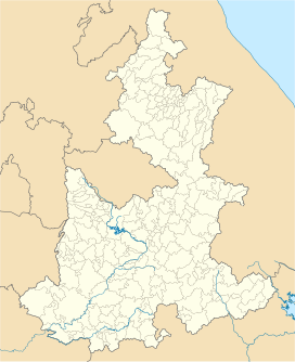 Sierra Negra Location  Sierra Negra Sierra Negra (Mexico) | |
| Location | Chalchicomula de Sesma, Puebla, Mexico |
| Geology | |
| Mountain type | Stratovolcano |
| Volcanic arc/belt | Trans-Mexican Volcanic Belt |

Overview
Sierra Negra is located within the Pico de Orizaba National Park. The mountain is the site for two of the world's premier astronomical instruments, the Large Millimeter Telescope and the High Altitude Water Cherenkov Observatory. Therefore, the access to the mountain is restricted and has to be applied for at least a week in advance.[3] The service road for this facility is claimed to be the highest road in North America. A part of the telescope facility is visible as a white dot in the first picture below and more clearly in the second picture.
The Spanish word sierra is usually applied to mountain ranges or ridges. However, a few mountains were given the name sierra after the Conquest, like Sierra de Tlaxcala or Sierra de Tolocan (now outdated names for Malinche and Nevado de Toluca, respectively).[4] As listed by the Mexican geographical institute INEGI, the official name for the Sierra Negra ("Black Mountains") is Cerro La Negra ("Black Lady Hill"), although the latter is largely unused in common speech. The Nahuatl names Tliltépetl ("Black Mountain") or Atlitzin ("Our Lord (or Lady) of the Waters") are sometimes attached.[3] Speakers of Orizaba Nahuatl call the mountain Iztactepetl Icni ("Sibling of the White Mountain"; the "White Mountain" being the Pico de Orizaba).
The mountain range to the east of the city of Tehuacán (south of but still in sight of the Pico de Orizaba), with such principal towns as Zoquitlán and Coyomeapan, is also known as the "Sierra Negra", which (unsurprisingly) can cause confusion.
See also
- List of mountain peaks of Mexico
- List of the highest major summits of North America
- Trans-Mexican Volcanic Belt
- National Institute of Astrophysics, Optics and Electronics
- List of national parks of Mexico
References
- "Relieve. Puebla". INEGI. Retrieved 2016-10-16.
- "E14B56: Orizaba" (PDF). INEGI. 1985. Retrieved 2016-10-16.
- Neyra Jáuregui, Jorge A. (2012). Guía de las altas montañas de México y una de Guatemala. Mexico City: CONABIO. pp. 222–237. ISBN 978-607-7607-60-1.
- Acuña, René, ed. (1984). Relaciones geográficas del siglo XVI: Tlaxcala. Mexico City: UNAM. p. 73. ISBN 968-58-0590-3.
External links
- "Sierra Negra". SummitPost.org. Retrieved 2016-10-16.
- The Large Millimeter Telescope
- Peakbagger.com: Sierra Negra
- "Pico de Orizaba". Global Volcanism Program. Smithsonian Institution. (includes Sierra Negra)
- Yarza de la Torre, Esperanza (1971). Volcanes de México. Aguilar. p. 237 pp. (in Spanish)
На других языках
[de] Sierra Negra
Der Vulkan Sierra Negra (andere Namen: Cerro La Negra, Atlitzin oder Tliltépetl) ist ein erloschener Vulkan im mexikanischen Bundesstaat Puebla, nahe der Grenze zu Veracruz. Mit seinen 4580 m ist er der fünfthöchste Berg Mexikos. Aufgrund seiner Nähe zum viel höheren Pico de Orizaba (5610 m) wurde der Sierra Negra jedoch bis vor dem Bau des Large Millimeter Telescope auf seinem Gipfel in Wanderführern oder gar von den mexikanischen Behörden oft nicht berücksichtigt.- [en] Sierra Negra
[es] Sierra Negra
La Sierra Negra es un volcán ubicado en Puebla, México, cerca del límite estatal con Veracruz. En su cumbre se localiza el Gran Telescopio Milimétrico Alfonso Serrano (GTM), el mayor radiotelescopio del mundo en su rango de frecuencia.[1] Con sus 4580 metros sobre el nivel del mar,[2] se trata de la quinta cima más alta del país. No obstante, por encontrarse adyacente al mucho más alto y famoso Pico de Orizaba o Citlaltépetl (5610 m s. n. m.), la Sierra Negra es frecuentemente pasada por alto y excluida de guías mexicanas de montañismo.[3][fr] Sierra Negra (Mexique)
La sierra Negra en français : « montagne Noire » est un stratovolcan actif situé au Mexique, dans la Cordillère néovolcanique. Culminant à 4 580 mètres d'altitude, il est l'un des sommets les plus élevés du pays, et avoisine le point culminant national, le Pico de Orizaba, qui se trouve à plus de 7 km au nord-est. La sierra Negra est située sur le territoire de la municipalité de Chalchicomula de Sesma, dans l'État de Puebla.[it] Sierra Negra
Il Sierra Negra (4.580 m s.l.m.) , chiamato anche Tliltépetl ('monte nero' in náhuatl) o Atlitzin ('venerabile signore dell'acqua') è un vulcano estinto.Другой контент может иметь иную лицензию. Перед использованием материалов сайта WikiSort.org внимательно изучите правила лицензирования конкретных элементов наполнения сайта.
WikiSort.org - проект по пересортировке и дополнению контента Википедии