geo.wikisort.org - Mountains
Semyonov Peak (Russian: Пик Семёнова, romanized: Pik Semyonova, Kyrgyz: Семёнов чокусу, romanized: Semyonov chokusu) is a 5,816-metre (19,081 ft) high mountain in the Tian Shan on the border between Kyrgyzstan and Kazakhstan.[2][3]
| Semyonov Peak | |
|---|---|
| Pik Semyonova | |
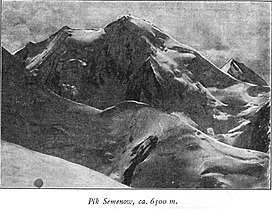
 Taken by German geographer Gottfried Merzbacher in 1902/3 | |
| Highest point | |
| Elevation | 5,816 m (19,081 ft)[1] |
| Prominence | 802 m (2,631 ft)[1] |
| Coordinates | 42°16′34″N 80°7′5″E |
| Geography | |
 Semyonov Peak Issyk-Kul Region, Kyrgyzstan Almaty Region, Kazakhstan  Semyonov Peak Semyonov Peak (Kazakhstan) | |
| Parent range | Saryjaz Range, Tian Shan |
Semyonov Peak is one of the highest peaks of the Saryjaz Range. To its northwest lies the Semyonov Glacier.[2] It lies 8.64 km northwest of Khan Tengri (6995 m) on the opposite side of the Northern Engilchek Glacier. The peak is named after the Russian geographer Pyotr Semyonov-Tyan-Shansky.[2]
References
- "Semionova". Peakbagger.com. Retrieved 2020-11-20.
- "Семёнов чокусу" [Semyonov Peak] (PDF). Кыргызстандын Географиясы [Geography of Kyrgyzstan] (in Kyrgyz). Bishkek. 2004. p. 83.
- "Pik Semenova". peakvisor.com. Retrieved 2020-11-20.
На других языках
[de] Pik Semjonow
Der Berg Pik Semjonow (auch Semjonowa) befindet sich im Tian Shan an der Grenze zwischen Kasachstan und Kirgisistan.- [en] Semyonov Peak
[ru] Пик Семёнова
Пик Семёнова — горная вершина в Центральном Тянь-Шане в Киргизии. Высшая точка хребта Сарыджаз (5816 м). Поднимается над долиной с ледником Северный Иныльчек.Текст в блоке "Читать" взят с сайта "Википедия" и доступен по лицензии Creative Commons Attribution-ShareAlike; в отдельных случаях могут действовать дополнительные условия.
Другой контент может иметь иную лицензию. Перед использованием материалов сайта WikiSort.org внимательно изучите правила лицензирования конкретных элементов наполнения сайта.
Другой контент может иметь иную лицензию. Перед использованием материалов сайта WikiSort.org внимательно изучите правила лицензирования конкретных элементов наполнения сайта.
2019-2025
WikiSort.org - проект по пересортировке и дополнению контента Википедии
WikiSort.org - проект по пересортировке и дополнению контента Википедии