geo.wikisort.org - Mountains
The Ruchi is a mountain in the Glarus Alps, located at an elevation of 3,107 m (10,194 ft) on the border between the Swiss cantons of Glarus and Graubünden. It overlooks the Muttsee (2,446 m or 8,025 ft) on its west side from where a trail leads to the summit. On its south-east side lies a small glacier, the Glatscher da Gavirolas. The Ruchi is connected to the higher summit of the Hausstock on the north-east by a 2 km (1.2 mi) long ridge.[2]
| Ruchi | |
|---|---|
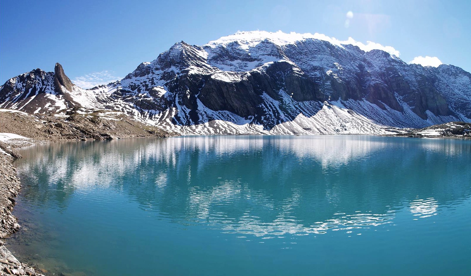 The west side of the Ruchi from Muttsee | |
| Highest point | |
| Elevation | 3,107 m (10,194 ft) |
| Prominence | 170 m (560 ft)[1] |
| Parent peak | Hausstock |
| Coordinates | 46°51′55″N 9°2′43″E |
| Geography | |
 Ruchi Location in Switzerland | |
| Location | Glarus/Graubünden, Switzerland |
| Parent range | Glarus Alps |
The nearest settlements are the villages of Linthal to the north, and Andiast to the south. Administratively, the mountain lies in the municipalities of Glarus Süd and Waltensburg/Vuorz.[2]
References
- Retrieved from the Swisstopo topographic maps. The key col is located north of the Chli Ruchi at 2,937 metres.
- map.geo.admin.ch (Map). Swiss Confederation. Retrieved 2015-06-09.
External links
 Media related to Ruchi at Wikimedia Commons
- Ruchi on Hikr
- Ruchi on Peakbagger
This Canton of Glarus location article is a stub. You can help Wikipedia by expanding it. |
This article about a mountain, mountain range, or peak located in Graubünden is a stub. You can help Wikipedia by expanding it. |
На других языках
[de] Ruchi
Der Ruchi (3107 m ü. M.) ist ein Berg in den Glarner Alpen zwischen Linthal und Waltensburg/Vuorz in den Kantonen Glarus und Graubünden in der Schweiz. Der Name Ruchi bezeichnet öde Schutthalden (Schweizerdeutsch: ruch = rau).- [en] Ruchi (Glarus Alps)
Другой контент может иметь иную лицензию. Перед использованием материалов сайта WikiSort.org внимательно изучите правила лицензирования конкретных элементов наполнения сайта.
WikiSort.org - проект по пересортировке и дополнению контента Википедии