geo.wikisort.org - Mountains
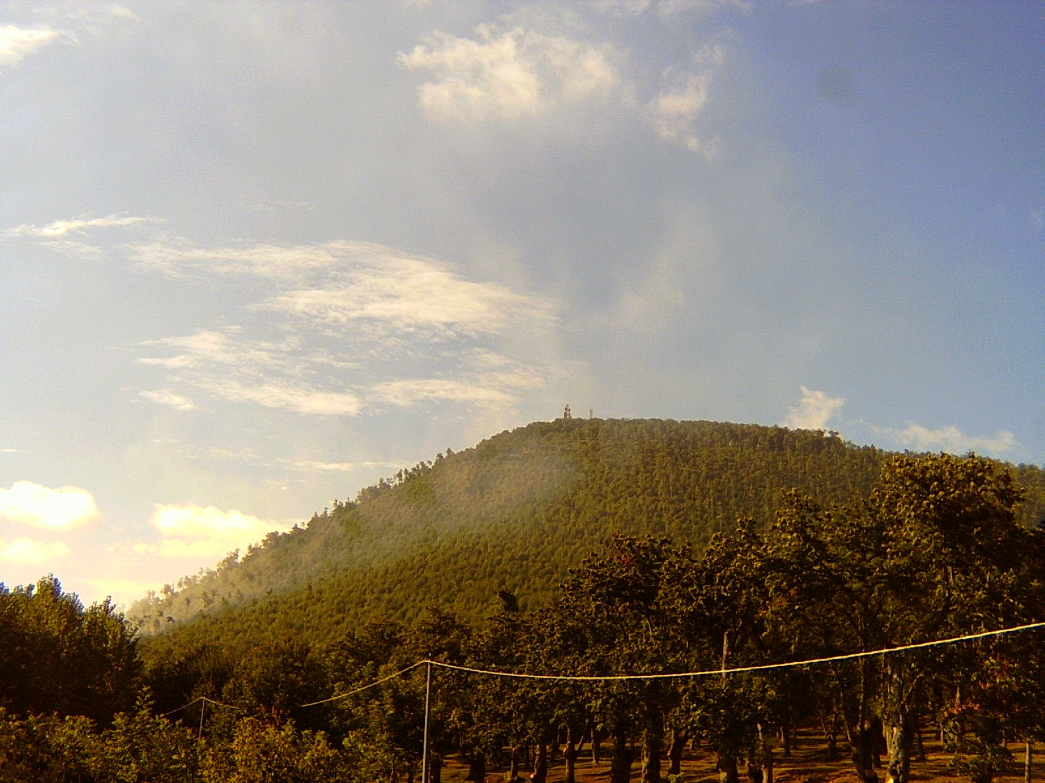
The Volcano of Roccamonfina is an extinct volcano in Roccamonfina, Campania, southern Italy. It was active from some 650,000 to 50,000 years ago. It comprises an isolated large cone of some 25 km (16 mi) perimeter between the Monti Aurunci, the plain and valley of the Garigliano, the Monte Massico and the Monti Trebulani. The central caldera has a diameter of nearly 6 km (4 mi) and the small commune (town) of Roccamonfina is located inside it. Volcanic activity is now replaced by minor seismic movements and by the presence of mineral waters. The mount is part of the Roccamonfina-Garigliano Mouth Regional Park, created in 1999.
This article does not cite any sources. (May 2019) |
The Ciampate del Diavolo are a series of hominid footprints in solidified ash from an eruption of the volcano 345,000 years ago.
Geology
The volcano originated as a stratovolcano in the Garigliano rift valley, with a group of eruptive mouths spread in a 1,000 km2 (386 sq mi) area; later an effusive activity concentrated in the central area, forming a volcanic cone some 1,800 m-high, mostly formed of tephra and accompanied by minor cones such as the Monte Ofelio at south-west. Some 400,000 years ago, the collapse of the volcano's eastern sector formed a caldera which, for some time, was occupied by a volcanic lake.
A second period of volcanic activity began some 385,000 years ago with an explosive eruption, including eruptions from the former caldera. This phase continued until some 285,000 years ago. The formation of the volcano also modified the course of the Garigliano and Volturno rivers. The Volturno moved southwest in what is its current course; the Garigliano no longer reached the sea, and formed a lake (Lake Lirino) until (around 200,000 years ago) it eroded rocks near Suio and assumed the current course.
References
- "Roccamonfina". Global Volcanism Program. Smithsonian Institution. Retrieved 2021-06-25.
На других языках
[de] Roccamonfina (Vulkan)
Der Roccamonfina ist ein erloschener Vulkan im nördlichen Kampanien in Süditalien. Er befindet sich im 1993 eingerichteten Regionalpark Roccamonfina-Foce Garigliano. Innerhalb der Caldera liegt der Ort Roccamonfina. Der Vulkan war vor 650.000 bis 50.000 Jahren aktiv und besteht aus einem isolierten großen Kegel mit einem Umfang von etwa 25 km zwischen den Monti Aurunci, der Ebene und dem Tal des Garigliano, dem Monte Massico und dem Monti Trebulani. Die zentrale Caldera hat einen Durchmesser von fast 6 km. Die vulkanische Aktivität ist abgeklungen und es sind noch geringfügige seismische Bewegungen und der Austritt mineralisierten Wassers feststellbar.- [en] Roccamonfina (volcano)
[es] Volcán Roccamonfina
Roccamonfina es un volcán extinto, activo hace entre 630.000 y 50.000 años. Se encuentra en la región italiana de la Campania, en la provincia de Caserta.[it] Roccamonfina (vulcano)
Il Roccamonfina è un vulcano, attivo tra 630.000 e 50.000 anni fa, situato in Campania, in provincia di Caserta.[ru] Роккамонфина (вулкан)
Роккамонфи́на[1][2] (итал. Roccamonfina) — потухший вулкан в провинции Казерта, в регионе Кампания, на юге Италии, который был активен в промежутке между 630 000 и 50 000 лет назад.Другой контент может иметь иную лицензию. Перед использованием материалов сайта WikiSort.org внимательно изучите правила лицензирования конкретных элементов наполнения сайта.
WikiSort.org - проект по пересортировке и дополнению контента Википедии