geo.wikisort.org - Mountains
The Queen Alexandra Range is a major mountain range of the Transantarctic Mountains System, located in the Ross Dependency region of Antarctica.
| Queen Alexandra Range | |
|---|---|
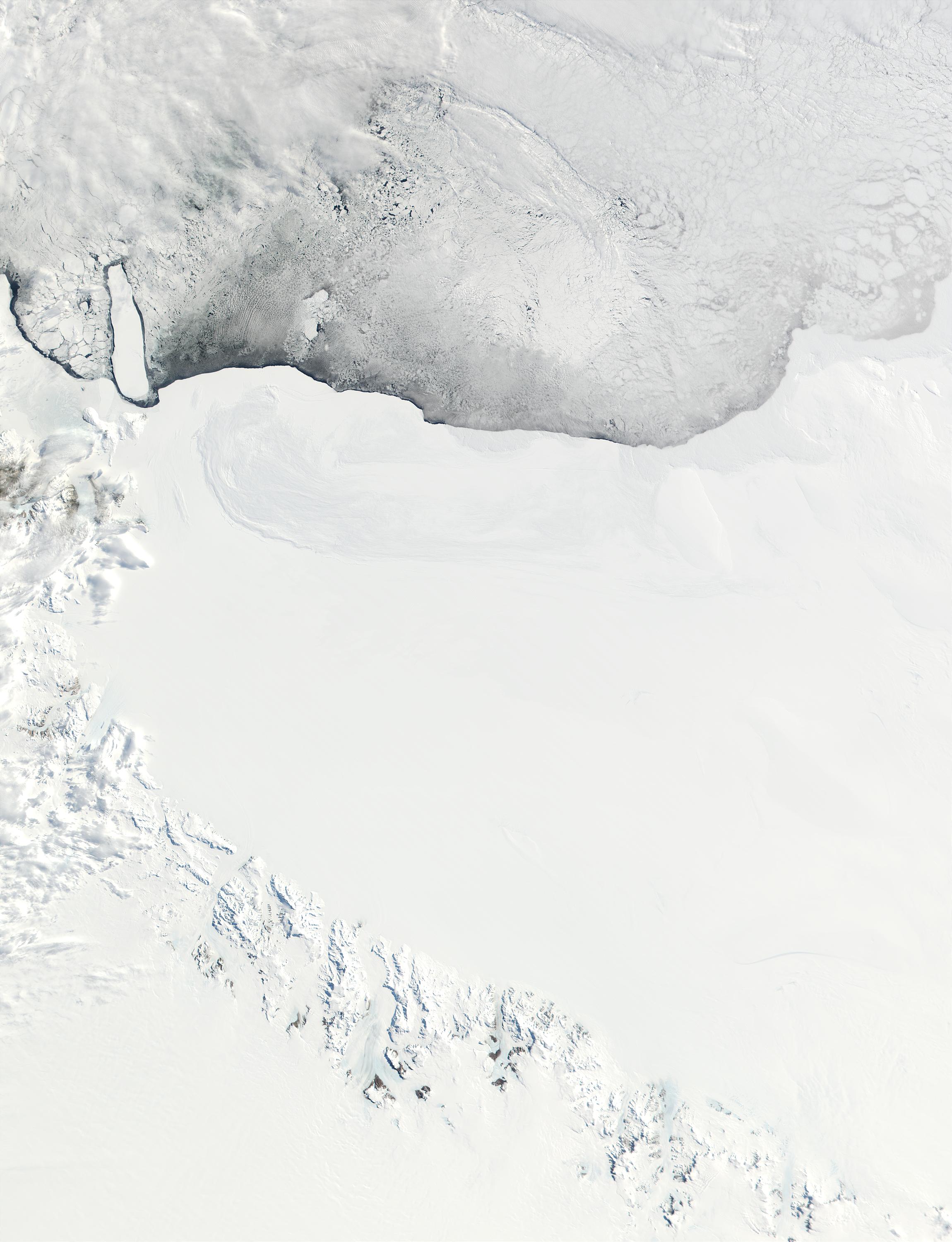 The Queen Alexandra Range is at the top, at the upper base of the Ross Ice Shelf (NASA). | |
| Highest point | |
| Peak | Mount Kirkpatrick |
| Elevation | 4,528 m (14,856 ft) |
| Dimensions | |
| Length | 160 km (99 mi)[1] |
| Area | 74,641 km2 (28,819 sq mi) |
| Geography | |
 Location in Antarctica | |
| Range coordinates | 84°00′S 168°00′E[2] |
It is about 160 km (99 mi) long, bordering the entire western side of Beardmore Glacier from the Polar Plateau to the Ross Ice Shelf. Alternate names for this range include Alexandra Mountains, Alexandra Range and Königin Alexandra Gebirge.[2]
The highest peak of the range is Mount Kirkpatrick at 4,528 metres (14,856 ft). Other peaks in the range include Mount Dickerson (4,120 m).
Discovery
This mountain range was discovered on the journey toward the South Pole by the British Antarctic Expedition, and was named by Ernest Shackleton for Queen consort Alexandra of the United Kingdom.[2] Shackleton and his men, and a later expedition headed by Robert Falcon Scott, both collected rock samples from the range that contained fossils. The discovery that multicellular life forms had lived so close to the South Pole was an additional piece of evidence that accompanied the publication (in 1910 and independently in 1912) of the theory of continental drift.
Mountains and peaks
| Mountain | Metres | Feet | Coordinates |
|---|---|---|---|
| Decennial Peak | 4,020 | 13,189 | 84°22′S 166°02′E |
| Mount Stanley | 3,220 | 10,564 | 84°09′S 165°29′E |
| Mount Bishop | 3,020 | 9,908 | 83°43′S 168°42′E |
| Ahmadjian Peak | 2,910 | 9,547 | 83°41′S 168°42′E |
| Mount Fox | 2,820 | 9,252 | 83°38′S 169°15′E |
| Mount Ida | 1,565 | 5,135 | 83°35′S 170°29′E |
| Mount Kurlak |
Ahmadjian Peak
Ahmadjian Peak is a prominent ice-covered peak, standing 4.5 miles (7 km) southwest of Mount Fox. Named by Advisory Committee on Antarctic Names (US-ACAN) for Vernon Ahmadjian, United States Antarctic Research Program (USARP) biologist at McMurdo Station, 1963–64.[3]
Mount Bishop
Mount Bishop stands 3.2 km (2 mi) south of Ahmadjian Peak. Named by US-ACAN after Lieutenant Barry Chapman Bishop (1932–94), United States Air Force (USAF), an observer with the Argentine Antarctic Expedition (1956–57); member of the Staff of the U.S. Antarctica Projects Officer, 1958 and 1959; member of the American party which on May 22, 1962, succeeded in climbing Mount Everest.[4]
Decennial Peak
Decennial Peak is a peak situated 4.8 km (3 mi) southwest of Mount Kirkpatrick. Mapped by United States Geological Survey (USGS) from surveys and U.S. Navy air photos, 1958–65. Named by US-ACAN in recognition of the Decennial of the Institute of Polar Studies, Ohio State University, in 1970, the same year the university celebrated its Centennial. The university and the Institute have been very active in Antarctic investigations since 1960.[5]
Mount Elizabeth
Mount Elizabeth is a large ice-free mountain 4,480 metres high situated 6 mi south of Mount Anne. Discovered by the British Antarctic Expedition and named for Elizabeth Dawson-Lambton, a supporter of the BAE.
Mount Fox
Mount Fox is a mountain standing 1 mi SW of Mount F. L. Smith. Discovered and named by the British Antarctic Expedition.[6]
Mount Ida
Mount Ida is a conspicuous bare rock mountain, standing 2 miles (3.2 km) west of Granite Pillars, just southeast of the head of King Glacier. Discovered by the British Antarctic Expedition (1907–09), and named for Ida Jane Rule of Christchurch, New Zealand, who later married Edward Saunders, Secretary to Shackleton, who assisted in preparing the narrative of the expedition.[7]
Mount Stanley
Mount Stanley stands northeast of the head of Wyckoff Glacier near the western limits of Grindley Plateau. Named by the British Antarctic Expedition (1907–09) for the eldest brother of Dr. E.S. Marshall, a member of the expedition. This identification is the New Zealand Geological Survey Antarctic Expedition (NZGSAE) (1961–62) interpretation of the original positioning by the British Antarctic Expedition (1907–09).[8]
Morris Heights
Morris Heights (83°28′S 169°42′E) is a relatively smooth ice-covered heights, forming a peninsula-like divide between Beaver and King Glaciers at the north end of Queen Alexandra Range. Named by Advisory Committee on Antarctic Names (US-ACAN) for Lieutenant Clarence T. Morris, U.S. Navy, aerology officer on the staff of the Commander, U.S. Naval Support Force, Antarctica, 1962 and 1963. Mount Gunner is a partially snow-covered peak, 1,430 metres (4,700 ft) high, that rises from the southern part of the Morris Heights.
See also
- Elliot Peak
- Peterson Ridge
References
- "Queen Alexandra Range". Peakbagger. Retrieved 25 May 2017.
- "Queen Alexandra Range". Geographic Names Information System. United States Geological Survey, United States Department of the Interior. Retrieved 2004-11-02.
- "Ahmadjian Peak". Geographic Names Information System. United States Geological Survey, United States Department of the Interior. Retrieved 2008-03-23.
- "Mount Bishop". Geographic Names Information System. United States Geological Survey, United States Department of the Interior. Retrieved 2006-10-10.
- "Decennial Peak". Geographic Names Information System. United States Geological Survey, United States Department of the Interior. Retrieved 2005-11-11.
- "Mount Fox". Geographic Names Information System. United States Geological Survey, United States Department of the Interior. Retrieved 2010-05-23.
- "Mount Ida". Geographic Names Information System. United States Geological Survey, United States Department of the Interior. Retrieved 2008-03-20.
- "Mount Stanley". Geographic Names Information System. United States Geological Survey, United States Department of the Interior. Retrieved 2005-11-29.
Authority control | |
|---|---|
| General |
|
| National libraries | |
На других языках
[de] Königin-Alexandra-Kette
Die Königin-Alexandra-Kette (englisch Queen Alexandra Range) ist ein etwa 160 Kilometer langer und aus bis zu 4528 m[1] hoch ansteigenden Tafelbergen bestehender Gebirgszug in der antarktischen Ross Dependency. Der britische Polarforscher Ernest Shackleton und drei Begleiter entdeckten den Gebirgszug im Dezember 1908 beim Versuch, im Rahmen der Nimrod-Expedition den geographischen Südpol zu erreichen, und benannten ihn nach der britischen Queen Consort Alexandra.[2]- [en] Queen Alexandra Range
[es] Cordillera Reina Alexandra
La cordillera Reina Alexandra es una gran cordillera en el este de la Antártida, con cerca de 160 km de largo, bordea todo el lado occidental del glaciar Beardmore, principal paso entre la meseta Antártica y la plataforma de hielo de Ross. Los nombres alternativos para esta cordillera son Alexandra Mountains, Alexandra Range y Königin Alexandra Gebirge.[fr] Chaînon de la Reine-Alexandra
Le chaînon de la Reine-Alexandra est un massif de montagnes qui culmine au mont Kirkpatrick, à 4 528 m d'altitude, plus haut sommet de la chaîne Transantarctique.[ru] Куин-Александра (хребет)
Куи́н-Алекса́ндра (англ. Queen Alexandra Range) — горный хребет в Антарктиде, в средней части системы Трансантарктических гор.Другой контент может иметь иную лицензию. Перед использованием материалов сайта WikiSort.org внимательно изучите правила лицензирования конкретных элементов наполнения сайта.
WikiSort.org - проект по пересортировке и дополнению контента Википедии