geo.wikisort.org - Mountains
Pointe de Paumont (in French) or Cima del Vallone (in Italian) is a mountain of Savoie, France and of the Province of Turin, Italy. It lies in the Cottian Alps range. It has an elevation of 3,171 metres above sea level.
| Pointe de Paumont | |
|---|---|
| Cima del Vallone | |
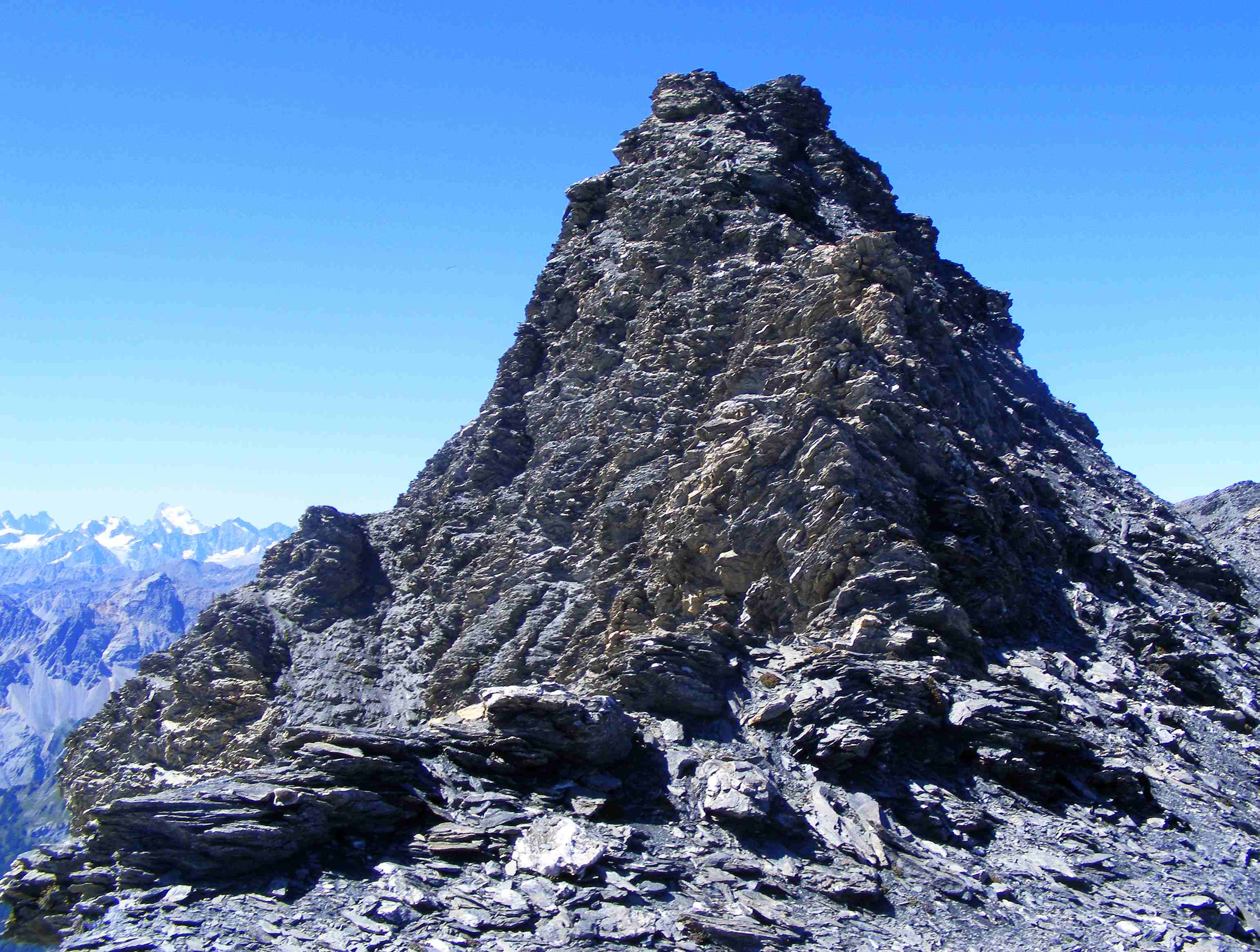
 The mountain seen from Punta Bagnà | |
| Highest point | |
| Elevation | 3,171 m (10,404 ft)[1] |
| Prominence | 378 m (1,240 ft)[1] |
| Parent peak | Aiguille de Scolette[2] |
| Isolation | 3.21 km (1.99 mi) |
| Listing | Alpine mountains above 3000 m |
| Coordinates | 45°08′21″N 06°43′41″E[1] |
| Geography | |
 Pointe de Paumont Location in the Alps | |
| Location | Rhône-Alpes, France Piedmont, Italy |
| Parent range | Cottian Alps |
| Climbing | |
| Easiest route | from Pelouse pass (E ridge) or Roccia Verde pass (S ridge) |
Etymology
Paumort, the name used on French maps, should come from a toponym used on the Italian side of the mountain (croce di Paumont, rio di Paumont), which derives from Piedmontese "pàu mòrt" («fear of death»).[3]
Geography
In the French subdivision of Western Alps it belongs to the Massif du Mont-Cenis while in the SOIUSA (International Standardized Mountain Subdivision of the Alps) it' the highest mountain of a subgroups (STG) called Crête Grand Vallon-pointe du Fréjus ( Fr) or Cresta Gran Vallone-punta del Fréjus (It) - code:I/A-4.III-B.5.a.[4]
Administratively the mountain is divided between the commune of Avrieux (F, north face) and the comune of Bardonecchia (I, south-western and south-eastern faces).
Access to the summit
The easiest route for the summit starts from Pelouse's pass, which connects Avrieux and Bardonecchia, and follows the eastern ridge of the mountain passing by Cime Gardoria/Cima Gardiola (3,137 m). Other two routes, roughly of the same climbing grade, follow the other two ridges which meet on the mountain's summit: the southern one from Roccia Verde pass and the northwestern one from Punta Bagnà.[3]
Notes
- Géoportail IGN on www.geoportail.fr
- key col: Col de Pelouse
- Aruga, Roberto; Pietro Losana; Alberto Re (1985). Alpi Cozie settentrionali. Guida ai monti d'Italia (in Italian). Club Alpino Italiano.
- Marazzi, Sergio (2005). Atlante Orografico delle Alpi. SOIUSA (in Italian). Priuli & Verlucca. p. 90. ISBN 978-88-8068-273-8.
Maps
- Italian official cartography (Istituto Geografico Militare - IGM); on-line version: www.pcn.minambiente.it
- French official cartography (Institut Géographique National - IGN); on-line version: www.geoportail.fr
- Istituto Geografico Centrale - Carta dei sentieri e dei rifugi scala 1:50.000 n.1 Valli di Susa Chisone e Germanasca and 1:25.000 n.104 Bardonecchia Monte Thabor Sauze d'Oulx
External links
![]() Media related to Cima del Vallone at Wikimedia Commons
Media related to Cima del Vallone at Wikimedia Commons
На других языках
- [en] Pointe de Paumont
[fr] Pointe de Paumont
La pointe de Paumont (en italien cima del Vallone[4]) est une montagne de 3 171 mètres d'altitude dans les Alpes.[it] Cima del Vallone
La Cima del Vallone (Pointe de Paumont in francese) è una montagna delle Alpi Cozie (Gruppo della Pierre Menue) alta 3171 m e situata lungo la linea di confine tra l'Italia e la Francia.Другой контент может иметь иную лицензию. Перед использованием материалов сайта WikiSort.org внимательно изучите правила лицензирования конкретных элементов наполнения сайта.
WikiSort.org - проект по пересортировке и дополнению контента Википедии