geo.wikisort.org - Mountains
Pen y Gaer (or Pen-y-gaer) is the location of a Bronze Age and Iron Age hillfort near the village of Llanbedr-y-Cennin in the Conwy valley, Wales.
| Pen y Gaer | |
|---|---|
| Highest point | |
| Elevation | 385 m (1,263 ft) |
| Prominence | 36 m (118 ft) |
| Parent peak | Carnedd Llewelyn |
| Listing | TuMP |
| Geography | |
| Location | Snowdonia |
| OS grid | SH749693 |
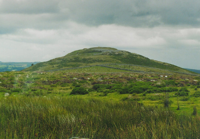

A natural defensive site, it had a long history of occupation, indicated by the complexity of the defences, which were amended over time. There are two Bronze Age cairns on the north-west slope, and extensive prehistoric and later field systemsare nearby. The remains as seen today are mostly of Iron Age origin, but further earthworks, probably of medieval origin, lie on the south-eastern slopes.
The remains of the two walls of stone can be seen, as can those of a chevaux-de-frise. The entrance is to the west, and access can be gained from a car park, reached by the road from the village.
See also
- List of hillforts in Wales
External links
На других языках
- [en] Pen y Gaer
[fr] Pen y Gaer
Pen y Gaer (Pen-y-gaer en gallois) est une colline fortifiée de type castrum située près du village de Llanbedr y Cennin dans le county borough de Conwy, au pays de Galles. Ses deux fortifications remontent à l'âge du bronze. Les fondations de douze huttes sont encore visibles[2].Текст в блоке "Читать" взят с сайта "Википедия" и доступен по лицензии Creative Commons Attribution-ShareAlike; в отдельных случаях могут действовать дополнительные условия.
Другой контент может иметь иную лицензию. Перед использованием материалов сайта WikiSort.org внимательно изучите правила лицензирования конкретных элементов наполнения сайта.
Другой контент может иметь иную лицензию. Перед использованием материалов сайта WikiSort.org внимательно изучите правила лицензирования конкретных элементов наполнения сайта.
2019-2025
WikiSort.org - проект по пересортировке и дополнению контента Википедии
WikiSort.org - проект по пересортировке и дополнению контента Википедии