- Acaray
- Ahuila Gencha Machay
- Amaru Marka Wasi
- Arhuaturo
- Asana
- Asiru Phat'jata
- Aspero
- Auga Punta
- Auquilohuagra
- Awkin Punta
- Awkimarka (Apurímac)
- Awkimarka (Huánuco)
- Aya Muqu
- Ayamachay
- Ayawayq'u
- Azángaro
- Baths of Boza
- Bandurria
- Buena Vista
- Cahuachi
- Cajamarquilla
- Cao Viejo
- Carachupa
- Carajía
- Caral
- Caves of Sumbay
- Cerro Baúl
- Cerro Pátapo
- Cerro Trinidad
- Chacamarca
- Chan Chan
- Chanquillo
- Chauchilla Cemetery
- Chavín de Huantar
- Chawaytiri
- Cheqollo
- Chichakuri
- Chipaw Marka
- Choquepuquio
- Choquequirao
- Choquequirao Puquio
- Churajón
- Chuya
- Cochabamba
- Cochapata
- Colcampata
- Collor
- Condorcaga
- Cota Coca
- Coricancha
- Cumbemayo
- Cutimbo
- El Brujo
- El Cañoncillo
- El Ingenio
- El Paraíso
- Garagay
- Gran Pajatén
- Gran Vilaya
- Guellayhuasin
- Guitarrero Cave
- Hatun Machay
- Hatun Misapata
- Hatun Rumiyoc
- Hatun Uchku
- Hatun Usnu
- Hatunmarka
- Honcopampa
- Huaca de la Luna
- Huaca del Dragón
- Huaca del Sol
- Huaca Huallamarca
- Huaca Prieta
- Huaca Pucllana
- Huaca San Marcos
- Huaca Santa Ana
- Huacramarca
- Hualpayunca
- Huamanmarca, La Convención
- Huamboy
- Huankarán
- Huánuco Pampa
- Huari
- Huayna Picchu
- Huayrapongo
- Huchuy Qosqo
- Huiñao
- Inca Uyo
- Incahuasi, Lima
- Ingatambo
- Inka Mach'ay
- Inka Raqay, Apurímac
- Inka Raqay, Ayacucho
- Inka Tampu, Huayopata
- Inka Tampu, Vilcabamba
- Inka Tunuwiri
- Inka Wasi, Ayacucho
- Inka Wasi, Huancavelica
- Inkapintay
- Inkilltambo
- Inti Punku
- Inti Watana, Ayacucho
- Inti Watana, Calca
- Inti Watana, Urubamba
- Intikancha
- Intini Uyu Pata
- Intipa Ñawin
- Intiyuq K'uchu
- Iskuqucha
- Isog
- Jinkiori
- Jisk'a Iru Muqu
- Kanamarka
- Kanichi
- Kenko
- Killa Mach'ay
- Killarumiyuq
- Kotosh
- Kuelap
- Kukuli
- Kuntur Wasi
- Kunturmarka, Ayacucho
- Kunturmarka, Pasco
- Kuntuyuq
- Kusichaka valley
- Khichuqaqa
- Khuchi Mach'ay
- K'allapayuq Urqu
- K'ipakhara
- Laguna de las Momias
- Lauricocha Caves
- Layzón
- Llactan
- Llamachayuq
- Llamachayuq Qaqa
- Llamayuq
- Llamuqa
- Llaqta Qulluy, Acoria
- Llaqta Qulluy, Conayca
- Llaqta Qulluy, Tayacaja
- Llaqta Qulluy, Vilca
- Llaqtapata
- Machu Colca
- Machu Picchu
- Machu Pirqa
- Machu Pitumarka
- Machu Q'inti
- Mallkuamaya
- Mameria
- Maray Qalla
- Marayniyoq
- Marcahuamachuco
- Markahirka
- Markansaya
- Markapukyu
- Marpa
- Mawk'allaqta, Castilla
- Mawk'allaqta, Espinar
- Mawk'allaqta, La Unión
- Mawk'allaqta, Melgar
- Mawk'allaqta, Paruro
- Mawk'allaqta, Sandia
- Mawk'ataray
- Mazur
- Miculla
- Millka
- Miraflores
- Mirq'imarka
- Miyu Pampa
- Molloko
- Moray
- Mulinuyuq
- Mullu Q'awa
- Muyu Muyu
- Muyu Urqu
- Muyuq Marka
- Nazca Lines
- Nina Kiru
- Ninamarca
- Ñawpallaqta, Huanca Sancos
- Ñawpallaqta, Fajardo
- Ñawpallaqta, Lucanas
- Ñusta Hispana
- Ollantaytambo
- Pacatnamu
- Pachacamac
- Pachatusan
- Paiján
- Pañamarca
- Paracas Candelabra
- Paraccra
- Patallaqta
- Pikillaqta
- Pikimach'ay
- Pilluchu
- Pinkuylluna
- Pirca Pirca, La Libertad
- Pirca Pirca, Lima
- Pirhuaylla
- Piruro
- Pirwayuq
- Písac
- Puka Pukara
- Puka Tampu
- Puka Urqu
- Pukara, Coporaque
- Pukara, Fajardo
- Pukara, Puno
- Pukara, Vilcas Huamán
- Pukarani
- Pumamarka, San Sebastián
- Pumamarka, Urubamba
- Pumaq Hirka
- Pumawasi
- Punkuri
- Puqin Kancha
- Puruchuco
- Purunllacta, Cheto
- Purunllacta, Soloco
- Pusharo
- Pusuquy Pata
- Puyupatamarca
- Qaqapatan
- Qenko
- Qillqatani
- Qillqa
- Qillqay Mach'ay
- Quiaca
- Quillarumi
- Quishuar
- Qullqapampa
- Qulu Qulu
- Qunchamarka
- Qunchupata
- Quri Winchus
- Qurimarka, Apurímac
- Qurimarka, Cusco
- Quriwayrachina, Anta
- Quriwayrachina, Ayacucho
- Quriwayrachina, La Convención
- Qasa Pata
- Qhapaq Kancha
- Raqch'i
- Revash
- Rumicolca
- Rumiwasi
- Runayoc
- Runkuraqay
- Sacsayhuamán
- Sara Sara
- Sayacmarca
- Sayhuite
- Sechín
- Sillustani
- Sipán
- Sóndor
- Soro Mik'aya Patjxa
- Susupillu
- Tambo Totem
- Tambomachay
- Tampu Mach'ay, Huancavelica
- Tampukancha
- Tanqa Tanqa
- Tantarica
- Taqrachullu
- Tarahuasi
- Tarmatambo
- Templo del Zorro
- The Toads of Wiraqucha
- Tikra
- Tinyaq
- Tipón
- Titiqaqa
- Toquepala Caves
- Toro Muerto
- Trinchera
- Túcume
- Tunanmarca
- Tunay Q'asa
- Tupu Inka
- T'akaq
- T'uqu T'uquyuq
- Uchkus Inkañan
- Urpish
- Uskallaqta
- Usnu, Ayacucho
- Usnu, Huánuco
- Usnu Muqu
- Usqunta
- Uyu Uyu
- Venado cautivo
- Ventanillas de Otuzco
- Ventarron
- Vilcabamba
- Vilcashuamán
- Viracochapampa
- Vitcos
- Waman Pirqa
- Wamanilla
- Wamanmarka, Chumbivilcas
- Wamanmarka, Lima
- Wanakawri, Cusco
- Wanakawri, Huánuco
- Waqlamarka
- Waqra Pukara
- Waqutu
- Warahirka
- Waraqayuq
- Waraqu Urqu
- Warawtampu
- Wari Willka
- Waruq
- Wat'a, Cusco
- Wat'a, Huánuco
- Wayna Q'inti
- Wayna Tawqaray
- Wichama
- Wichqana
- Wich'un
- Wila Wilani
- Wilca
- Wilcahuaín
- Willkaraqay
- Wiñay Wayna
- Wiraqucha Pirqa
- Yanaca
- Yanaqi - Qillqamarka
- Yaynu
- Yuraq Mach'ay
|


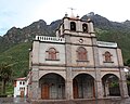 Pachatusan above the sanctuary Señor de Huanca