geo.wikisort.org - Mountains
Mount Sarnegor (Bulgarian: връх Сърнегор, romanized: vrah Sarnegor, IPA: [ˈvrɤx sɐrnɛˈɡɔr]) is the mostly ice-covered mountain of elevation 1189 m[1] in Solvay Mountains on Brabant Island in the Palmer Archipelago, Antarctica. It has steep and partly ice-free southwest and northwest slopes, and surmounts Zlatiya Glacier to the north, Rush Glacier to the south and Aluzore Gap to the east-northeast. A westerly offshoot of the feature forms Sidell Spur, extending to the seashore.
The mountain is named after the settlement of Sarnegor in Southern Bulgaria.
Location
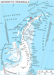
Mount Sarnegor is located at 64°21′34″S 62°31′27″W, which is 4.4 km southeast of Fleming Point, 2.77 km south of Veles Bastion, 6.32 km west of Mount Imhotep, 4.7 km north by east of Mount Aciar and 5.26 km east-northeast of Devene Point. British mapping in 1980 and 2008.
Maps
- Antarctic Digital Database (ADD). Scale 1:250000 topographic map of Antarctica. Scientific Committee on Antarctic Research (SCAR). Since 1993, regularly upgraded and updated.
- British Antarctic Territory. Scale 1:200000 topographic map. DOS 610 Series, Sheet W 64 62. Directorate of Overseas Surveys, Tolworth, UK, 1980.
- Brabant Island to Argentine Islands. Scale 1:250000 topographic map. British Antarctic Survey, 2008.
Notes
- Reference Elevation Model of Antarctica. Polar Geospatial Center. University of Minnesota, 2019
References
- Bulgarian Antarctic Gazetteer. Antarctic Place-names Commission. (details in Bulgarian, basic data in English)
- Mount Sarnegor. SCAR Composite Antarctic Gazetteer.
External links
- Mount Sarnegor. Copernix satellite image

This article includes information from the Antarctic Place-names Commission of Bulgaria which is used with permission.
This Brabant Island location article is a stub. You can help Wikipedia by expanding it. |
На других языках
[de] Mount Sarnegor
Mount Sarnegor (bulgarisch връх Сърнегор .mw-parser-output .Latn{font-family:"Akzidenz Grotesk","Arial","Avant Garde Gothic","Calibri","Futura","Geneva","Gill Sans","Helvetica","Lucida Grande","Lucida Sans Unicode","Lucida Grande","Stone Sans","Tahoma","Trebuchet","Univers","Verdana"}wrach Sarnegor) ist ein 1150 m hoher und größtenteils vereister Berg auf der Brabant-Insel im Palmer-Archipel westlich der Antarktischen Halbinsel. In den Solvay Mountains ragt er 4,4 km südöstlich des Fleming Point, 2,77 km südlich der Veles Bastion, 6,32 km westlich des Mount Imhotep, 4,7 km nördlich bis östlich des Mount Aciar und 5,26 km ostnordöstlich des Devene Point auf. Seine südwestlichen und nordwestlichen Hänge sind steil und teilweise unvereist. Der Slatija-Gletscher liegt nördlich, der Rush-Gletscher südlich und das Aluzore Gap ostnordöstlich von ihm. Ein westlicher Ausläufer des Bergs bildet den Sidell Spur.- [en] Mount Sarnegor
Другой контент может иметь иную лицензию. Перед использованием материалов сайта WikiSort.org внимательно изучите правила лицензирования конкретных элементов наполнения сайта.
WikiSort.org - проект по пересортировке и дополнению контента Википедии