geo.wikisort.org - Mountains
Mount Ruskin is a 12,920-foot-elevation (3,938 meter) mountain summit located in Kings Canyon National Park, in Fresno County of northern California, United States.[3] It is situated west of the crest of the Sierra Nevada mountain range, immediately east of Cartridge Pass, and 1.4 miles (2.3 km) south of Vennacher Needle, the nearest higher neighbor.[1] Topographic relief is significant as the south aspect rises over 3,280 feet (1,000 meters) above South Fork Kings River in 1.5 mile.
| Mount Ruskin | |
|---|---|
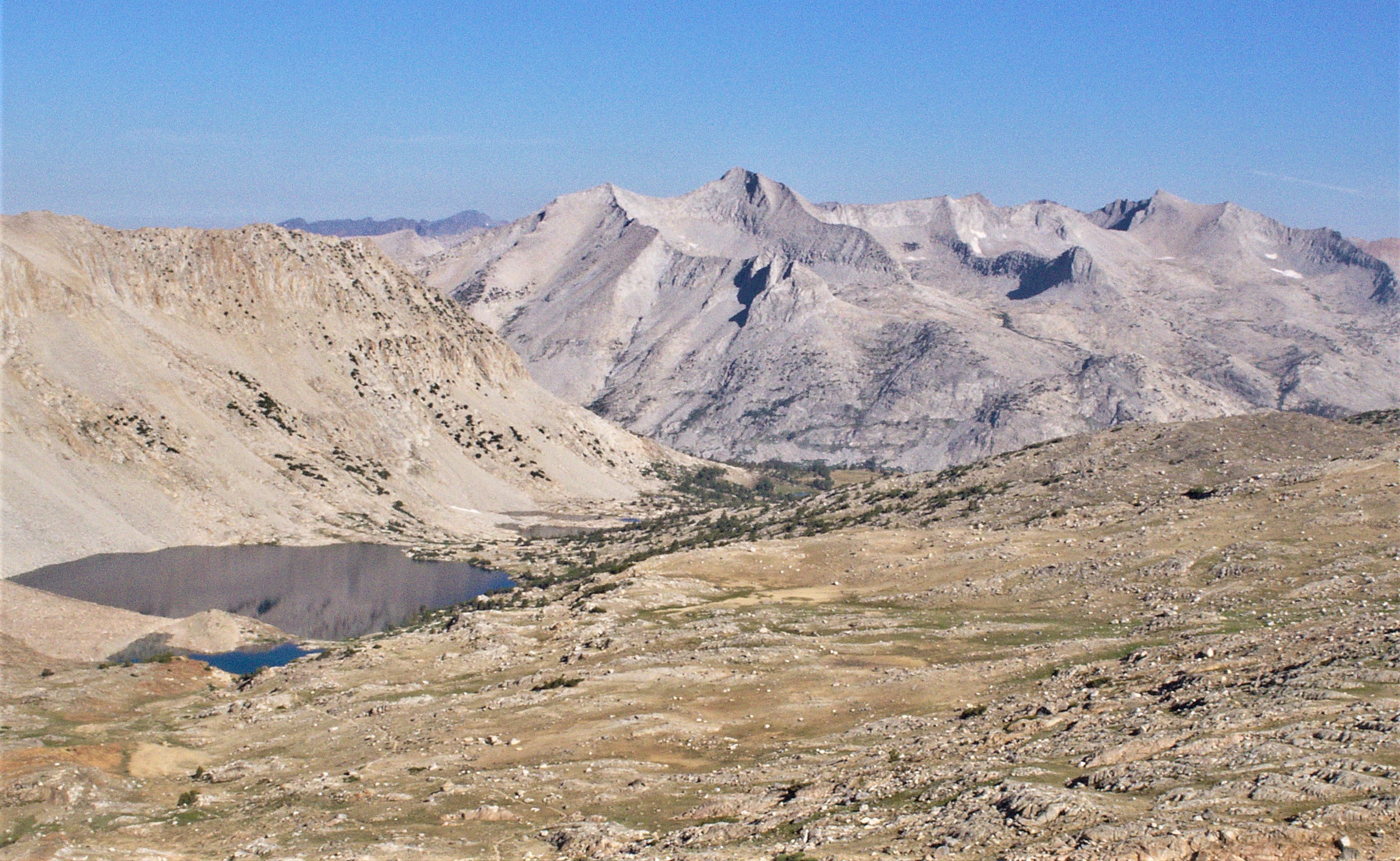
 South aspect, from Bench Lake area | |
| Highest point | |
| Elevation | 12,920 ft (3,940 m)[1] |
| Prominence | 553 ft (169 m)[1] |
| Parent peak | Vennacher Needle (12,995 ft)[2] |
| Isolation | 1.40 mi (2.25 km)[2] |
| Listing | Sierra Peaks Section |
| Coordinates | 36°58′42″N 118°28′24″W[3] |
| Naming | |
| Etymology | John Ruskin |
| Geography | |
 Mount Ruskin Location in California  Mount Ruskin Mount Ruskin (the United States) | |
| Location | Kings Canyon National Park Fresno County California, U.S. |
| Parent range | Sierra Nevada |
| Topo map | USGS Mount Pinchot |
| Geology | |
| Type of rock | granitic |
| Climbing | |
| First ascent | 1895 |
| Easiest route | class 3[2] |
History
The first ascent of the summit was made August 7, 1895, by Bolton Coit Brown via the class 3 northwest ridge from Cartridge Pass. The class 3 west slope was first climbed August 13, 1945, by Art Reyman.[4]
Mount Ruskin was named in 1895 by Professor Bolton Brown for John Ruskin (1819–1900), English writer and critic.[5] This mountain's name has been officially adopted by the United States Board on Geographic Names.[3]
Climate
According to the Köppen climate classification system, Mount Ruskin is located in an alpine climate zone.[6] Most weather fronts originate in the Pacific Ocean, and travel east toward the Sierra Nevada mountains. As fronts approach, they are forced upward by the peaks, causing them to drop their moisture in the form of rain or snowfall onto the range (orographic lift). Precipitation runoff from this mountain drains into tributaries of the Kings River.
See also
 Mountains portal
- List of mountain peaks of California
References
- "Mount Ruskin, California". Peakbagger.com. Retrieved 2021-04-29.
- "Ruskin, Mount - 12,919' CA". listsofjohn.com. Retrieved 2021-04-29.
- "Mount Ruskin". Geographic Names Information System. United States Geological Survey, United States Department of the Interior. Retrieved 2021-04-29.
- Fred L. Jones, A Climber’s Guide to the High Sierra (1954)
- Francis P. Farquhar, Place Names of the High Sierra (1926)
- Peel, M. C.; Finlayson, B. L.; McMahon, T. A. (2007). "Updated world map of the Köppen−Geiger climate classification". Hydrol. Earth Syst. Sci. 11. ISSN 1027-5606.
External links
- Weather forecast: Mount Ruskin
Другой контент может иметь иную лицензию. Перед использованием материалов сайта WikiSort.org внимательно изучите правила лицензирования конкретных элементов наполнения сайта.
WikiSort.org - проект по пересортировке и дополнению контента Википедии