geo.wikisort.org - Mountains
Mount Richard-Molard, also known as Mount Nimba, is a mountain along the border of Ivory Coast and Guinea in West Africa. The highest peak for both countries and the Nimba Range is at 1,752 m (5,748 ft). The mountain is a part of the Guinea Highlands, which straddles the borders between the two countries and Liberia. The nearest major settlements are the town Yekepa in Liberia and the towns of Bossou and N'Zoo in Guinea.[1]
| Mount Richard-Molard | |
|---|---|
| Mount Nimba | |
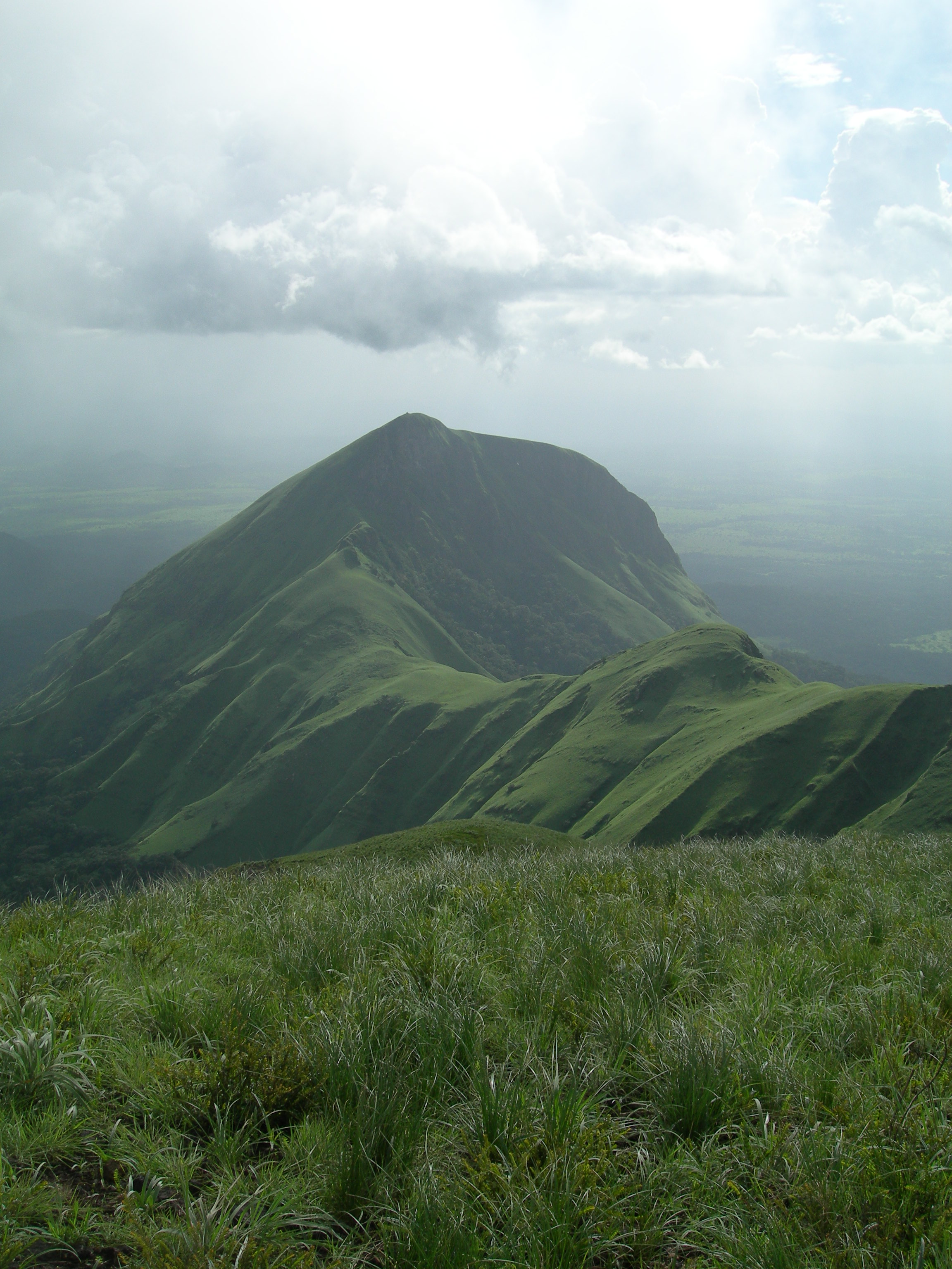 Grass at the summit of Mount Richard-Molard | |
| Highest point | |
| Elevation | 1,752 m (5,748 ft) |
| Listing | Country high point |
| Coordinates | 7°37′21″N 8°24′20″W |
| Geography | |
 Mount Richard-Molard Location of Mount Nimba in Côte d'Ivoire (on the Guinean border)  Mount Richard-Molard Mount Richard-Molard (Liberia)  Mount Richard-Molard Mount Richard-Molard (Guinea) | |
| Location | Ivory Coast – Guinea |
| Parent range | Nimba Range |
Toponymy
The mountain is named after the French geographer Jacques Richard-Molard, who died in an accident at the mountain site in 1951.[2] Before that it was called Mount Nouon.[3]
Geology
The mountain is rich in iron ore and cobalt. The mix of iron rich quartzite sheets, schists and granite gneiss have characterised the geological pedogenesis.[citation needed]
Conservation
Mount Richard-Molard lies within the Mount Nimba Strict Nature Reserve, which currently covers 17,540 hectares and straddles the borders of Guinea and Ivory Coast.[citation needed][4]
World Heritage status
Mount Nimba Strict Nature Reserve is a site with outstanding universal value and was therefore nominated to the World Heritage List in 1981.[5] It has been listed as World Heritage in Danger since 1992.
This site was added to Guinea's "Tentative List" for consideration for UNESCO World Heritage Site status on 29 March 2001, in the cultural category.[6]
Mount Nimba Strict Nature Reserve has been listed as a World Heritage Site in both Guinea and Ivory Coast, under the criteria for natural heritage.[7]
See also
- Iron ore in Africa
- Mount Nimba Strict Nature Reserve
References
- Colombant, Nico (30 January 2008)."Villagers Resist Environmentalists Around Guinea's Mount Nimba". Voice of America.
- Westermann, Diedrich; Smith, Edwin William; Forde, Cyril Daryll (1951). Africa. Oxford University Press. p. 335. OCLC 50238863
- Pugh, John Charles; Morgan, W. B. (1969). West Africa. London: Methuen. ISBN 0-416-26900-1.
- www.world-heritage-solutions.com https://www.world-heritage-solutions.com/case-studies/mount-nimba-strict-nature-reserve-guinea-and-c%C3%B4te-d-ivoire/. Retrieved 2020-05-30.
{{cite web}}: Missing or empty|title=(help) - "Mount Nimba Strict Nature Reserve". UNESCO World Heritage Centre. Retrieved 2017-11-27.
- Paysage culturel des monts Nimba, UNESCO World Heritage Centre. (in French)
- "Mount Nimba Strict Nature Reserve". UNESCO World Heritage Centre. Retrieved 2016-11-25.
External links
- World Heritage Site Data Sheet–Mount Nimba Strict Nature Reserve
- Rollard Ch., Wesolowska W. 2002. Jumping spiders (Arachnida, Araneae, Salticidae) from the Nimba Mountains in Guinea. Zoosystema. Paris, 24 (2):283-307
- TLC Africa[Usurped!]
На других языках
[de] Mont Nimba
Der Mont Nimba (früher auch Mont Richard-Molard oder Mont Nouon[1]) ist mit einer Höhe von 1752 m der höchste Berg der Elfenbeinküste und von Guinea. Er befindet sich auf der Grenze dieser beiden Staaten und ist nur zehn Kilometer von der Grenze zu Liberia entfernt. Er ist ebenfalls die höchste Erhebung der Nimbaberge.- [en] Mount Richard-Molard
[es] Monte Nimba
El monte Richard-Molard, también conocido como monte Nimba, es una montaña a lo largo de la frontera entre Costa de Marfil y Guinea en África Occidental. Sus 1752 metros la convierten en el punto más alto de ambas naciones. Es, además, el pico más alto de la cordillera del Nimba (la «dorsal guineana»), delimitando la frontera entre los dos países y Liberia. El asentamiento cercano mayor es la ciudad de Yekepa al oeste, en Liberia, y Bossou en Guinea.[1][fr] Mont Nimba
Le mont Nimba est une montagne s'élevant à 1 752 m d'altitude aux confins de la Guinée à l'ouest et au nord, dont il constitue le point culminant, et de la Côte d'Ivoire à l'est. Il est riche en minerai de fer. Dans son prolongement, au sud-ouest, se trouve le mont Richard-Molard (env. 1 280 m), qui constitue le tripoint entre ces deux pays et le Liberia.[it] Monte Nimba
Il monte Nimba è una montagna situata al confine tra Costa d'Avorio, Guinea e Liberia paesi dei quali costituisce la massima elevazione[1], ed è una delle vette principali dell'Africa occidentale.[ru] Нимба
Ни́мба[1] — горы в Африке на границе Гвинеи, Кот-д’Ивуара и Либерии.Другой контент может иметь иную лицензию. Перед использованием материалов сайта WikiSort.org внимательно изучите правила лицензирования конкретных элементов наполнения сайта.
WikiSort.org - проект по пересортировке и дополнению контента Википедии