geo.wikisort.org - Mountains
Mount Matheson, at 292 metres (958 ft), is the highest point in East Sooke, British Columbia. From the top there are panoramic views from Cape Flattery to Mount Baker. The bedrock is Eocene-era basalt.[3]
| Mount Matheson | |
|---|---|
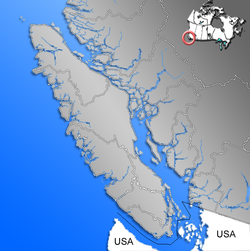 Mount Matheson British Columbia, Canada  Mount Matheson Mount Matheson (British Columbia) | |
| Highest point | |
| Elevation | 292 m (958 ft)[1] |
| Prominence | 250 m (820 ft)[1] |
| Listing | Mountains of British Columbia |
| Coordinates | 48°21′32″N 123°36′37″W[2] |
| Geography | |
| Location | British Columbia, Canada |
| District | Sooke Land District |
| Parent range | Vancouver Island Ranges |
| Topo map | NTS 92B5 Sooke |
References
- "Mount Matheson". Bivouac.com. Retrieved 2010-05-09.
- "Mount Matheson". BC Geographical Names. Retrieved 2010-01-16.
- http://ftp.maps.canada.ca/pub/nrcan_rncan/publications/ess_sst/119/119507/gscmap-a_1553a_e_1983_mn01.pdf Geology, Victoria, west of sixth meridian. J.E. Muller, 1983
This article about a location in British Columbia, Canada is a stub. You can help Wikipedia by expanding it. |
Текст в блоке "Читать" взят с сайта "Википедия" и доступен по лицензии Creative Commons Attribution-ShareAlike; в отдельных случаях могут действовать дополнительные условия.
Другой контент может иметь иную лицензию. Перед использованием материалов сайта WikiSort.org внимательно изучите правила лицензирования конкретных элементов наполнения сайта.
Другой контент может иметь иную лицензию. Перед использованием материалов сайта WikiSort.org внимательно изучите правила лицензирования конкретных элементов наполнения сайта.
2019-2026
WikiSort.org - проект по пересортировке и дополнению контента Википедии
WikiSort.org - проект по пересортировке и дополнению контента Википедии