geo.wikisort.org - Mountains
Mount Kōya (高野山, Kōya-san) is a large temple settlement in Wakayama Prefecture, Japan to the south of Osaka. In the strictest sense, Mount Kōya is the mountain name (sangō) of Kongōbu-ji Temple, the ecclesiastical headquarters of the Kōyasan sect of Shingon Buddhism.[1]
| UNESCO World Heritage Site | |
|---|---|
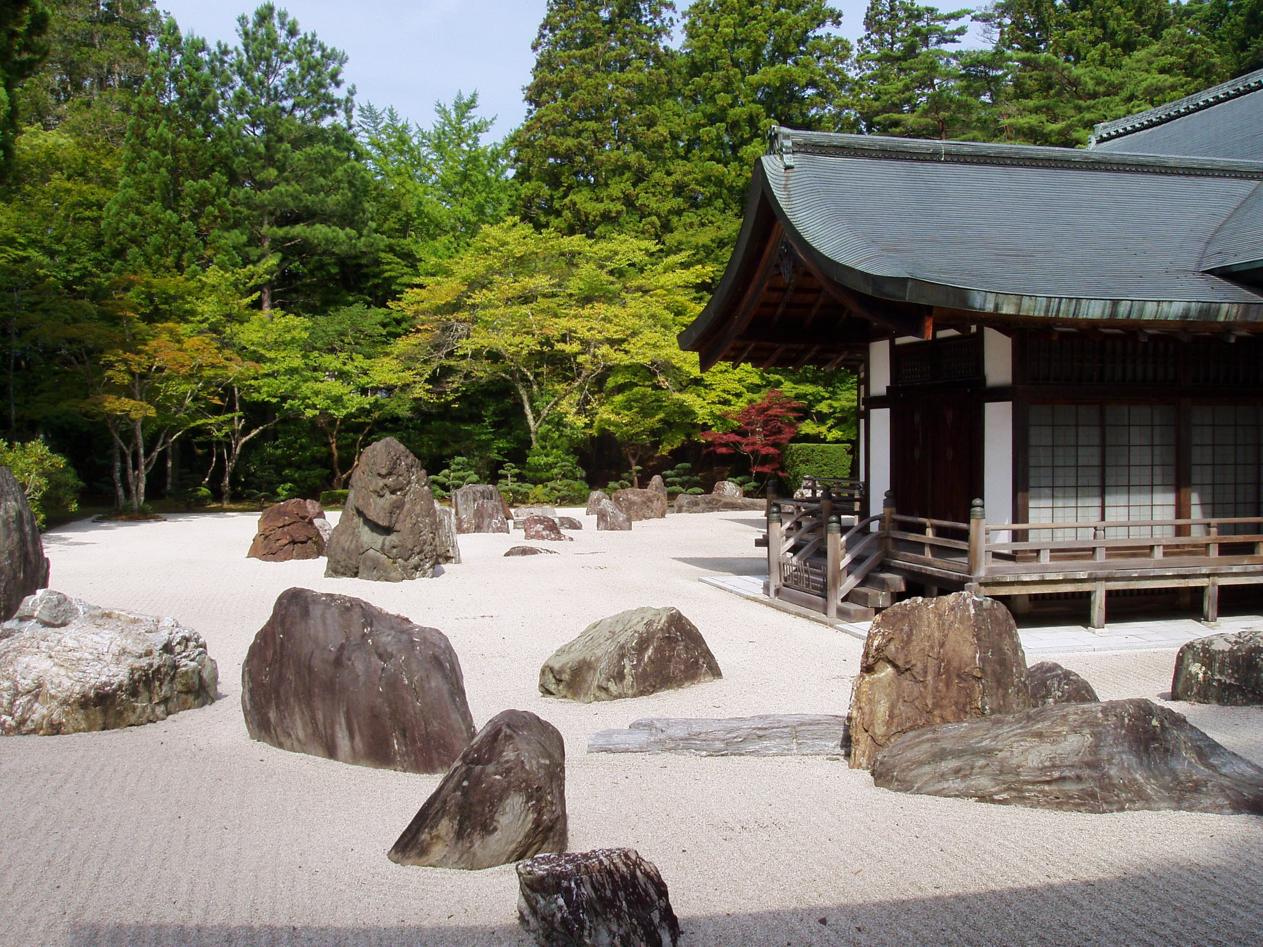
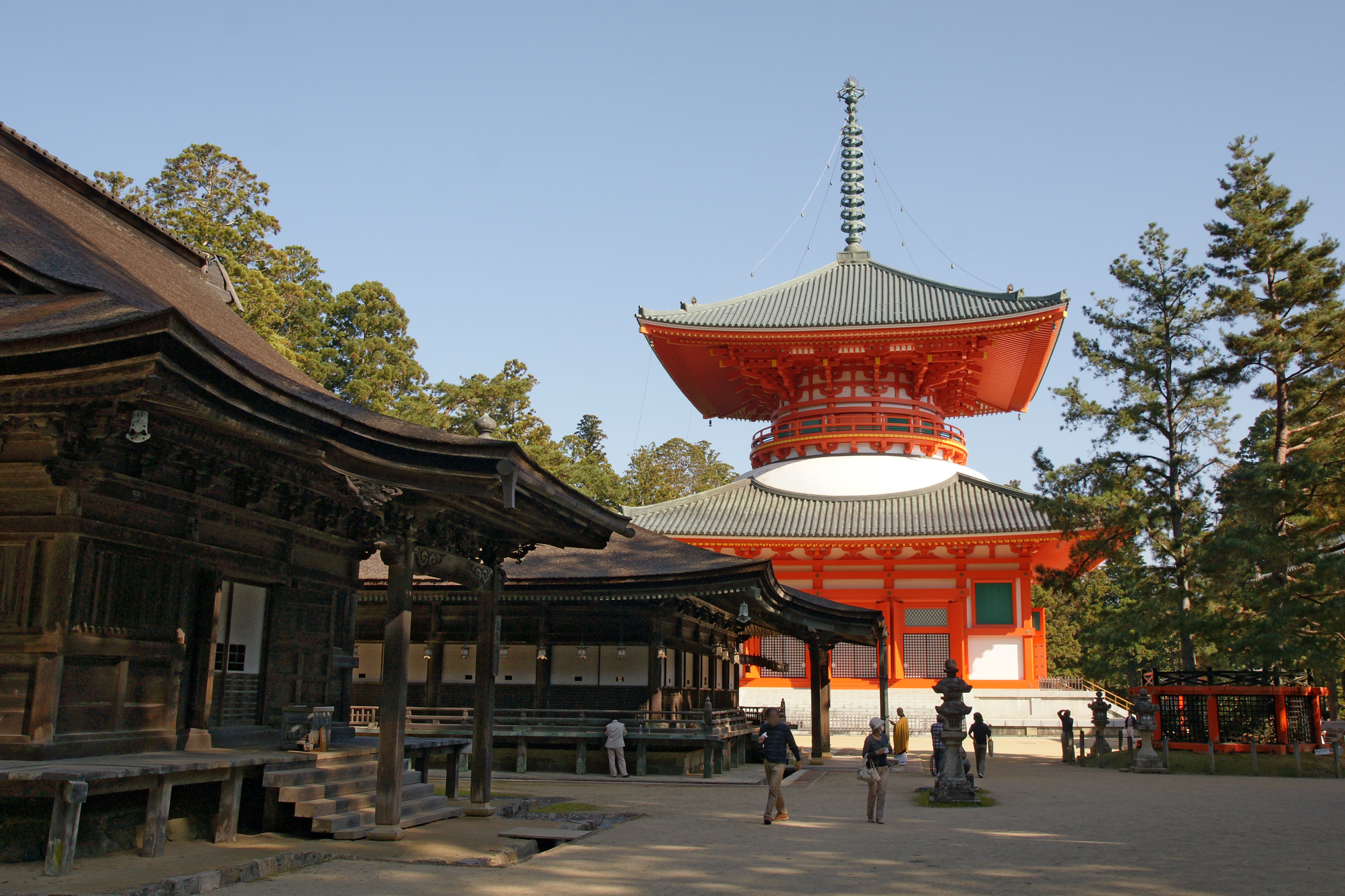 Danjogaran, the central point of Mount Kōya | |
| Location | Wakayama Prefecture, Japan |
| Part of | Sacred Sites and Pilgrimage Routes in the Kii Mountain Range |
| Criteria | Cultural: ii, iii, iv, vi |
| Reference | 1142 |
| Inscription | 2004 (28th Session) |
| Coordinates | 34°12′45″N 135°35′11″E |
 Location of Mount Kōya in Japan | |
First settled in 819 by the monk Kūkai, Mount Kōya is primarily known as the world headquarters of the Kōyasan Shingon sect of Japanese Buddhism. Located on an 800-meter-high plain amid eight peaks of the mountain (which was the reason this location was selected, in that the terrain is supposed to resemble a lotus plant), the original monastery has grown into the town of Kōya, featuring a university dedicated to religious studies and 120 sub-temples, many of which offer lodging to pilgrims. Mount Kōya is also a common starting point to the Shikoku Pilgrimage (四国遍路, Shikoku Henro) associated with Kūkai.
The mountain is home to the following famous sites:
- Kongōbu-ji (金剛峯寺), the head temple of the Kōyasan Shingon Buddhism. Located roughly in the middle of the sanctuary, Kongobuji is colloquially known as "Kōyasan-Issan", literally meaning "the mountain of Kōya". The temple was built by the warlord Toyotomi Hideyoshi for the benefit of his mother when she died. Originally named Seigan-ji, it was later renamed Kongōbu-ji in the Meiji Era.[2]
- Danjogaran (壇上伽藍), at the heartland of the Mount Kōya settlement. Garan[3] is a name for an area that has the main sacred buildings: a main hall, several pagodas, a scripture storage, a bell tower, a lecture hall, and other halls dedicated to important deities. There is also a shrine dedicated to the Shintō gods of that mountain area and in front of it an assembly hall (Sannō-dō). Danjō Garan is one of the two sacred spots around Mount Kōya.[4]
- Konpon Daitō (根本大塔), the "Basic Great Pagoda" that according to Shingon Buddhist doctrine represents the central point of a mandala covering all of Japan. Standing at 48.5 meters tall and situated right in the middle of Kōyasan, this pagoda was built as a seminary for the esoteric practices of Shingon Buddhism. This pagoda and the Okunoin Temple form a large sanctuary.
- Sannō-dō (山王堂), an assembly hall for special ceremonies dedicated to the Shintō gods guarding the area
- Okunoin (奥の院), the mausoleum of Kūkai, surrounded by an immense graveyard (the largest in Japan)
- Kōyasan chōishi-michi (高野山町石道), the traditional route up the mountain with stone markers (ishi) every 109 meters (chō)
- Daimon (大門), the main gate for Mount Kōya.[5] This mammoth gate stands as the main entrance to Kōyasan. It is flanked on each side by Kongo warriors who guard the mountain.
- Tokugawa Family Tomb. This mausoleum was built by the third shōgun Iemitsu Tokugawa. It took ten years to build and is architecturally representative of the Edo Period. First Edo shōgun Ieyasu is enshrined on the right and the second shōgun Hidetada on the left. The structure is decorated with carvings and brass fittings.
- It also houses a replica of the Nestorian stele.[6]
In 2004, UNESCO designated Kongõbu-ji on Mount Kōya, as part of the World Heritage Site "Sacred Sites and Pilgrimage Routes in the Kii Mountain Range".[7] Kōya Sankeimichi, the traditional pilgrimage route to Mount Kōya was also inscribed as part of the World Heritage Site.[7]
The complex includes a memorial hall and cemetery honoring Japanese who were imprisoned or executed for committing atrocities during World War II.[8]
Access
Kōya-san is accessible primarily by the Nankai Electric Railway from Namba Station (in Osaka) to Gokurakubashi Station at the base of the mountain. A cable car from Gokurakubashi ("Paradise Bridge") then whisks visitors to the top in 5 minutes. The entire trip takes about 1.5 hours on an express train or 2 hours by non-express.
Local automobile traffic can be very heavy on weekends until well into the evening. On weekdays, however, the mountain offers a pleasant drive followed by the excitement of reaching the monasteries lining the summit. Many Buddhist monasteries on the mountain function as hotels for visitors providing traditional accommodation with an evening meal and breakfast. Guest are also invited to participate in the morning services.
Buses
- There is a bus which runs non-stop from Kansai Airport to Mount Kōya, and it costs 2,000 yen (adult). The bus is operated by Kansai Airport Transportion and Willer Express.[9]
- The Koyasan Marine Liner bus runs from Wakayamakō Station to Okunoin Bus stop on Mount Kōya, and it costs 2250 yen (adult). The bus is operated by Daijū Bus - 大十バス.[10]
Climate
| Climate data for Mount Kōya (1991−2020 normals, extremes 1979−present) | |||||||||||||
|---|---|---|---|---|---|---|---|---|---|---|---|---|---|
| Month | Jan | Feb | Mar | Apr | May | Jun | Jul | Aug | Sep | Oct | Nov | Dec | Year |
| Record high °C (°F) | 15.1 (59.2) |
17.9 (64.2) |
19.9 (67.8) |
26.5 (79.7) |
29.6 (85.3) |
30.8 (87.4) |
33.7 (92.7) |
33.2 (91.8) |
31.1 (88.0) |
27.2 (81.0) |
22.2 (72.0) |
19.7 (67.5) |
33.7 (92.7) |
| Average high °C (°F) | 3.4 (38.1) |
4.8 (40.6) |
9.2 (48.6) |
15.1 (59.2) |
20.1 (68.2) |
22.8 (73.0) |
26.6 (79.9) |
27.8 (82.0) |
23.7 (74.7) |
17.8 (64.0) |
12.2 (54.0) |
6.3 (43.3) |
15.8 (60.5) |
| Daily mean °C (°F) | −0.3 (31.5) |
0.4 (32.7) |
4.0 (39.2) |
9.4 (48.9) |
14.4 (57.9) |
18.1 (64.6) |
22.1 (71.8) |
22.8 (73.0) |
19.1 (66.4) |
13.2 (55.8) |
7.5 (45.5) |
2.2 (36.0) |
11.1 (51.9) |
| Average low °C (°F) | −4.0 (24.8) |
−3.8 (25.2) |
−1.0 (30.2) |
3.7 (38.7) |
8.9 (48.0) |
14.0 (57.2) |
18.4 (65.1) |
18.8 (65.8) |
15.3 (59.5) |
9.1 (48.4) |
3.0 (37.4) |
−1.6 (29.1) |
6.7 (44.1) |
| Record low °C (°F) | −12.8 (9.0) |
−13.4 (7.9) |
−9.4 (15.1) |
−5.1 (22.8) |
−1.4 (29.5) |
3.4 (38.1) |
9.9 (49.8) |
11.8 (53.2) |
5.0 (41.0) |
−1.5 (29.3) |
−5.0 (23.0) |
−10.0 (14.0) |
−13.4 (7.9) |
| Average precipitation mm (inches) | 87.6 (3.45) |
97.4 (3.83) |
141.7 (5.58) |
141.5 (5.57) |
166.6 (6.56) |
260.3 (10.25) |
256.4 (10.09) |
192.5 (7.58) |
247.5 (9.74) |
203.3 (8.00) |
108.4 (4.27) |
89.3 (3.52) |
2,003.1 (78.86) |
| Average precipitation days (≥ 1.0 mm) | 11.7 | 11.1 | 12.6 | 11.2 | 10.7 | 13.7 | 12.7 | 10.9 | 11.7 | 11.2 | 8.7 | 11.4 | 137.6 |
| Mean monthly sunshine hours | 82.9 | 96.7 | 138.5 | 176.5 | 185.5 | 124.9 | 146.1 | 166.8 | 124.7 | 130.6 | 115.6 | 93.0 | 1,582.3 |
| Source: Japan Meteorological Agency[11][12] | |||||||||||||
Gallery
 Entrance to Kōya-san with two pillars showing the temple name Kongōbu-ji (Kongōbu Temple) and its mountain name Kōya-san
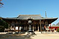 Main Hall (Kondō) of Kongōbu Temple (Danjōgaran)
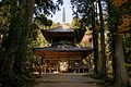 Saitō, West Pagoda (Danjōgaran)
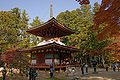 Tōtō, East Pagoda(Danjōgaran)
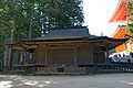 Fudōdo, the hall dedicated to Fudō Myōō (National Treasure)
 Sanō-in, Hall of the "Mountain King", the local Shintō deity (Danjōgaran)
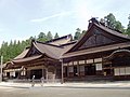 Kongōbu-Temple
 Banryūtei, a rock garden in Kongōbu-Temple
 Pagoda of Kongōsanmai-Temple (Kongōsanmai-in), the second oldest "treasure pagoda" in Japan (National Treasure)
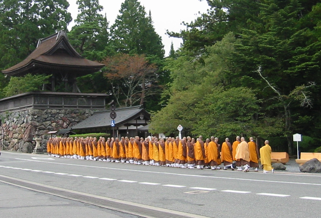
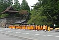 Shingon Buddhist monks, Mount Kōya, 2004
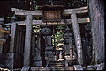 Shimazu clan graves
 Okunoin Cemetery
 Graves in Okunoin Cemetery
 Okunoin Cemetery
 A statue of a deceased pilgrim at his grave site in Okunoin Cemetery
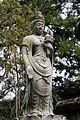 A Kannon-statue in Okunoin Cemetery
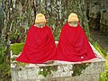 Two Kṣitigarbha-statues (Jizō bosatsu), Okunoin Cemetery
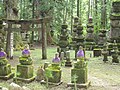 Okunoin Cemetery
 A Path in Okunoin Cemetery
 Tokugawa Mausoleum


See also
- Koyasan Reihōkan
- Mount Ōmine
- Sacred mountains
- Tourism in Japan
Notes
- As there are many temples with identical names, Chinese and Japanese temples are traditionally given additional "mountain names". These are no geographical designations. There is no mountain called Kōya-san in Japan.
- "ポメラニアンに適したフード". www.shukubo.jp. Retrieved 2019-02-25.
- Garan is an abbreviation of sōgyaranma (僧伽藍摩), skr. saMghaaraama सँघाराम), meaning "garden of monks". In Japan it was later used for central areas of big temples such as Kōya-san.
- "About Mount Koya Danjo Garan - Mount Koya Travel Guide | Planetyze". Planetyze. Retrieved 2017-11-07.
- "About Daimon - Mount Koya Travel Guide | Planetyze". Planetyze. Retrieved 2017-11-07.
- Keevak, Michael (2008). The Story of a Stele: China's Nestorian Monument and Its Reception in the West, 1625-1916. Hong Kong University Press. p. 125. ISBN 978-962-209-895-4.
- Centre, UNESCO World Heritage. "Sacred Sites and Pilgrimage Routes in the Kii Mountain Range". UNESCO World Heritage Centre. Retrieved 2021-12-28.
{{cite web}}: CS1 maint: url-status (link) - Victoria, Brian A., "Mount Koya sites exemplify ‘parallel universe’ where war criminals are martyrs", Japan Times, 5 August 2015
- Detail
- Detail
- 観測史上1~10位の値(年間を通じての値). JMA. Retrieved March 4, 2022.
- 気象庁 / 平年値(年・月ごとの値). JMA. Retrieved March 4, 2022.
Further reading
Nicoloff, Philip L. (2008). Sacred Koyasan: A pilgrimage to the Mountain Temple of Saint Kōbō Daishi and the Great Sun Buddha. State University of New York Press. ISBN 978-0-7914-7259-0.
External links
- Sacred Sites and Pilgrimage Routes in the Kii Mountain Range (UNESCO)
- KONGOBUJI(金剛峰寺)
- Mount Koya-san JAPAN: the Official Guide
- Koyasan Tourist Association
- Photo set of the Okunoin cemetery of Koyasan (photos under Creative Commons license)
На других языках
[de] Kōya-san
Als Kōya-san (jap. 高野山; kōya = Hochebene, san = Berg) bezeichnet man im heutigen allgemeinen Sprachgebrauch eine Gruppe von Bergen in Japans Präfektur Wakayama südlich von Ōsaka samt der von ihnen eingeschlossenen Hochebene (Seehöhe ca. 800 m).[Anm 1]- [en] Mount Kōya
[fr] Mont Kōya
Le mont Kōya (高野山, Kōya-san?) est une zone montagneuse du Japon située dans le bourg de Kōya (préfecture de Wakayama), au sud-est d'Osaka. Il a donné son nom à un complexe de 117 temples bouddhistes.[it] Monte Kōya
Il monte Kōya (高野山, Kōya-san) si trova nella penisola di Kii (紀伊半島, Kii Hantō), a sud della città di Osaka, nella prefettura di Wakayama.[ru] Коя-сан
Коя-сан (яп. 高野山 Ко:я-сан) — гора в префектуре Вакаяма в Японии к югу от Осаки.Другой контент может иметь иную лицензию. Перед использованием материалов сайта WikiSort.org внимательно изучите правила лицензирования конкретных элементов наполнения сайта.
WikiSort.org - проект по пересортировке и дополнению контента Википедии