geo.wikisort.org - Mountains
Mount Buller is a mountain in the Victorian Alps of the Great Dividing Range, located in the Australian state of Victoria. It has an elevation of 1,805 metres (5,922 ft) AHD,[1]
| Mount Buller | |
|---|---|
 Mount Buller from the Howqua Valley | |
| Highest point | |
| Elevation | 1,805 metres (5,922 ft) AHD [1] |
| Coordinates | 37°8′43″S 146°25′34″E[2] |
| Geography | |
 Mount Buller Location in Victoria | |
| Location | Victoria, Australia |
| Parent range | Victorian Alps, Great Dividing Range |
| Climbing | |
| Easiest route | Hike; ski |
Toponym
The British explorer and surveyor Major Sir Thomas Livingstone Mitchell named the mountain after an acquaintance in the Colonial Office, Charles Buller. The Aboriginal name for the mountain is Bulla Bulla meaning "good".[3]
Geography
This section needs additional citations for verification. (January 2014) |
The summit of Buller can be approached by vehicle via the village coupled with a short 500 metre (1600 foot) walk. It is also possible to climb the peak from Delatite River level along the Klingsporn walking track. The Klingsporn track was originally a bridle trail used by stockmen taking their cattle up to high ground during the summer months.
The walk begins at Merimbah and is a 8 kilometres (5.0 mi) walk on a well defined track. Mclaughlin Spur offers good views to the summit fire tower and the rocky outcrops that must be traversed. At the summit there is a stone distance dial and a fire tower that is staffed during the summer months.
Resort
The Mount Buller Alpine Resort is a popular destination in winter for skiers and snowboarders of all abilities who wish to attend for the day. With it only being a 3 hour drive, it is the nearest major downhill ski resort to Melbourne. In the warmer months, it provides a base for day visitors and hikers in the Victorian Alps.
Gallery
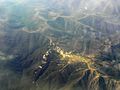 Aerial photo of Mount Buller.

See also
References
- "Place Names Search:Mount Buller". Geoscience Australia. Archived from the original on 10 February 2012. Retrieved 8 February 2012.
- "Mount Buller". Gazetteer of Australia online. Geoscience Australia, Australian Government.
- Blake, Les (1977). Place names of Victoria. Adelaide: Rigby. pp. 182, 50.
External links
- "Mount Buller, Skiing Snowboarding and Snow Holidays". MtBuller. Archived from the original on 4 March 2010. Retrieved 3 March 2010.
- "Be on the top of the world". Mount Buller Official Website. Retrieved 3 March 2010.
| Authority control |
|
|---|
На других языках
- [en] Mount Buller (Victoria)
[es] Monte Buller
El Monte Buller es una montaña en los Alpes Australianos.[fr] Mont Buller
Le mont Buller (Mount Buller en anglais) est l'un des principaux sommets d'Australie dans les Alpes australiennes. Il est situé dans l'État de Victoria, à 250 km au nord-est de Melbourne. Il culmine à 1 805 mètres. Il accueille sur ses flancs la principale station de ski, ouverte de début juin à fin septembre, d'Australie de 1 375 à 1 780 mètres et qui compte 25 pistes.Другой контент может иметь иную лицензию. Перед использованием материалов сайта WikiSort.org внимательно изучите правила лицензирования конкретных элементов наполнения сайта.
WikiSort.org - проект по пересортировке и дополнению контента Википедии