geo.wikisort.org - Mountains
Mount Adelung (Russian: Гора Аделунга) is the highest peak in Pskem Range (Russian: Пскемский хребет) in the extreme north-east of the Tashkent Region, Uzbekistan.[1] Mount Adelung is the highest point of Tashkent Province at 4,301 meters, just 2 meters higher than the nearby Mount Beshtor, located a little further to the south-west in the same range, and it is often erroneously identified in various web sources as the "highest point in Uzbekistan". In fact, this honor goes to the Khazret Sultan, a peak with an altitude of 4,643 m in Surxondaryo Region, in the Uzbek part of the Gissar Range, on the border with Tajikistan, which was formerly known as Peak of the 22nd Congress of the Communist Party.[2][3]
| Adelung | |
|---|---|
| гора Аделунга, Adelunga Toghi | |
 | |
| Highest point | |
| Elevation | 4,301 m (14,111 ft) |
| Coordinates | 42°07′N 70°58′E |
| Geography | |
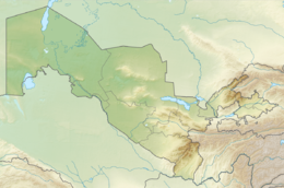 Adelung Location in Uzbekistan | |
| Location | Tashkent Region, Uzbekistan |
| Parent range | Pskem Mountains |
Some web sources use the name Adelunga Toghi, where Adelunga corresponds to the Russian possessive form of Adelung and Toghi presumably stands for mountain in the Uzbek language (tog’ in Latin script, тоғ in Cyrillic script).[original research?] It is not known at this stage of writing which Adelung the mountain is named after.
References
- Physical map of Tashkent Region, Uzgeodezkadastr, Tashkent, 2002 (low resolution)
- Atlas of the Soviet Central Asian Republics, Geodesy and Cartography Authority, Moscow, 1988, in Russian.
- Administrative map of the Republic of Uzbekistan, State Committee of Land Resources, Geodesy, Cartography, and State Cadastre, Tashkent, 2007.
This Uzbekistan location article is a stub. You can help Wikipedia by expanding it. |
На других языках
[de] Adelunga Togʻi
Der Adelunga Togʻi (auch Adelunga Toghi) ist ein Berg mit 4301 m Höhe im Talas-Alatau, einer zum Tienschan gehörenden Gebirgskette. Er liegt in Usbekistan an der Nordostgrenze zu Kirgisistan.- [en] Mount Adelung
[fr] Mont Adelung
Le mont Adelung est une montagne d'Ouzbékistan.[ru] Аделунга
Пик Аделунга (узб. Adelunga choʻqqisi) — горная вершина Пскемского хребта (в его северо-восточной части)[1], на границе Узбекистана и Киргизии. Имеет высоту 4301 м над уровнем моря.Другой контент может иметь иную лицензию. Перед использованием материалов сайта WikiSort.org внимательно изучите правила лицензирования конкретных элементов наполнения сайта.
WikiSort.org - проект по пересортировке и дополнению контента Википедии