geo.wikisort.org - Mountains
Morro de la Agujereada is the highest altitude of the island of Gran Canaria, Canary Islands, Spain. Located in Pico de las Nieves, it reaches a height of 1,956 meters above sea level (according to the IGN), being the highest altitude in the province of Las Palmas. Gran Canaria is the third highest island in the Canary Islands, after Tenerife and La Palma.
| Morro de la Agujereada | |
|---|---|
 Morro de la Agujereada in Pico de las Nieves. | |
| Highest point | |
| Elevation | 1,956 m (6,417 ft)[1] |
| Prominence | 1,956 m (6,417 ft)[1] |
| Coordinates | 27°57′39″N 15°34′16″W[1] |
| Geography | |
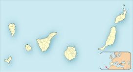 Morro de la Agujereada Location in the Canary Islands, on the island of Gran Canaria | |
| Location | Gran Canaria, Canary Islands, Spain |
| Geology | |
| Mountain type | Stratovolcano |
Although traditionally Pico de las Nieves was considered to be 1,949 meters high, Morro de la Agujereada actually reaches its highest point at 1,956 meters.[2] Morro de la Agujereada is a rocky promontory at the highest point of Pico de las Nieves, whose slopes cover the central area of the summit, and in which numerous snow pits were dug in the past.
References
- "El Morrón de la Agujereada, Spain". Peakbagger.com. Retrieved 2020-08-31.
- "La tecnología destrona al Pico de las Nieves como techo de la isla".
| |||||||||
| Governance |
|   | |||||||
| Municipalities |
| ||||||||
| History |
| ||||||||
| Nature |
| ||||||||
| Landmarks and attractions |
| ||||||||
| Transport |
| ||||||||
| Sport |
| ||||||||
| Education and science |
| ||||||||
This Canary Islands location article is a stub. You can help Wikipedia by expanding it. |
На других языках
[de] Morro de la Agujereada
Der Morro de la Agujereada ist mit einer Höhe von 1956 Metern über dem Meeresspiegel der höchste Berg auf der kanarischen Insel Gran Canaria.- [en] Morro de la Agujereada
[es] Morro de la Agujerada
El Morro de la Agujerada es una elevación rocosa ubicada en la isla de Gran Canaria ―Canarias, España―, siendo el punto de mayor altitud de la misma con 1957 metros sobre el nivel del mar.[1]Другой контент может иметь иную лицензию. Перед использованием материалов сайта WikiSort.org внимательно изучите правила лицензирования конкретных элементов наполнения сайта.
WikiSort.org - проект по пересортировке и дополнению контента Википедии