geo.wikisort.org - Mountains
Monte Pruno is a mountain in the southern Cilento region of the Province of Salerno, in the Campania region, of southern Italy. It is 879 metres (2,884 ft) above sea level.
This article may be expanded with text translated from the corresponding article in Italian. (May 2010) Click [show] for important translation instructions.
|
| Monte Pruno | |
|---|---|
 | |
| Highest point | |
| Elevation | 879 m (2,884 ft) |
| Coordinates | 40°24′N 15°21′E |
| Geography | |
 Monte Pruno Location in Italy | |
| Location | Cilento, Province of Salerno, Campania, Italy |
| Parent range | Lucan Apennines, of the Apennine Mountains |
Geography
The mountain is in the Lucan Apennines mountain range of the Apennine Mountains system. It is located in the Pruno forest area, in the municipality of Roscigno.
Monte Pruno is protected within Cilento and Vallo di Diano National Park.
History
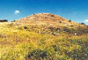
On the mountain outside the town of Roscigno is the archaeological site of Monte Pruno, a settlement of the Oenotrians and the Lucani (7th-3rd centuries BCE).
See also
External links
![]() Media related to Monte Pruno at Wikimedia Commons
Media related to Monte Pruno at Wikimedia Commons
Archaeological sites in Campania | ||
|---|---|---|
| Province of Avellino |
|    |
| Province of Benevento |
| |
| Province of Caserta |
| |
| Province of Naples |
| |
| Province of Salerno |
| |
This Campanian location article is a stub. You can help Wikipedia by expanding it. |
На других языках
- [en] Monte Pruno
[it] Monte Pruno
Il monte Pruno (m.879 s.l.m.) è il monte più elevato che si trova nel comune di Roscigno[1] in provincia di Salerno all'estremità della catena degli Alburni. Il monte domina il valico tra il Vallo di Diano e la pianura costiera.Текст в блоке "Читать" взят с сайта "Википедия" и доступен по лицензии Creative Commons Attribution-ShareAlike; в отдельных случаях могут действовать дополнительные условия.
Другой контент может иметь иную лицензию. Перед использованием материалов сайта WikiSort.org внимательно изучите правила лицензирования конкретных элементов наполнения сайта.
Другой контент может иметь иную лицензию. Перед использованием материалов сайта WikiSort.org внимательно изучите правила лицензирования конкретных элементов наполнения сайта.
2019-2026
WikiSort.org - проект по пересортировке и дополнению контента Википедии
WikiSort.org - проект по пересортировке и дополнению контента Википедии