geo.wikisort.org - Mountains
Mont Sainte-Odile (German: 'Odilienberg' or Ottilienberg; called Allitona in the 8th century) is a 764-metre-high peak in the Vosges Mountains in Alsace in France, immediately west of Barr. The mountain is named after Saint Odile. It has a monastery/convent at its top called the Hohenburg Abbey, and is notable also for its stone fortifications called "the Pagan Wall." In 1992, Air Inter Flight 148 crashed near this area.
| Mont Sainte-Odile | |
|---|---|
| German: 'Odilienberg' | |
 Mont Sainte-Odile and the Monastery | |
| Highest point | |
| Elevation | 764 m (2,507 ft)[1] |
| Coordinates | 48.4374580°N 7.4044908°E |
| Geography | |
| Location | Alsace, France |
| Parent range | Vosges Mountains |


History
The mountain and its surroundings contain evidence of Celtic settlements. The mountain enters recorded history during the Roman times; a fortress was supposedly destroyed by the Vandals in 407.[2] In the second half of the 9th century, when Vikings attacked the Low Countries, which had been recently converted to Christianity and were governed from Utrecht, the Utrecht bishops went into exile and stayed for a while in Mont Sainte-Odile.[3]
At least since the 19th century, its beauty has been celebrated[4] and the mountain, with convent and pagan wall, is often included in tourist guides,[5] incl. Baedeker's.[6]
Hohenburg Abbey
The convent is said to have been founded by Adalrich, Duke of Alsace, in honor of his daughter, Saint Odile, about the end of the 7th century, and it is certain that it existed at the time of Charlemagne. Destroyed during the Middle Ages, it was rebuilt by Premonstratensians at the beginning of the 17th century. It was acquired later by the bishop of Strasbourg, who restored the building and the adjoining church in 1853.
A famous manuscript, the Hortus Deliciarum, was compiled in the convent.
The Pagan Wall
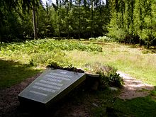
The Pagan Wall (German: Heidenmauer, French: Mur païen) is a huge construction about 10 kilometres (6.2 mi) long which encircles Mont Sainte Odile. It is composed of about 300,000 blocks, between 1.6 metres (5.2 ft) and 1.8 metres (5.9 ft) wide and up to 3 metres (9.8 ft) high. The origins and date were disputed for a long time, with some claiming that it was a 3,000-year-old druid construction. Recent research has shown that it dates from the 7th century, about the time that the convent was built.[7] The designation "Pagan" is attributed to Pope Leo IX.
Airbus crash
At 7:20 pm on 20 January 1992, Air Inter Flight 148, an Airbus A320, crashed on a ridge near Mont Sainte-Odile. There were 87 casualties and 9 survivors.
In art and literature
A 2000 poem, "Return to St. Odilienberg, Easter 2000," by the American poet Claire Nicholas White, is inspired by the abbey.[8]
See also
- Places dedicated to Saint Odile
- Niedermunster Abbey, Alsace
References
- Official maps of IGN available on the Géoportail.
- Lee, Katharine (1883). In the Alsatian Mountains: A Narrative of a Tour in the Vosges. London: Richard Bentley. pp. 149–50.
- "Utrecht," in Jeep, John M. (2001). Medieval Germany: An Encyclopedia. Routledge. p. 775. ISBN 978-0-8240-7644-3.
- Lee, Katharine (1883). In the Alsatian Mountains: A Narrative of a Tour in the Vosges. London: Richard Bentley. pp. 154–56.
- Ardouin-Dumazet, Victor Eugène (1907). Voyage en France. Berger-Levrault, 1907. pp. 191–92.
- The Rhine, including the Black Forest & the Vosges: handbook for travellers. Karl Baedeker. 1911. p. 511.
- Châtelet, Madeleine. "CHÂTELET M., BAUDOUX J., 2016, Le « Mur païen » du Mont Sainte-Odile en Alsace : un ouvrage du haut Moyen Âge ? L'apport des fouilles archéologiques". Zeitschrift für Archäologie des Mittelalters.
- Creeley, Robert; David Lehmann (2002). The Best American Poetry 2002. Charles Scribner's Sons. pp. 176–223. ISBN 978-0-7432-0385-2.
- Forrer, Robert (1899). Der Odilienberg: Seine vorgeschichtlichen Denkmäler und mittelalterlichen Baureste, seine Geschichte und seine Legenden. K.J. Trübner.
- This article incorporates text from a publication now in the public domain: Chisholm, Hugh, ed. (1911). "Odilienberg". Encyclopædia Britannica (11th ed.). Cambridge University Press.
External links
| Wikimedia Commons has media related to Mont Sainte-Odile. |
На других языках
[de] Odilienberg
Der Odilienberg (auch St. Odilienberg, französisch Mont Sainte-Odile) erhebt sich im Elsass in der Nähe der Ortschaften Obernai (deutsch Oberehnheim) und Barr, Département Bas-Rhin, am Ostrand der Vogesen auf eine Höhe von 763 m über der Oberrheinebene und wird von Kloster Hohenburg gekrönt.- [en] Mont Sainte-Odile
[es] Monte de Santa Odilia
El Monte de Santa Odilia, (en idioma francés Mont Sainte-Odile, en idioma alemán Odilienberg), es una elevación de la cordillera de los Vosgos, al este de Francia, que alcanza su cima a los 763 m. Se localiza en el término municipal de la comuna de Ottrott, en el departamento alsaciano de Bajo Rin.[fr] Mont Sainte-Odile
Le mont Sainte-Odile (Odilieberri en alsacien, Odilienberg en allemand) est un mont vosgien, situé à Ottrott dans le département du Bas-Rhin, culminant à 767 mètres d'altitude.[it] Mont Sainte-Odile
Il Mont Sainte-Odile (Monte di Santa Ottilia, Odilienberg in tedesco) s'innalza a 764 metri s.l.m. nel territorio del comune alsaziano di Ottrott, nella regione francese del Grand Est, dipartimento del Basso Reno. Esso fa parte della catena montuosa dei Vosgi. Sulla sua sommità si erge l'abbazia di Hohenbourg (o abbazia di Santa Ottilia).[ru] Сент-Одиль
Гора Сент-Одиль (фр. Mont Sainte-Odile, нем. Odilienberg, буквально «Гора святой Одилии»), гора в Вогезах высотой 764 м, на вершине которой расположен бывший Гогенбургский монастырь[en] (Hohenburg Abbey; другие названия — монастырь на горе святой Одили, или аббатство Мон-Сент-Одиль; аббатство на горе Сент-Одиль).Другой контент может иметь иную лицензию. Перед использованием материалов сайта WikiSort.org внимательно изучите правила лицензирования конкретных элементов наполнения сайта.
WikiSort.org - проект по пересортировке и дополнению контента Википедии
